Planning and Building Control Directorate, Department of Environment, Food and Agriculture, Murray House, Mount Havelock, Douglas, Isle of Man,IM1 2SF
Dear Sirs,
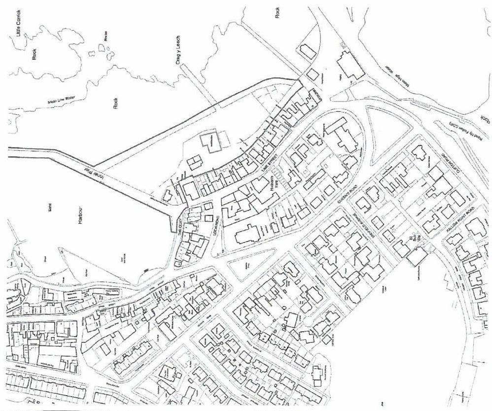
Planning Application Ref 16/01387/B – The Quay, Port St Mary
I have reviewed the above planning application and would like to raise concerns about the increasing congestion and decreasing parking in this area.
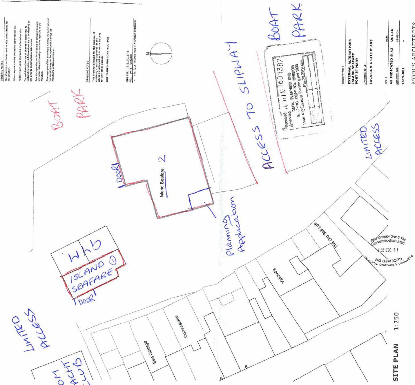
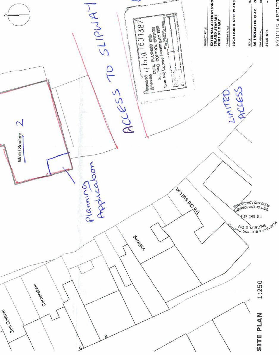
1) It is not clear from the application how busy this area already is. For information I have added some additional information to the area plan as attached.
2) From the amended plan you can see that Island Seafare is currently run between 2 different buildings in this area. There are a lot of movements between these 2 sites often with the use of a forklift truck. I can only assume that the proposal to change the existing door to double doors will mean more movements between 3 sites and inevitably the loss of parking spaces.
3) The Isle of Man Yacht Club is located in the same area. During the year they have events and functions which obviously means an increase in traffic and problems with parking. There is also a gym in the same area and again, cars arriving and departing during the day and evening. Areas which were open for parking are often not available as the factory often use a significant area for storing pallets and other materials.
4) I must also mention the Boat Park and slipway. Throughout the year (but especially in the summer months), cars arrive towing boats and the area in front of the building is used for manoeuvring cars/boats/trailers into the boat park and onto the slipway. It gets very congested especially when boat owners leave the trailers in parking spaces whilst they are away sailing.
I have attached a few photographs to try and give a better overview. (Sorry about the quality). Your consideration on the above would be much appreciated. Yours faithfully
Helen Kinvig Resident
Helen Kinvig
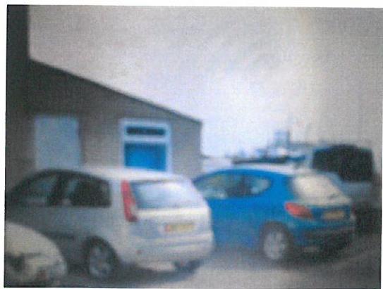
This is the actual building involved in the planning application. As you can see area is currently used for parking. (The parking spaces are marked)
A grainy, low-resolution photograph showing the exterior of a building with a blue door and cars parked in the foreground.
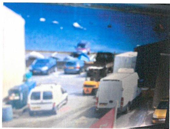
Vehicle access is already limited
A low-quality, blurry photograph showing a paved yard or parking area with several vehicles, including vans and cars, next to a building.
Parking areas used for storage
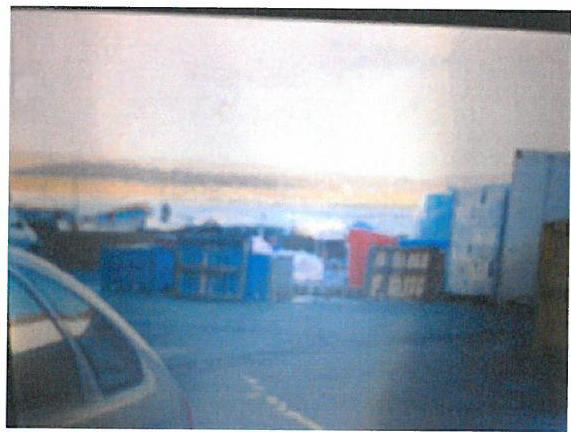
A low-quality, blurry photograph showing a car in the foreground and blue and red structures or containers in the background against a bright sky.
This is the area in front of the building which is used for manoeuvring cars/boats/trailers into the boat park
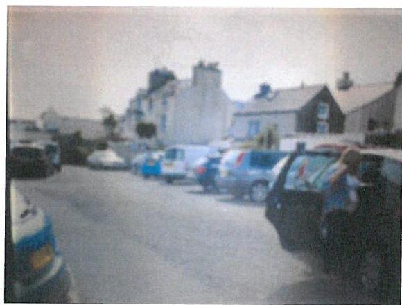
A low-resolution photograph showing a street scene with several parked cars and residential buildings in the background.
LOCATION PLAN 1:2000
SITE PLAN 1:250
COVERAGE STATUS This document is covered by the provisions of<br/>the law of the State of California, and is not for the public or<br/>for the public purposes.
WHY CAREING FOR CONSIDERATION FOR MAIL, FED, ST, AND<br/>MAIL, SEND, ACCEPT<br/>THIS IS FOR ADDRESS AND SIGNATURE OF RESPONSIBLE PERSON {{table:59211}} MODUS ARCHITECTS 3.11.11.11.11.11.11.11.11.11.11.11.11.11.11.11.11.11.11.11.11.11.11.11.11.11.11.11.11.11.11.11.11.
PRODUCT NAME
EXTERNAL ALTERATIONS TELEPH: 0844-690 POST ST MARY
TRANSMIT NO.
LOCATION & SITE PLANO
STATE AR PROVISION # 42 ZONE 100 SECTION 001 DEC 001
A black and white location plan showing the coastal area of Port St Mary, highlighting the harbour and surrounding streets.A hand-annotated site plan showing the layout of the Island Seafire property, including access routes to a slipway and boat park areas.A rotated site plan showing the location of 'Island Seafare' and neighboring properties with handwritten notes regarding access to a slipway.
Copyright in submitted documents remains with their authors. Request removal