Loading document...
The Barn, Ballavayre Farm, Ballakilpheric, Colby, Isle of Man
For Alan & Claire Heath
Contents
Appendices
This design statement supports a detailed planning application for converting a redundant barn at Ballavayre farm into a single four-bedroom family dwelling on behalf of the applicants, Mr & Mrs Heath.
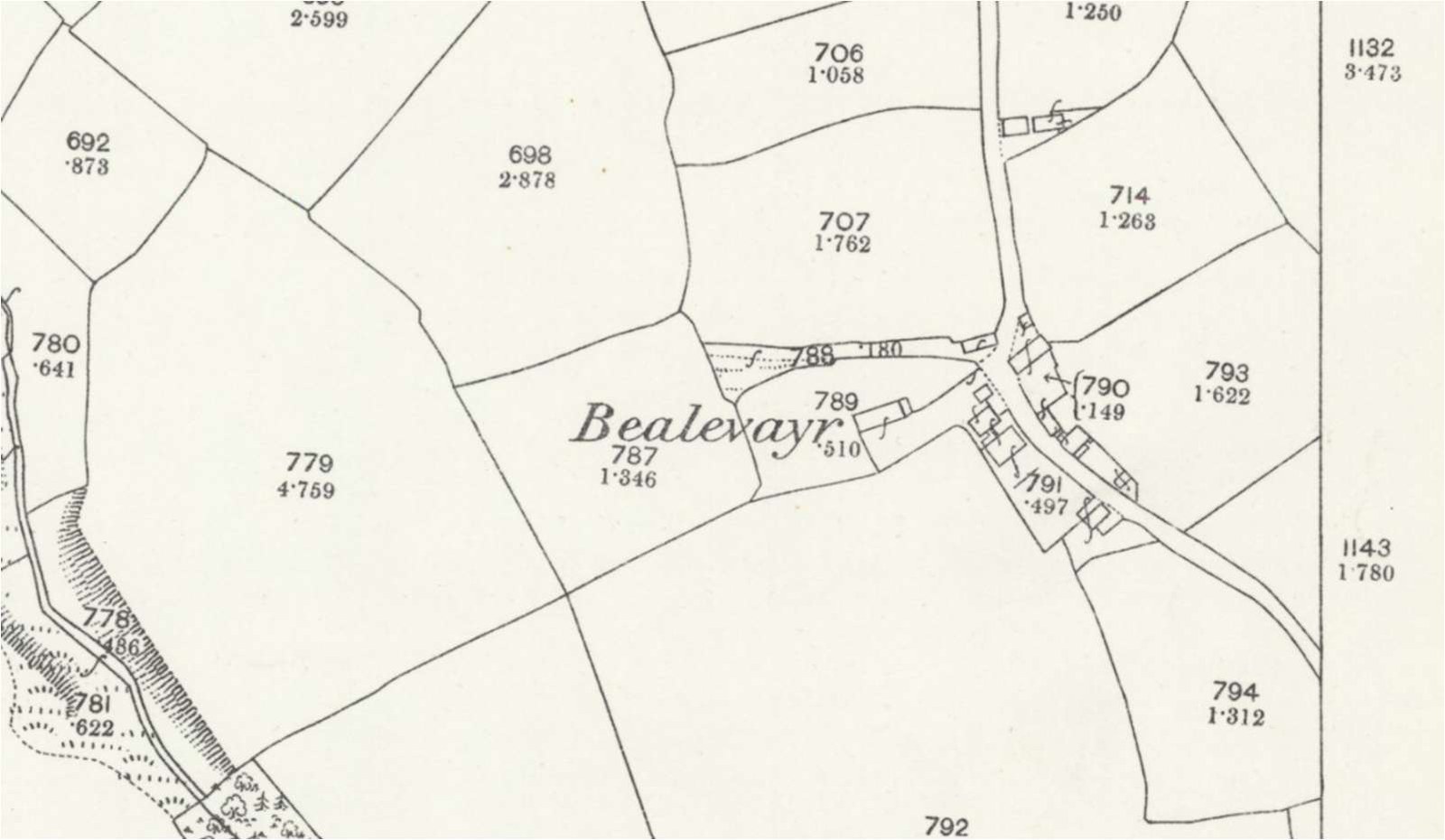
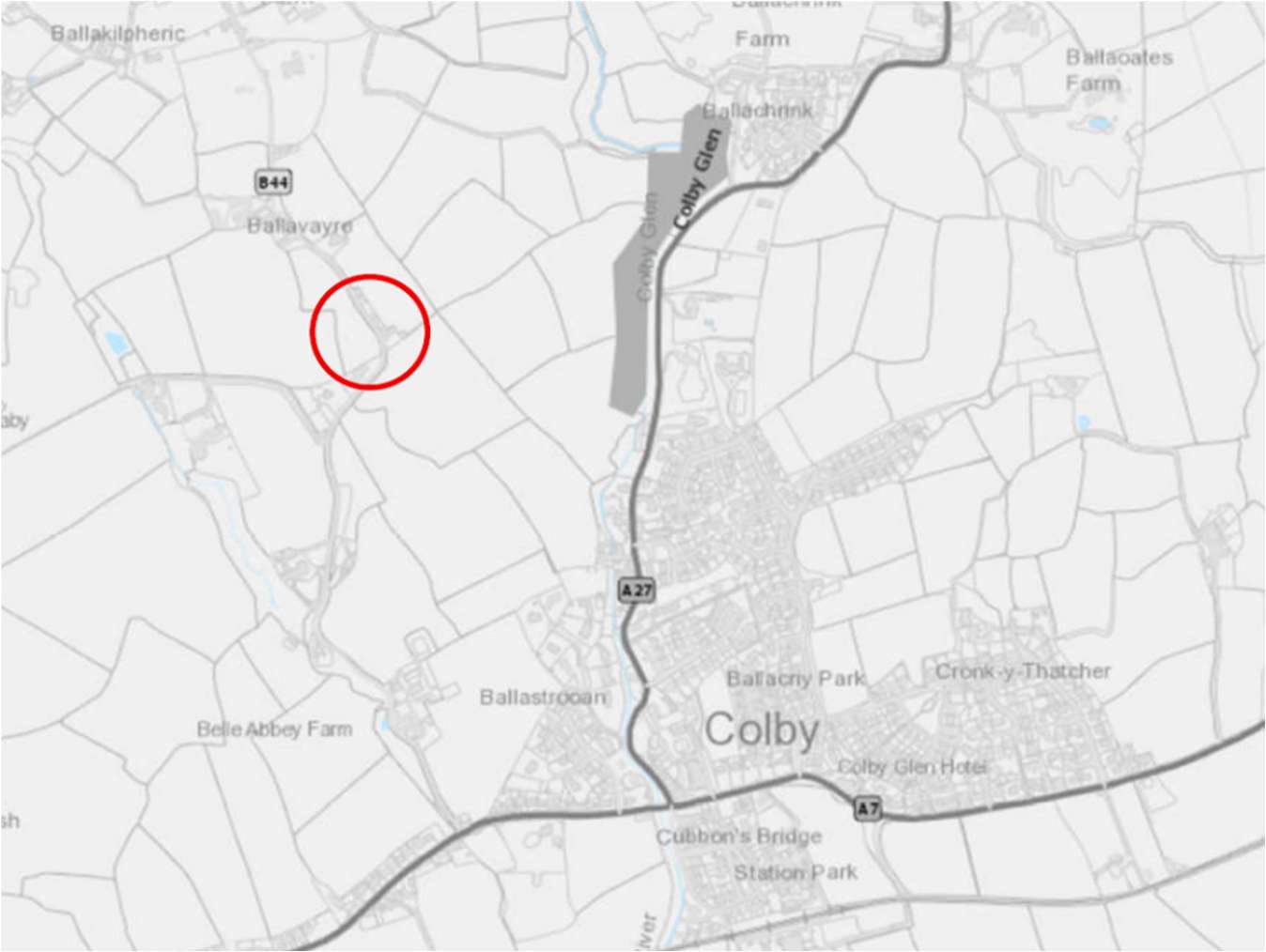
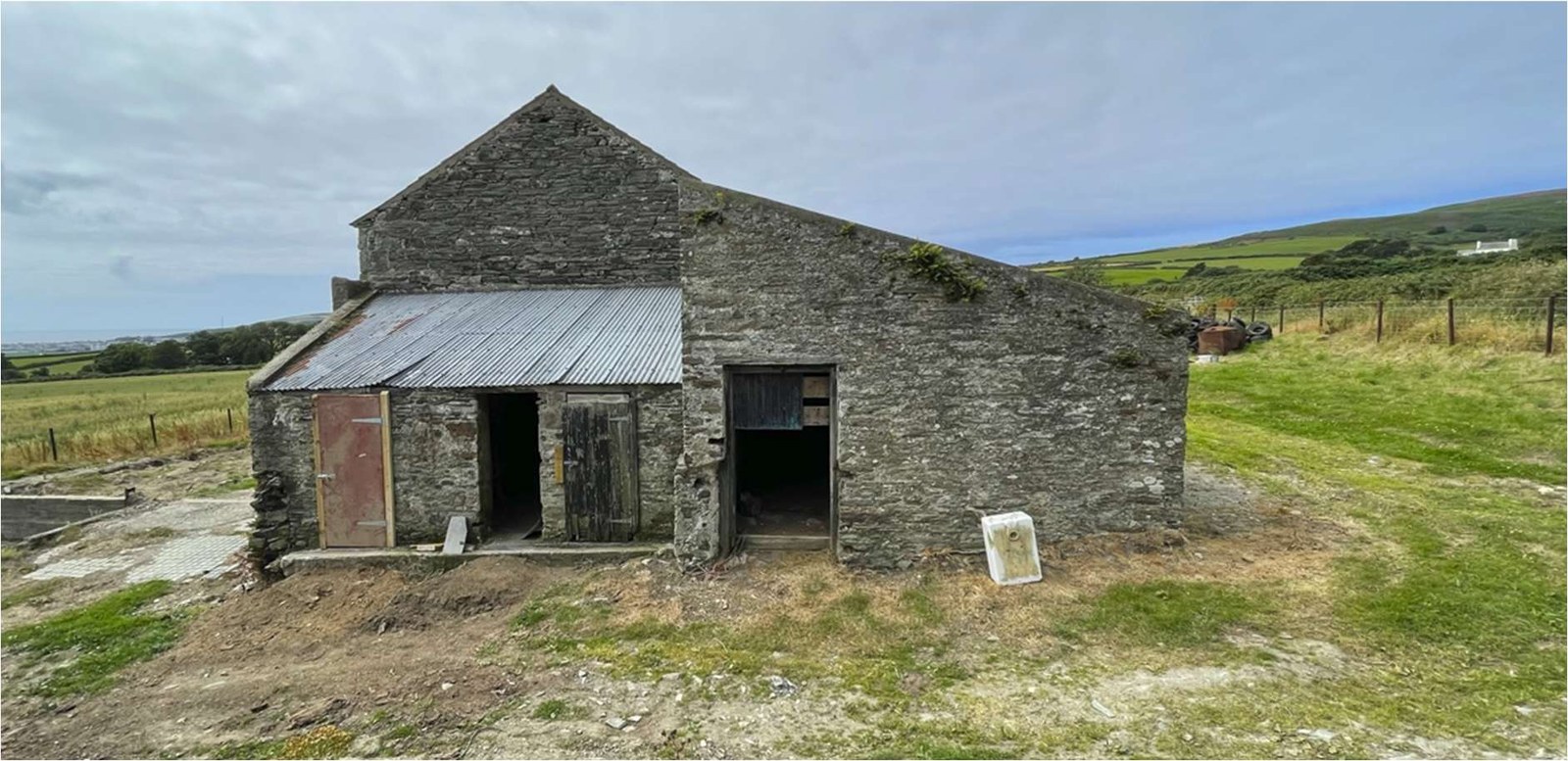
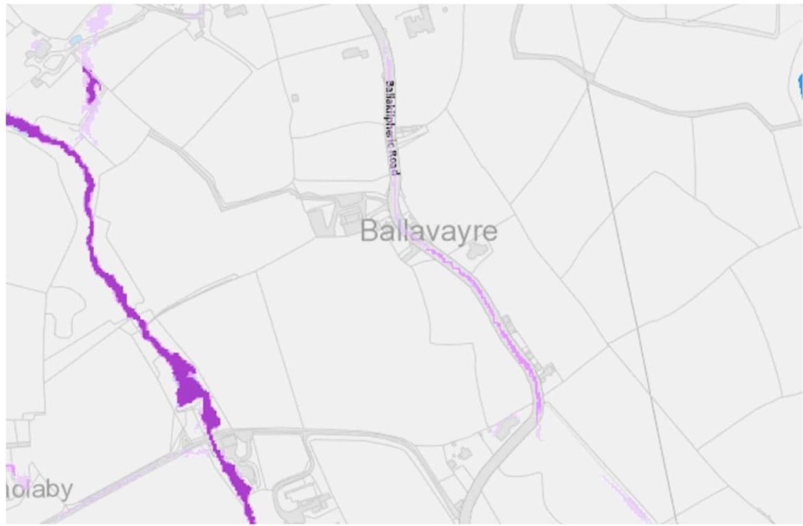
The barn is located at Ballavayre Farm and accessed via a private unmade access lane off Ballakillpheric ‘B44’, Colby, the site comprises of one redundant barn on a parcel of land 0.7 acres in size. Below the barn is identi ied on Isle of Man OS map published in 1875, formerly known as ‘Bealevayr’.
Ballavayre farm is not identi ied for development in the Area plan for the South 2013. Under the 1982 Development Plan, Ballavayre farm is located in an area designated as white land and is not within the area designated as having ‘High landscape or coastal value and scenic signi icance’
As the development site is located outside of the area zoned for development as identi ied above, the proposed must therefore be in accordance with General Policy 3 to be compliant.
General Policy 3 applies: Development will not be permitted outside of those areas which area zoned for development on the appropriate Area Plan with the exception of:
Furthermore, particular emphasis is to be placed on the conversion of redundant rural buildings to dwellings which is covered under Housing Policy 11;
Conversion of existing rural buildings into dwellings may be permitted, but only where:
Such conversion must:
Permission will not be given for the rebuilding of ruins or the erection of replacement buildings of similar, or even identical, form. Further extension of converted rural buildings will not usually be permitted, since this would lead to loss or reduction of the original interest and character.
This design statement seeks to address the points set out in the relevant policies in support of redeveloping the redundant barn.
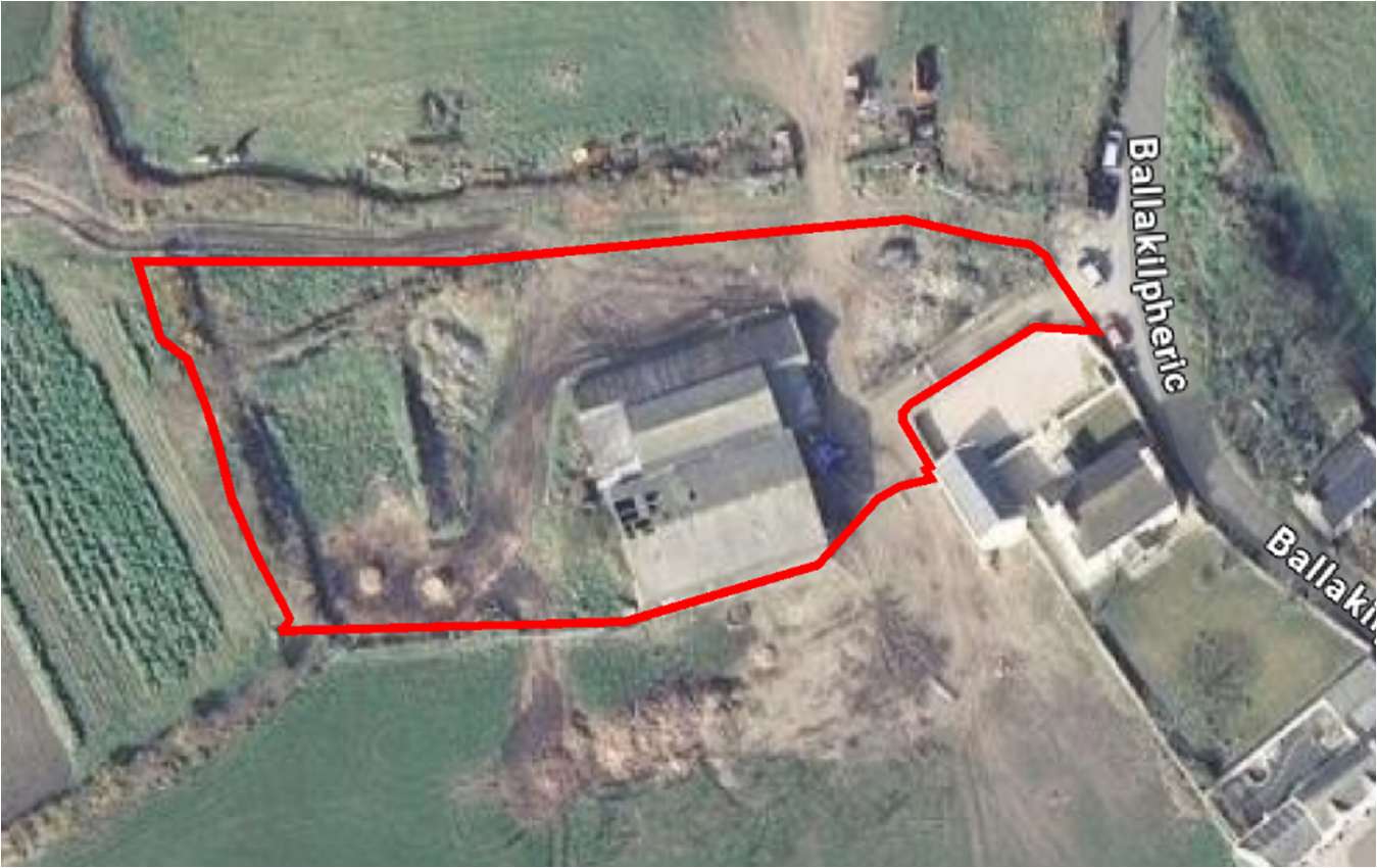
The site consists of the original derelict barn indicated on the 1875 OS map and adjoining buildings to the north and west of the original barn, a large agricultural shed which was adjoined to the south elevation of the original barn was demolished circa 2023. Man-made agricultural bunds are present to the west of the site but general site topography identi ies that the site has a gentle fall from the north to the south of the site offering uninterrupted views both to the south and east of the surrounding countryside.
Site boundaries are de ined via wire fence lines and earth embankments to immediate pastural lands with arable ields, farming access lane and boundary wall / garage to one immediately neighbouring property.
Note. google imagery not updated with agricultural shed adjoined to the south elevation of the barn now demolished circa 2023
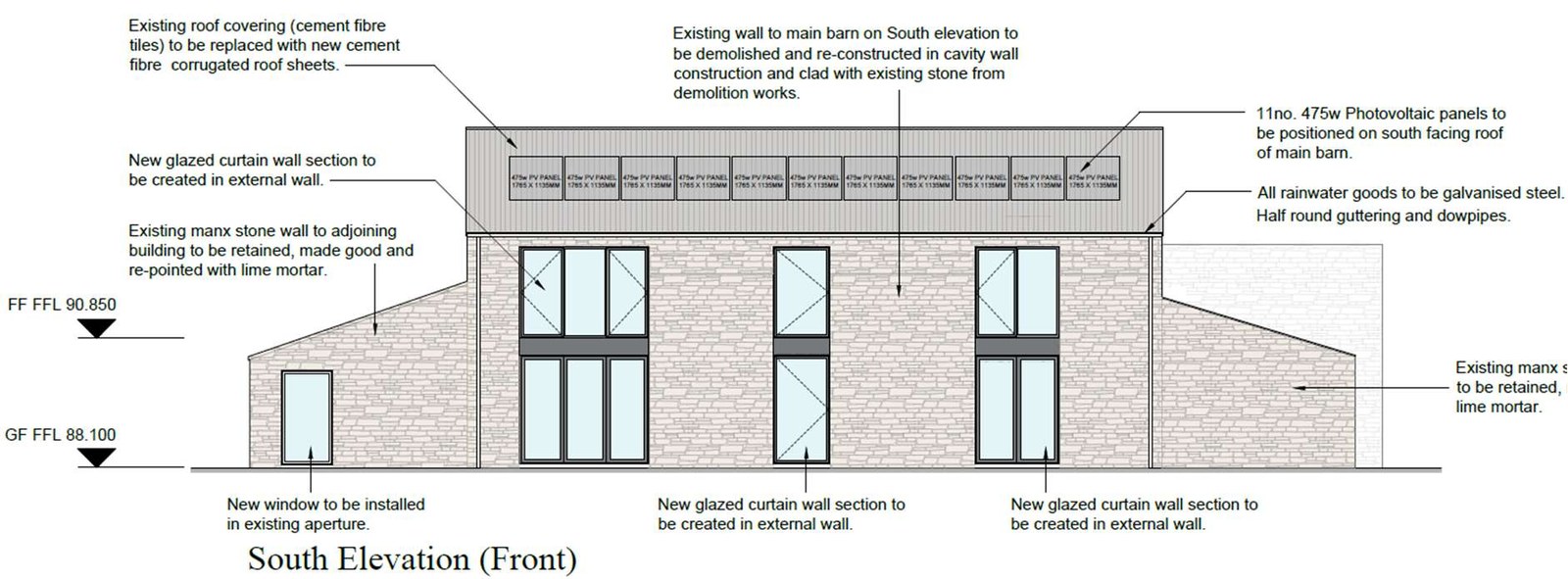
2.21 - South facing Elevation
2.22 - West facing Elevation
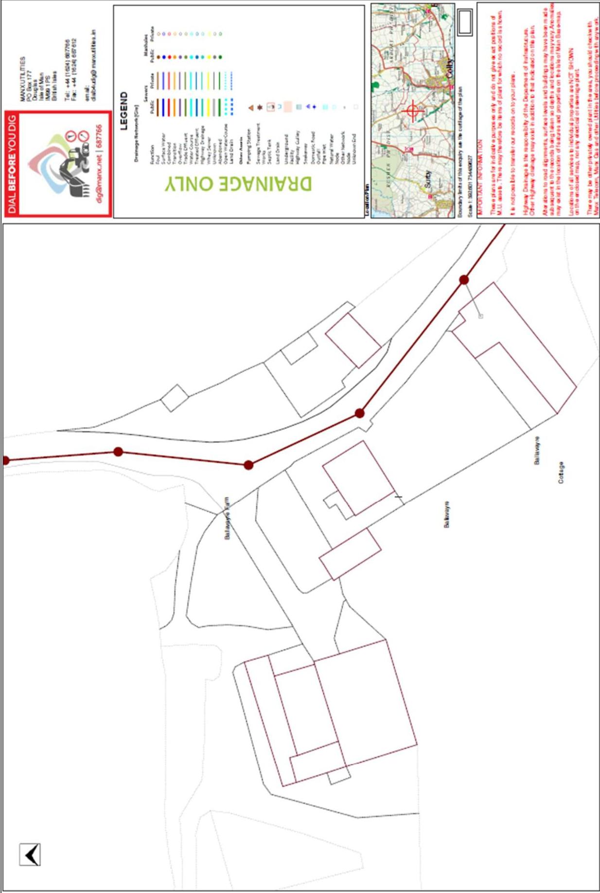
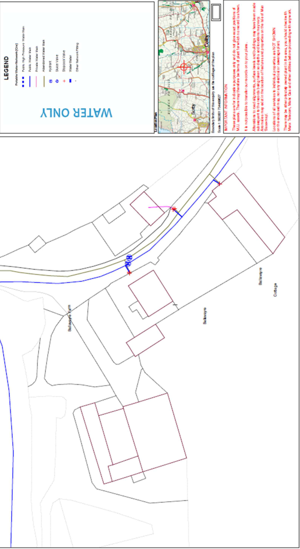
'Dialb4youdig' services have been contacted to establish if any existing services are located on the site and it has been confirmed that no existing services are present within the curtilage of the property.
Electricity, Water, Foul Sewer & Telecoms are all easily accessible at the end of the property access lane on the Ballakilpheric road, see 'appendix A' for existing services drawings provided by 'Dialb4youdig'
Storm water will be drained via suitably sized soakaways designed in accordance with BRE365. Percolation testing is to be undertaken prior to any commencement of works to determine ground conditions and soak away sizing.
Using the Isle of Man Government 'Flood Risk Viewer' the site has been identified as not being at any risk of flooding.
Figure 2.4 – Extract from Isle of Man Government 'Flood Risk Viewer'
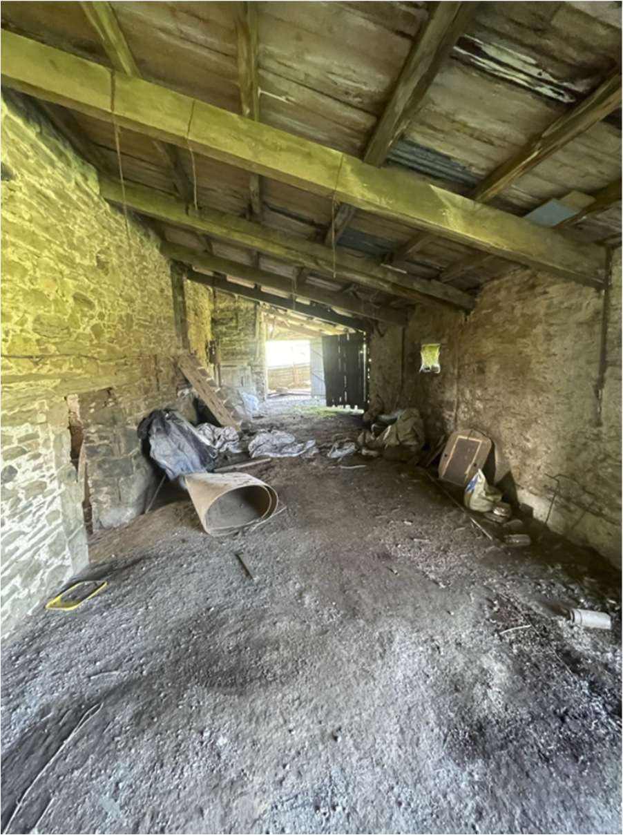
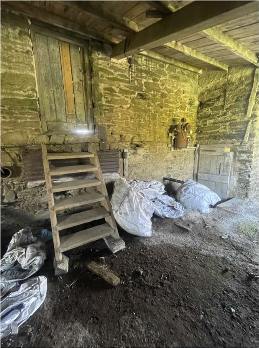
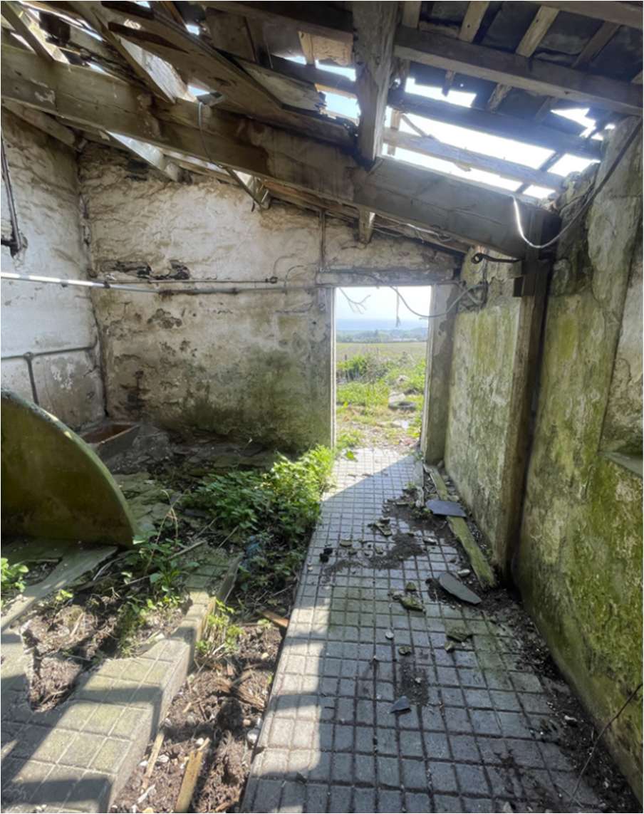
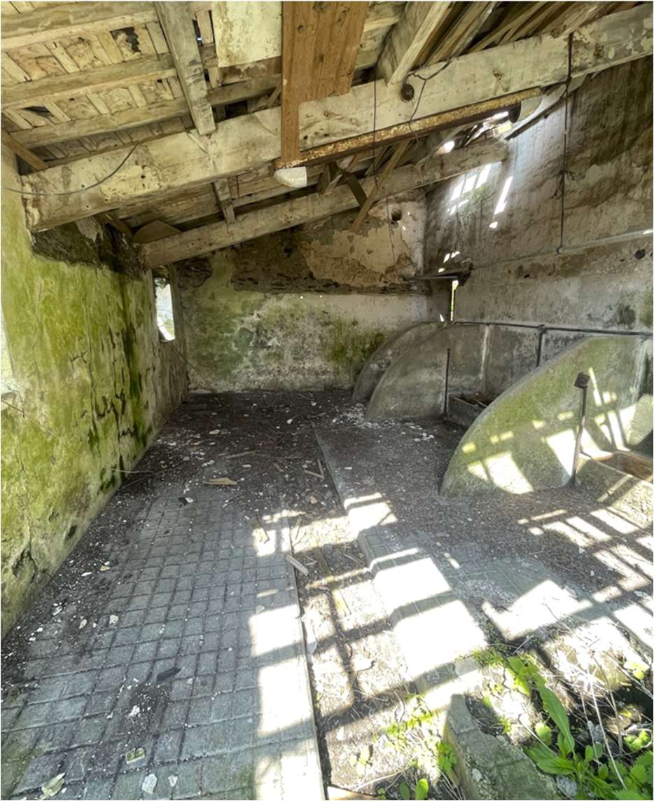
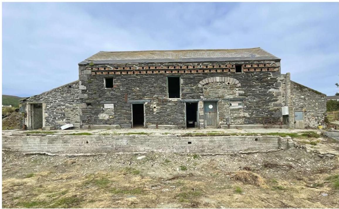
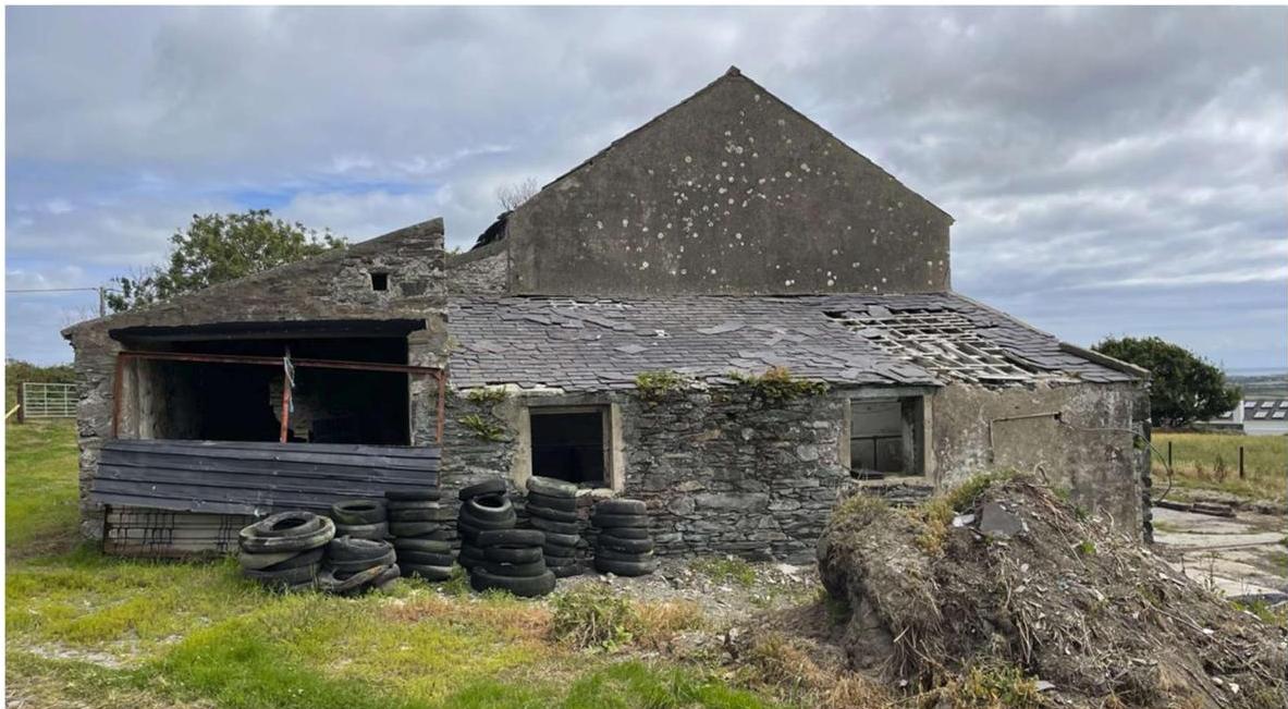
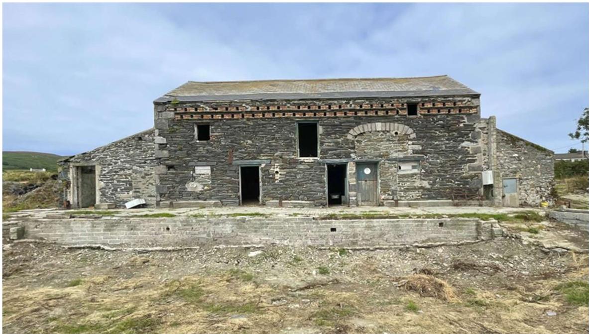
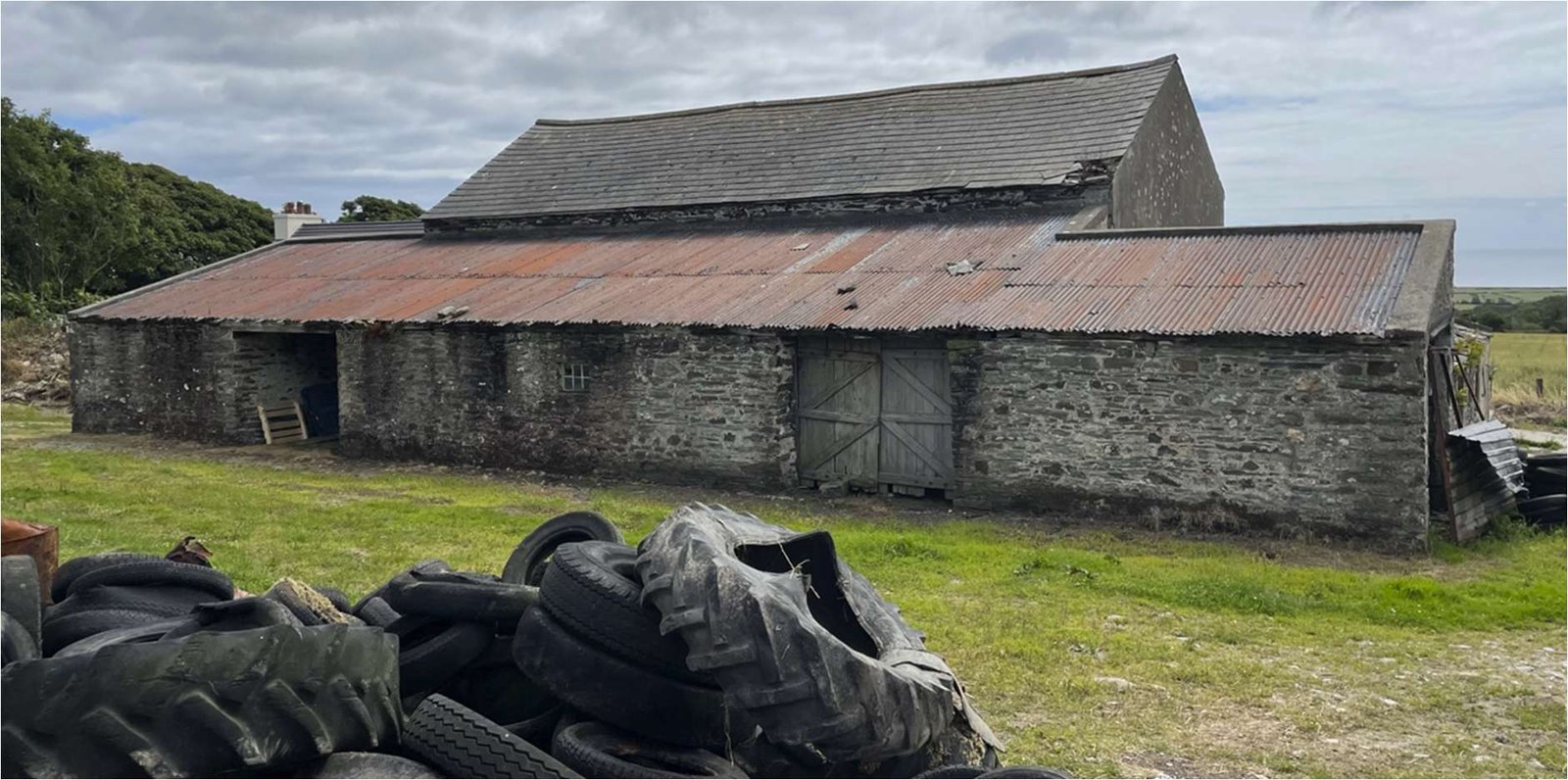
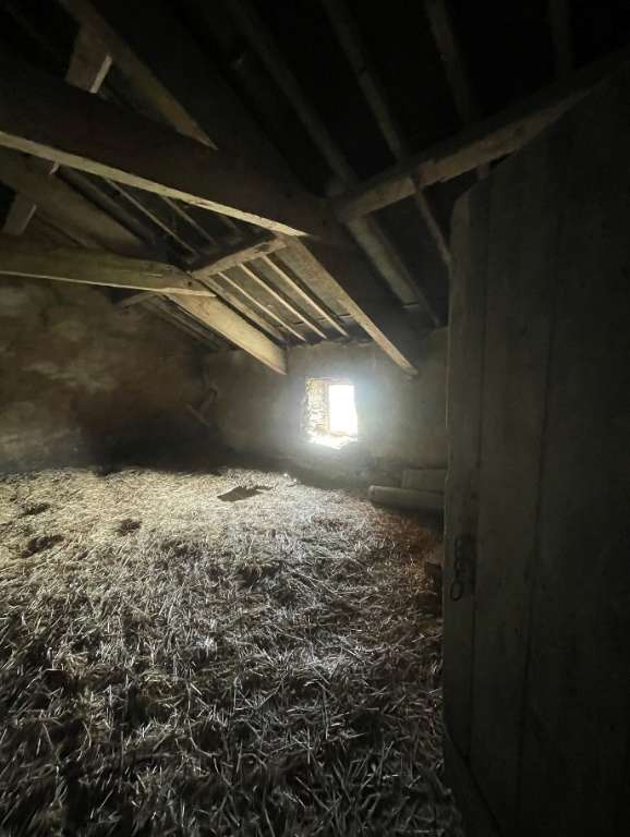
Photographs taken of the existing building condition in July 2025 Photo 1.1 Photo 1.2 Photo 1.3 Photo 1.4
Photo 1.5 Photo 1.6 Photo 1.7 Photo 1.8 Photo 1.9 Photo 1.10
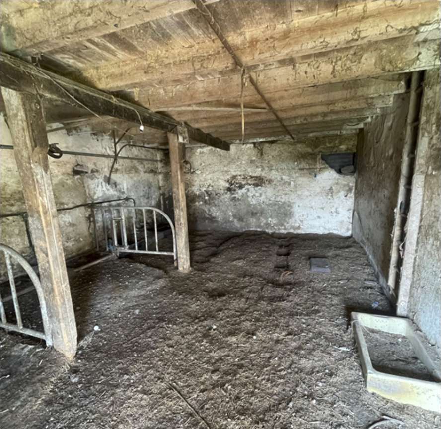
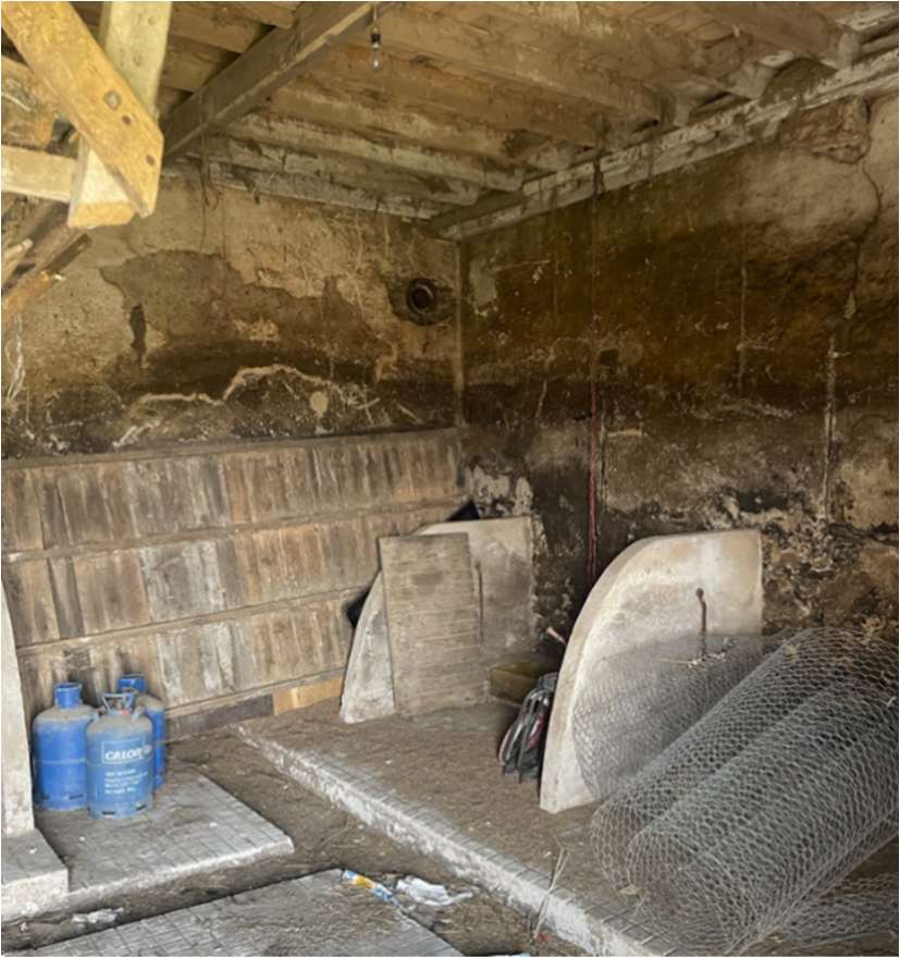
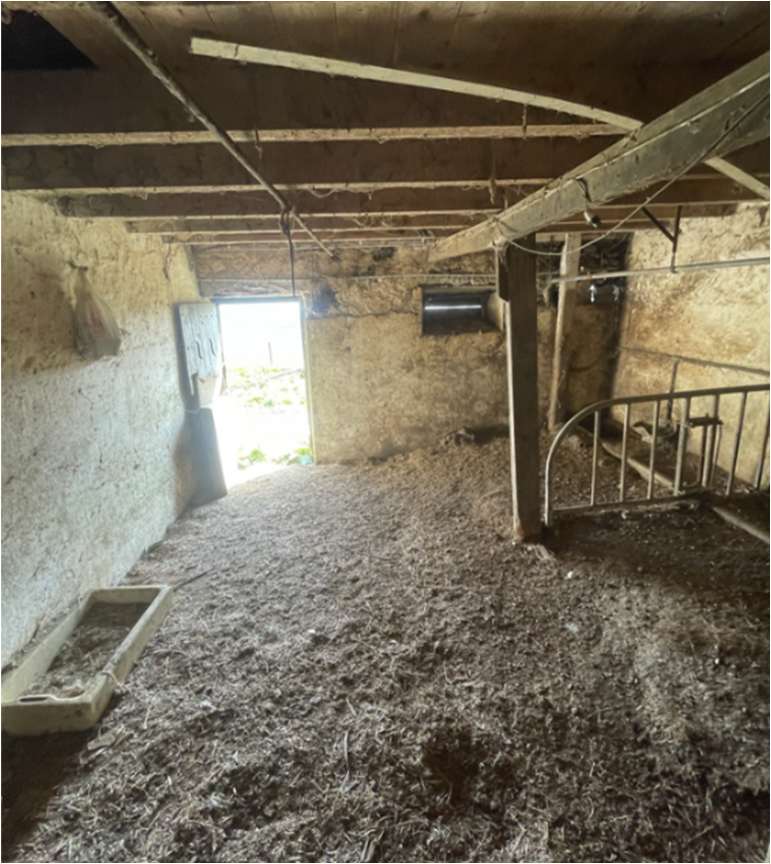
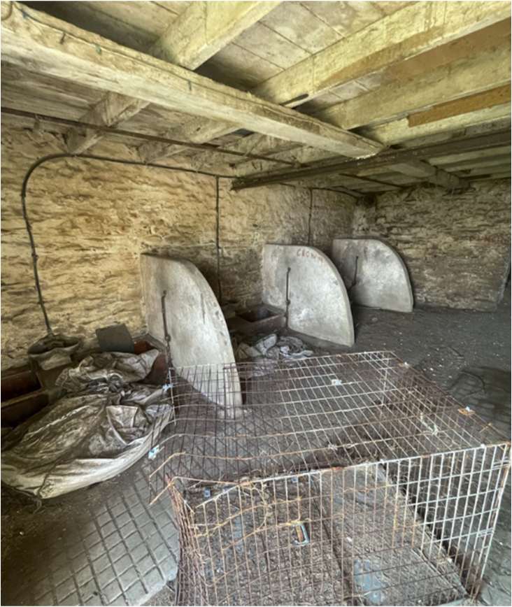
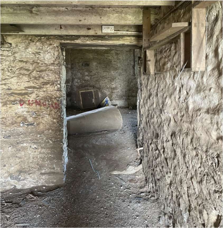
Photo 1.11 Photo 1.12
Photo 1.13
Photo 1.14 Photo 1.15
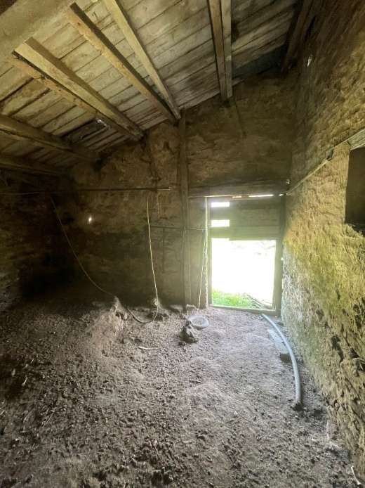
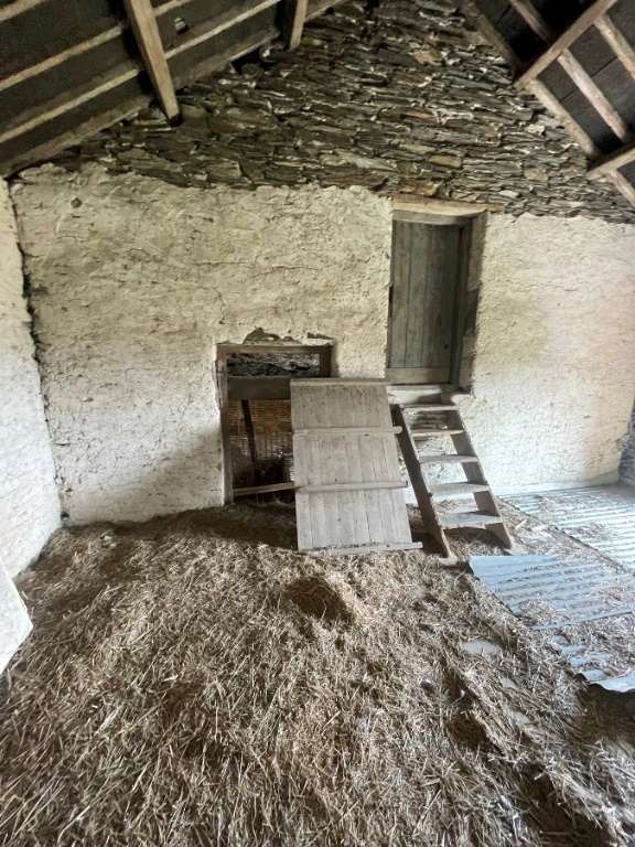
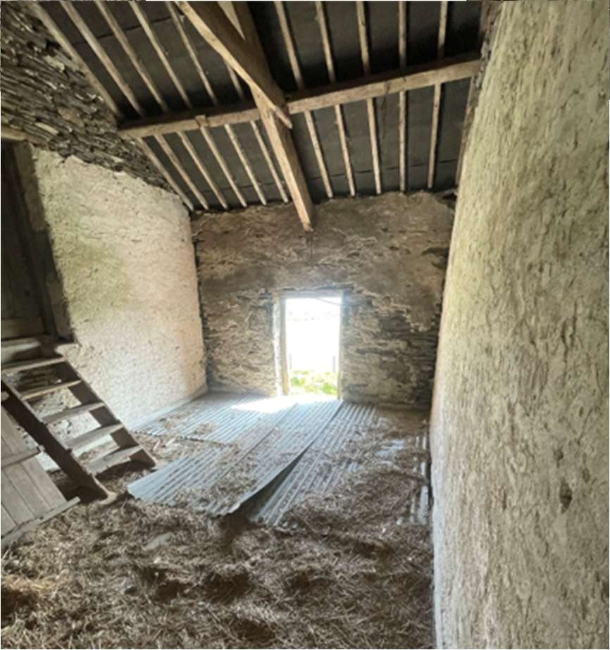
All existing walls are constructed in traditional Manx stone and are principally of reasonable condition with no obvious subsidence issues suggesting no foundation issues and good ground conditions, works will be required to remove vegetation from stonework and repoint existing walls that are to be retained using lime mortar.
The ground loor comprises of both concrete hardstand in milking areas and compacted dirt base elsewhere, it will be required to introduce a new insulated concrete loor slab throughout the property. Intermediate loors within the main barn are of timber construction but are neither structurally sound due to rot or of suitable height to provide new intermediate loors for the proposed dwelling, replacement of intermediate loors is proposed and this will also allow for a restraint system to be introduced to the external walls.
The structural A frame timbers of the roof structure are intact and it is proposed that these are to be retained where possible for aesthetics. The existing roof structure is requiring replacing with sagging due to undersized purlins and rafters. Roof coverings comprise of both galvanised corrugated metal roo ing sheets and cement ibre tiles but all roof coverings are damaged and have exceeded their life span and will require replacement.
A pre planning structural report has been undertaken by ‘Axis Consulting Engineers Ltd’’ which has concluded that the building is capable of conversion to a dwelling. This report has been included as part of the planning application, see Appendix B
The existing ground loor make up of concrete hardstanding or compacted dirt base is to be replaced with a new insulated concrete loor slab cast throughout the barn which will generally match that of the existing levels. Within the barns existing drainage troughs and concrete livestock enclosures will also be removed to suit the creation of habitable rooms.
The original intermediate timber loors which require replacement as noted in the pre planning structural report are to be re-introduced at an increased storey height to the original. Due to limited headroom (approx. 2m) on the existing ground loor storey it is proposed that the intermediate loor height is increased to suit 2.4m ceiling heights in ground loor habitable rooms to help improve levels of natural light and meet daylight requirements.
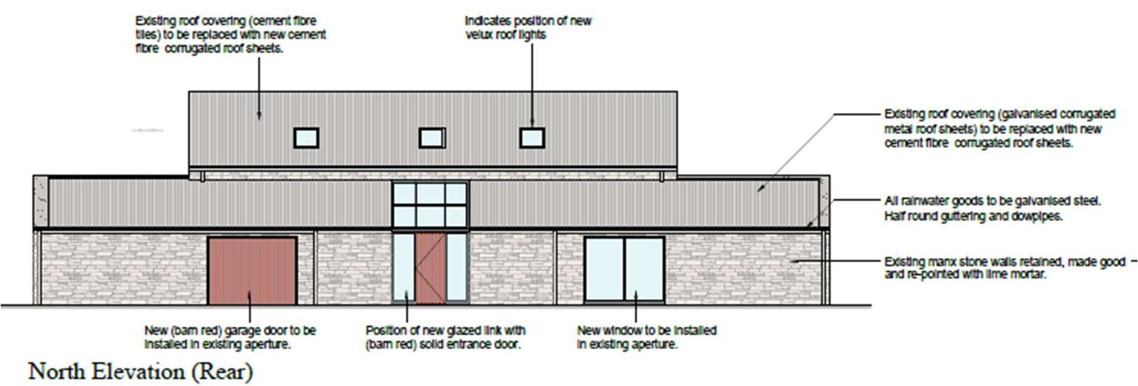
On the north facing elevation a new glazed link is proposed to serve as the principal entrance to the development. This contemporary link will split up the mass of this long un-interesting elevation creating a break between the proposed garage and habitable spaces while remaining sympathetic to the existing appearance of this elevation. The glazed link will also maximize daylight into the building on an elevation where good levels of natural light are dif icult to achieve making use of the existing openings.
It is proposed that the external wall to the main barn on the south facing elevation is to be demolished and re-constructed in masonry cavity wall construction and clad with the reclaimed stone of the demolition works. This decision has been taken to improve the thermal ef iciency of the building, address structural issues of the existing structure walls / loors and to better accommodate the design changes to this elevation.
With the increase to the irst loor storey height to create suitable headroom in the ground loor habitable rooms existing apertures in the elevation are not well positioned to provide good levels of natural light, con lict with the new intermediate loor and with adjoining buildings and roof structure running into to the main barn, new window openings in other elevations are dif icult to create without adversely impacting other elevations. Velux windows were considered as an option to improve levels of natural light to irst loor habitable rooms but this was not pursued as it negatively impacts the proposal of introducing solar panels to achieve better sustainability of the development which are best situated on the south facing roof face.
It is proposed that the south elevation is signi icantly modernized with the creation of 3 new contemporary glazed curtain wall panels which will serve habitable rooms at both ground and irst loor. This will allow rooms to achieve suf icient natural light levels and allow the development to take full advantage of the principle uninterrupted south facing views from the development.
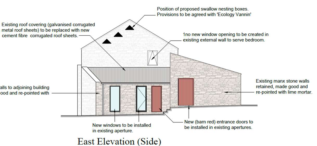
On the east elevation it is proposed that a section of existing wall is removed and rebuilt in a different position highlighted on the loor plans in masonry construction clad with re-used stone from the existing. This will have a minimal impact on the external appearance of the building with the ridge height of a small section of the north facing barn which did not form the original building increased to suit the position of the new wall. A section of external wall to the east elevation lean too building will also be demolished and rebuilt in cavity wall construction, clad with the reclaimed stone. Apertures will be introduced in different positions to the original but the 2no windows will visually replicate the existing, reconstruction of this wall will also remove the small existing rendered panel which is to be re-constructed in stone.
The existing rendered panel to the gable of the main barn is to be rerendered as the existing render has failed and is to be painted in a colour that replicates the natural tones of the existing stone.
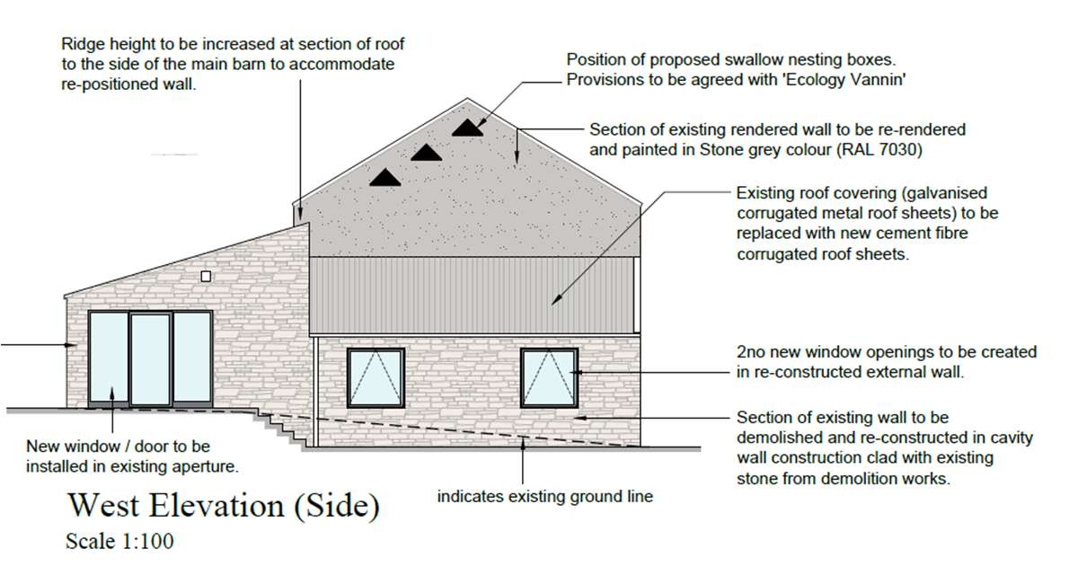
The west elevation will largely remain unchanged with all new windows and doors to suit existing apertures in the elevation. The introduction of 1no new window on the main barn gable at irst loor storey will serve as the only opening window to this habitable room.
All of the existing roof coverings have surpassed life expectancy and or failed, it is proposed that all roof coverings are to be replaced with new corrugated roo ing sheets which will replicate much of the existing roof coverings and that the cement ibre tiles to main barn although not original the replacement of this for corrugated roo ing sheets will be in keeping for an agricultural building while providing a durable and aesthetically pleasing design. New structural steel work will serve as the supporting structure for the roof, existing structural timber members and A frames are to be retained but solely for decorative aesthetics, in keeping with the original design of the structure.
The development is accessed via a private lane off Ballakilpheric Road, ownership of this lane is within the legal curtilage of the property. The renovation and conversion of the barn development into a private dwelling will create hard stand parking provisions and vehicle manoeuvring for 5no vehicles, an EV charging point will also be provided on the external garage wall.
The development boasts the potential to create excellent amenity space, external areas will comprise of tiered lawns, patio space and hardstand areas for vehicle parking and manoeuvring.
The north and east of the property will comprise mostly of hardstand providing access to the property, manoeuvring space and parking for vehicles with access to the principal entrance on the north elevation, all hardstand areas will be of gravel construction.
The west of the development lends itself to create large outdoor amenity space and will comprise of a two tiered lawn that will run from the north to south boundary of the site.
The South side of the external areas will comprise of mostly patio and outdoor entertainment space with a patio that runs the length of the south elevation of the barn, access can be gained to this from downstairs habitable rooms namely kitchen and living rooms. A sunken entertainment space which provides shelter from the elements will take advantage of the existing reduced ground where the recently demolished agricultural shed existed.
The proposal has been designed to make use of renewable and low carbon technologies. The existing building fabric is to be upgraded via new insulation internally to provide high-level thermal performance.
The south and west facing roof will maximise the use of photovoltaic panels and battery storage will provide storage capacity for PV’s. Heat recovery system (MVHR) will also be used to reduce energy consumption, capturing and reusing heat that would otherwise be lost while improving indoor air quality.
The structural conditions assessment con irms that the existing barn would be suitable for restoration and conversion to residential occupation. In accordance with Isle of Man planning ‘General Policy 3’ it has been considered that the existing development is suitable for re-development and in accordance with ‘Housing policy 11’ that the design meets this criteria.
The application is supported by reports and recommendations from ‘Ecology Vannin Consultancy’ with mitigation strategies to protect and encourage identi ied nesting bats, birds and lizards.
The scheme renovates the stone barns that have a strong architectural, historic and social interest and reestablishes the management of the agricultural land associated with the site. It has been considered that the existing buildings can suitably serve a residential dwelling without the need of any additional extension and that the contemporary modernization of certain aspects of the elevations are in keeping with the existing structure appropriate to the rural setting.
The ‘Ecology Vannin Consultants’ nesting assessment undertaken in September 2025 identi ied evidence of nesting birds (barn swallows) and that mitigations must be implemented to protect the species, no evidence of nesting bats at the site was identi ied however an additional winter assessment must also be undertaken to con irm no presence of nesting bats.
| Description | M10 | M10 |
|---|---|---|
| M10 | 1 | 1 |
| M10 | 1 | 1 |
| M10 | 1 | 1 |
| M10 | 1 | 1 |
| M10 | 1 | 1 |
| M10 | 1 | 1 |
| M10 | 1 | 1 |
| M10 | 1 | 1 |
| LEGEND |
|---|
| Drainage Network (D1) |
| Drainage Network |
| Drainage Network |
| Drainage Network |
| Drainage Network |
| Drainage Network |
| Drainage Network |
| Drainage Network |
| Drainage Network |
| Drainage Network |
| Drainage Network |
| Drainage Network |
| DRAINAGE ONLY |
|---|
Make an easy association taboo, please prepare something for following. All health and safety procedures including those covered by HSCOR®. Assure location for alternatives. This telex or assist marking for MUA assets (Any damage WILL result in repair and administration charges).
Send them the below date of release to the specialist 14 days (8457-3005)
1400
https://aproxx.com/1400
Make UTILITIES PO Box 177 Douglas Ala of Man MAN 17-5 Other Area Tel: +44 (1634) 657790 Fax: +44 (1634) 657812 email: [email protected]
Portable Water Network (Cox)
Public Water Way
Private Water Way
Code 1: ISO20170449807
IMPORTANT INFORMATION
These places are for A-4000 equipment only and do not give exact positions of WILL assets. There may therefore be items of plant for which no record is shown.
It is not possible to transfer our records on to your place.
Attendees to need alignments, surface fields and buildings may have been made subsequent to the records being taken as deaths and locations may vary. Remedies may send in the location of harbors and properties on the line of War Technology.
Locations of all services to individual properties are NOT SHOWN on the enclosed map, nor any channel or covering a plant.
There may be other priority to record plant in the area, you should check with Many Telecom, Mark Gas and other utilities before proceeding with any work.
 | Structure | Conduit | N | Ballavayre Farm | ||
| Ballavayre Ballavayre Cottage | Balls | |||||
| The position of Maria Tolworm plant is shown as accurately as possible but the locations must be regarded as approximate. For an accurate location of our existing plant, please contact EDGE®, giving a minimum of 5 working days before the commencement of the accessibility. This is a fine service, however Maria Tolworm will charge for any damage caused to their plant where the procedure is not followed. Note: This information is only valid for a period of 21 days from date of issue. Shown below. Date: 29/07/2025 | LEGEND | ☑ Joint Post | ☐ Caravan | ☑ 10 mm | ☐ | 1958 |
| ☐ Carrageway | ☐ Deli Tea (R) | ☐ 4+ 20 mm | ||||
| ☐ Fartway | ☐ Deli Tea (L) | ☐ 4+ 20 mm | ||||
| ☐ Grimmers | ☐ Baking | ☐ 4+ 30 mm | ||||
| ☐ Coupling | ☐ Pink | ☐ 4+ 30 mm | ||||
| ☐ Merthors | ☐ 4+ 30 mm | |||||
| ☐ 4+ 50 mm | ||||||
| ☐ 4+ 50 mm | ||||||
| ☐ Suited Order | ||||||
| ☐ Suited Guide |
World_Hillshade
Sources: Bell, TomTom, Germin, FAO, NOAA, USGS, © OpenStreetMap contribution, and the GIS User Community, Express Bell, Missin, Africa GIS, USGS, NAA, NIGA, OSWA, N Robinson, NOSID, NLS, OS, NMA, Geotahodymisen, Rijkswaterstaat, GSA, Geotend.
Isle of Man Energy - Gas Network tel: 01624 644444 IMPORTANT: VALID FOR 28 DAYS ONLY. For planning purposes only. Service pipes are not always shown but their presence should be anticipated, separate trial holes to confirm location of apparatus. No liability of any kind is accepted by I.E.G for any error or omission
Copyright in submitted documents remains with their authors. Request removal
View as Markdown