PLANNING STATEMENT FOR THE PARKING AND OPERATION OF MOBILE CATERING FACILITIES, SOUTH CAR PARK, ARCHALLAGAN FOREST, MAROWN
Sarah Corlett 26.09.2023
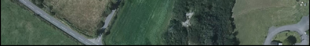
Aerial panoramic view of a rural site showing a road, grassy fields, and a cluster of trees.
1.0 Introduction
1.1 As the site is owned and managed by Department of Environment, Food and Agriculture, the application should be referred to the Council of Ministers for determination under Article 16 (1)(b) of the Town and Country Planning (Development Procedure) Order 2019.
1.2 The site is a small part of Archallagan Plantation which lies to the north of the Archallagan Road and west of a minor road which skirts the eastern edge of the plantation and heads east where it becomes the Rocky Road, to join the Garth Road (B35).
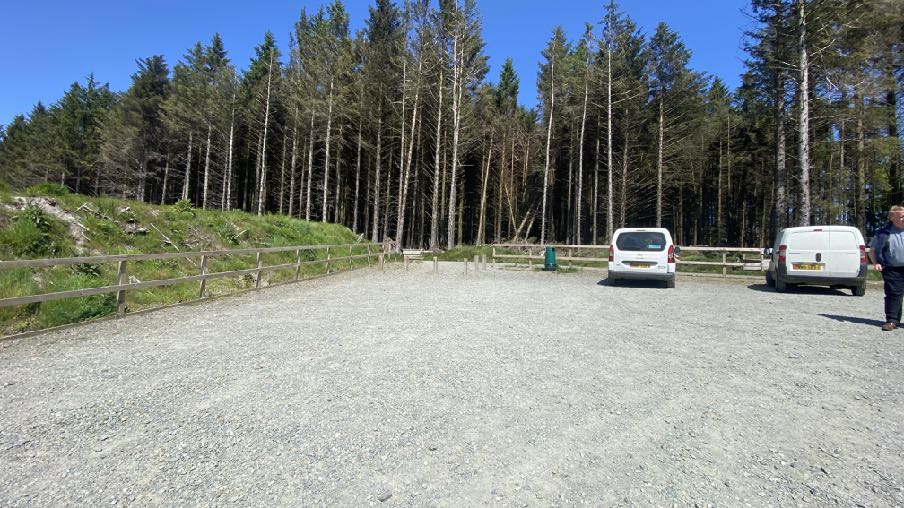
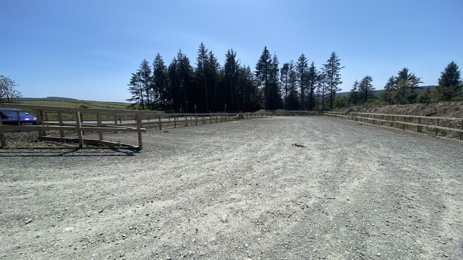
1.3 There is an existing car park at this southern end of the plantation, which has recently been extended (see Planning History and photograph below) and the proposal relates to this area.
1.4 The Archallagan Road leaves the A24 Foxdale Road to skirt the plantation: the nearest residential properties to the site lie on the Foxdale Road - Ploydwell Cottage and Archallagan Cottage and are approximately 200m from the site.
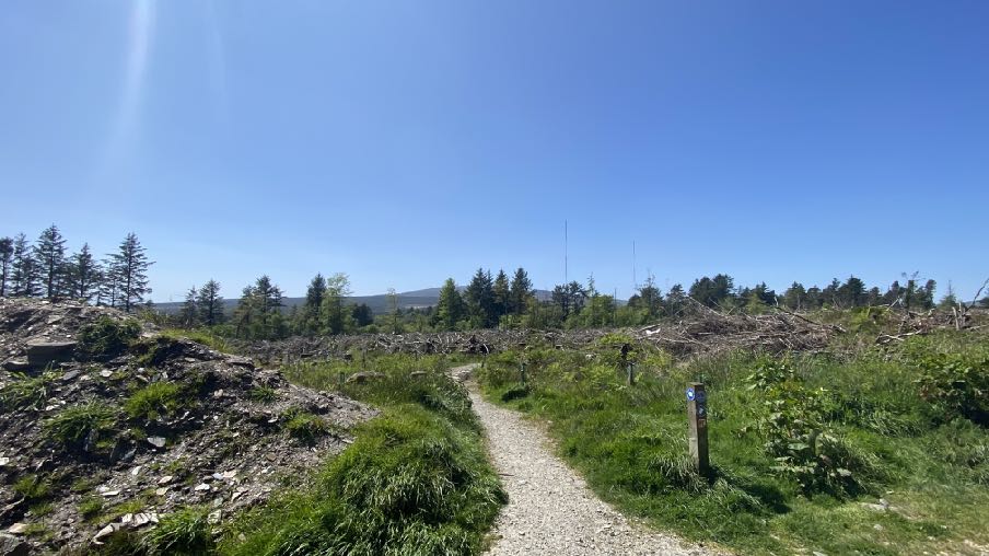
1.5 The recently cleared area to the north west has been replanted with 90% broadleafed trees.
2.0 Planning policy
2.1 Planning policy takes a number of forms: development plans set out what purpose or function land is designated for - land is designated for a particular purpose or not - and these development plans take the form of a variety of adopted Area or Local Plans (or where there is neither, Isle of Man Planning Scheme (Development Plan) Order 1982). Above this, there is the Isle of Man Strategic Plan 2016 which is not geographic but provides over-arching strategic policies which apply across the Island. Area Plans should be in general conformity with the Strategic Plan but where there is any contradiction or conflict, whichever was adopted later would prevail (paragraph 1.4.4).
2.2 Consideration can also be given in the determination of any planning application, to Planning Policy Statements, Planning Circulars, National Policy Directives (there is none as yet) or other statements of planning policy as well as other Government policies. Planning is a balance of all of these considerations as well as anything else which could be considered a material consideration.
Area Plan for the East
2.3 The relevant development plan for this site is the Area Plan for the East which was adopted by Tynwald in 2020. This has a series of maps and a Written Statement. The relevant map for this site is the general Proposals Map where the site lies within an area which is not designated for development.
2.4 There are no Constraints identified for this site on the Environmental Constraints map accompanying the Area Plan where the site is simply designated as ‘Plantation” with no further constraints. There are no Infrastructural or Community Constraints on the relevant maps.
2.5 There is a general presumption against development in undesignated areas, as set out in General Policy 3 of the Strategic Plan (see Appendix One). Environment Policies 1 and 2 presume against development which would be harmful to the character and appearance of the countryside, EP 2 placing even more weight on the protection of the character and quality of the countryside in areas which were identified on the Isle of Man Planning Scheme (Development Plan) Order 1982 as of an area of High Landscape or Coastal Value and Scenic Significance which does not include this site.
2.6 Environment Policy 2 refers to the areas of high landscape value and scenic significance but these have been replaced in the Area Plan for the South with the Landscape Character Assessment designations which characterise the countryside by the type of landscape rather than by its perceived quality. The site lies within an area in this assessment of Incised Slopes - Foxdale. The full assessment of 2008 on which the Area Plan policies are based, is set out in Appendix Two. The Area Plan Written Statement summarises these as follows:
The overall strategy is to conserve and enhance the character, quality and distinctiveness of the area, with its wooded valley bottoms, its strong geometric field pattern delineated by Manx hedges, its numerous traditional buildings and its network of small roads and lanes. The strategy should also include the restoration of landscapes disturbed by former mining activities.
Key Views
Open views down and across the valley towards St. Johns, the Greeba Valley and beyond to the peaks of the Northern Uplands from areas of higher ground. Enclosed views up to the surrounding Southern Upland areas and Stoney Mountain Plantation.
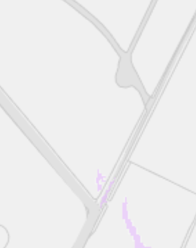
2.7 There is a small area of minor potential risk of surface water flooding on the national flood risk maps:
2.8 There are no buildings on the site, Registered or otherwise. The site is not within a Conservation Area. There are no Registered Trees on or near the site.
Planning policies
2.9 Whilst there is a presumption against development in this area according to General Policy 3, there is provision for “buildings or works required for interpretation of the countryside, its wildlife or heritage”. Paragraph 7.13.2 expands on this, stating that “There is, however, a general presumption against the introduction of new uses into the countryside (including industrial or office uses): (a) for which there is no local need; (b) which would materially effect the rural character of an area; (c) which would necessitate the creation of new
A cropped section of a map showing road lines and faint purple boundary markings.
buildings; and (d) which would be more appropriate in industrial zones, business parks or within urban centres.”
2.10 Development should not have a detrimental impact on woodlands particularly ancient, natural and semi-natural woodlands which have public amenity or conservation value (Environment Policy 3). Whilst most of the Island’s plantations were originally created for a harvesting the timber, many are now being managed for amenity purposes (hence the change of name from plantations to Forests).
2.11 Development should have an acceptable impact on ecology (Environment Policy 4).
2.12 Woodlands are accepted in the Strategic Plan (Appendix 6 A.6.3) as making a valuable contribution to the total recreational provision of communities, particularly those that are deficient in recreational space. The section of the Plan on Sport, Recreation, Open Space and Community Facilities also states that “10.1.1 The quality of life on the Island and the quality of our environment are improved by attractive open space and by facilities for recreation and other community purposes.”
2.13 It goes on:
10.3.2 Open Space forms part of our heritage as well as being an attractive and usable asset, and, in the wider context, provides visual and spiritual relief from the developed urban settlements on the Island. In addition, it provides recreational enjoyment in respect of various active and some less active forms of sporting activity. Open Spaces also provide a means of improving the health and fitness of the Island’s population. Open Space is defined in this context as land used for recreational purposes, both formal and informal, including amenity space whether privately or publicly owned.
10.3.3 The Strategic Plan needs to facilitate sport and recreation opportunities and to ensure that areas of open space are retained, and provided to meet local needs. The Strategic Plan will facilitate this by a three pronged approach:
a) protecting existing assets;
b) making good deficiencies in existing provision; and
c) providing adequate provision within new development.
2.14 Development which would adversely affect the environment is presumed against (Environment Policy 22):
7.17.2 In addition to the above, changes in the activities associated with the current permitted use of land or a building, which in themselves do not constitute development and therefore do not require planning permission, can have an adverse impact on adjacent properties by virtue of noise, light or general disturbance. For example the addition of security lighting on a property may cause light pollution affecting adjacent properties and the wider area. The introduction of new activities into established parks and recreation areas can have an impact on neighbours. In such cases the Department would advocate the person or organisation considering the change to give careful consideration to the potential impact of such activity in terms of location, siting and design.
2.15 Development for the improvement of existing facilities must have regard to any potential adverse impact on those in neighbouring property (Environment Policy 23).
3.0 Planning history and relevant applications
3.1 Planning approval was granted for the enlargement of the existing car park under 20/00854/B to provide up to 100 spaces. The inspector considering the application notes that “the proposed car park would facilitate the improved enjoyment of Archallagan Plantation, as increasingly the most popular of such attractions on the Island” and he notes that the three car parks are often over-subscribed by visitors engage in a wide variety of outdoor activities and that it would also support tourism. He concluded that the proposal satisfied the exceptional provisions of General Policy 3 which includes location-dependent development for the provision of necessary services or engineering operations essential for the interpretation of the countryside, its wildlife or heritage
3.2 There were objections from local residents and the local authority on the grounds of potential disturbance and traffic congestion however he considered that the car park extension would be well screened and that there was no evidence that it would generate such traffic as to cause additional congestion.
3.3 There have also been applications for the use of the plantation for the deposition of incinerable waste (02/018965/B - permitted) and for a timber boardwalk (15/00549/B - permitted).
3.4 In 14/00725/B for recreation facilities and a temporary toilet facility at Ape Mann, South Barrule plantation, concern was expressed at the temporary nature of the toilet facilities and with an encouragement that permanent facilities be provided within three months although this was not required by condition.
3.5 Across the road from Ape Mann, Laser Mayhem has been developing and now has a cafe, accommodated in an existing building. An application (17/00149/B) for the installation of containers to provide kitchen and classroom/office facilities was approved, the inspector concluded that “the three additional and two previously approved containers in the positions now proposed would support facilities for recreation and avoid unacceptable harm to the Southern Uplands landscape in terms of adopted policy” (paragraph 21). A previous application. 16/00277/B for alterations to the existing building on site to provide cooking facilities and a coffee shop was also approved. The inspector noted that “26. I consider the recreational use of the application site for which approval is now sought to be acceptable as social and physically beneficial and in keeping with other such uses already approved in the South Barrule Plantation…and the development is compliant with the Strategic Plan in this respect, including the exceptions contemplated by General Policy 3”.
3.6 15/00462/B sought approval for the extension of the existing car park and creation of a picnic area at Chibbanagh Plantation in Marown. This application was approved, the inspector considering that “I have also had regard to the fact that the exceptions in General Policy 3 of the
Strategic Plan to the normal restrictions on development outside of areas that are zoned for development include works that are required for interpretation of the countryside, its wildlife or heritage. It is in my view reasonable to regard the proposed car parking and picnic area either as falling with the category of development required for the interpretation of the countryside, or as being akin to development to that type” (paragraph 18).
3.7 Applications have been permitted for the installation of mobile catering vehicles within existing industrial estates: two examples of these are -
3.8 15/00333/C proposed a unit at Haldane Fisher builders’ merchants in Braddan and was approved subject, inter alia to a condition which required that:
2. If the catering van ceases to operate from the site on a permanent basis the unit mustbe removed from the site and the site returned to its use as car parking spaces for theadjacent industrial unit.
Reason: to provide adequate car parking for the industrial use of the site.
3.9 10/01687/B - B&Q car park - permitted without restrictive conditions.
4.0 The proposal
4.1 This application, along with others, is seeking permission for a temporary period for the sites to accommodate a catering vehicle to provide hot and cold drinks and food. It is not intended that these facilities will attract additional people to the sites who would just utilise the catering facilities and then leave, but to provide facilities for those who are visiting the sites and walking, cycling or otherwise enjoying the amenities that the forests have to offer.
4.2 The period being sought for the accommodation of the vehicles is five years to enable the Department to ascertain if there is a demand for and benefit from such facilities and if so, they would consider the development of more permanent facilities in these locations. After this time the vehicles would no longer be operating from these sites unless further approvals were sought and granted.
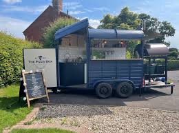
4.3 The catering facilities will be operated during daylight hours (times between dawn and dusk, each depending on the particular operator on each site) and there will be no additional lighting.
4.4 The catering vehicles will be something along the lines of the following, involving local operators which will be invited to tender for the opportunity to operate these facilities.
4.5 It is intended that the successful businesses will support the recreational use of their area withtheir menus appropriate for the users of the plantations and should support the Food Matters
Strategy. These food offered is anticipated to be coffee and cake based, vegetarian, artisan food offerings, local grown meat products. The Department is not looking for typical fast food facilities and each businesses will need to demonstrate that it will provide uniqueness that befits the setting. The vehicle may be removed at the end of each session or retained on site out of operation, depending upon the operator.
4.6 Each car park already has litter bins and seating facilities and additional will be provided if required. Such facilities do not require planning approval under Class 12 of the the Town and Country Planning (Permitted Development) Order 2012.
5.0 Conclusion
5.1 The site is not designated for development but it is clear from the Strategic Plan and the decisions taken in respect of applications for facilities in the Department’s forests and plantations throughout the Island, that the amenity and recreation value of these areas is a valuable asset and improvement of them, and encouragement of people to use them with a resultant improvement in the mental and physical health of the Island’s population. We would suggest that the application satisfies the requirements of the Strategic Plan and in respect of the presumption against development, is acceptable on the basis that they are “required for interpretation of the countryside, its wildlife or heritage” (General Policy 3h) as was concluded in the case of the applications for the car parks at this site, Laser Mayhem and Chibbanagh as noted above.
5.2 The recent Government Economic Strategy 2022 - 2032 aims to create a “secure, vibrant and sustainable future” for the Island, “improved health and well being” and By actively investing in key services & infrastructure that attract and retain economically active people, supported by a range of incentives and disincentives to sustain targeted growth” with the Island becoming an even more attractive place to live. These investments include culture, light and transport facilities whilst protecting the natural environment and “expanding and improving facilities and activities for children, young people and families”.
5.3 The proposed facilities are aimed at improving existing facilities and making outdoor recreation a more attractive proposition for the Island’s population. The temporary nature of the proposals will enable the Department, and those living in the vicinity of the sites, and those who will use them, to gauge whether the facilities are desirable, correctly located and serviced and to ensure that there are no environmental issues before something more permanent may be considered.
5.4 Whilst temporary, these vehicles are not unsightly and are often quirky and will not have any adverse or permanent impact on the character or appearance of the area. The site already has information boards, a hard surfaced car park and fencing. There will be no loss of trees, no harm to ecology and no disturbance to or pollution of adjacent land. It should be noted that this site is already well used and is a popular recreational destination, evidenced by the Department’s extension of the car park in which this new facility will be accommodated, and the installation of board walk facilities.
5.5 We would welcome conditions which could be attached to any approval which may be granted which would restrict the permission to a temporary period of five years starting from the date of the permission, should it be granted, for a restriction on any lighting, for the operation to be no earlier than dawn nor later than dusk on any day. The Department already supervises each site for litter bin provision and emptying and the maintenance and provision of seating and tables and this would continue should the catering facilities be installed and additional facilities installed if required.
Appendix One - policies
Strategic Plan
Strategic Policy 4: Proposals for development must:
(a) Protect or enhance the fabric and setting of Ancient Monuments, Registered Buildings(1), Conservation Areas(2) , buildings and structures within National Heritage Areas and sites of archaeological interest;
(b) protect or enhance the landscape quality and nature conservation value of urban as well as rural areas but especially in respect to development adjacent to Areas of Special Scientific Interest and other designations; and
(c) not cause or lead to unacceptable environmental pollution or disturbance.
General Policy 3: Development will not be permitted outside of those areas which are zoned for development on the appropriate Area Plan with the exception of:
(a) essential housing for agricultural workers who have to live close to their place of work; (Housing Policies 7, 8, 9 and 10);
(b) conversion of redundant rural buildings which are of architectural, historic, or social value and interest; (Housing Policy 11);
(c) previously developed land(1) which contains a significant amount of building; where the continued use is redundant; where redevelopment would reduce the impact of the current situation on the landscape or the wider environment; and where the development proposed would result in improvements to the landscape or wider environment;
(d) the replacement of existing rural dwellings; (Housing Policies 12, 13 and 14);
(e) location-dependent development in connection with the working of minerals or the provision of necessary services;
(f) building and engineering operations which are essential for the conduct of agriculture or forestry;
(g) development recognised to be of overriding national need in land use planning terms and for which there is no reasonable and acceptable alternative; and
(h) buildings or works required for interpretation of the countryside, its wildlife or heritage.
Environment Policy 1: The countryside and its ecology will be protected for its own sake. For the purposes of this policy, the countryside comprises all land which is outside the settlements defined in Appendix 3 at A.3.6 or which is not designated for future development on an Area Plan. Development which would adversely affect the countryside will not be permitted unless there is an over-riding national need in land use planning terms which outweighs the requirement to protect these areas and for which there is no reasonable and acceptable alternative.
Environment Policy 2: The present system of landscape classification of Areas of High Landscape or Coastal Value and Scenic Significance (AHLV’s) as shown on the 1982 Development Plan and subsequent Local and Area Plans will be used as a basis for development control until such time as it is superseded by a landscape classification which will introduce different categories of landscape and policies and guidance for control therein. Within these areas the protection of the character of the landscape will be the most important consideration unless it can be shown that:
(a) the development would not harm the character and quality of the landscape; or
(b) the location for the development is essential.
Environment Policy 3: Development will not be permitted where it would result in the unacceptable loss of or damage to woodland areas, especially ancient, natural and semi-natural woodlands, which have public amenity or conservation value.
Environment Policy 4: Development will not be permitted which would adversely affect:
(a) species and habitats of international importance:
(i) protected species of international importance or their habitats; or (ii) proposed or designated Ramsar and Emerald Sites or other internationally important sites.
(b) species and habitats of national importance:
(i) protected species of national importance or their habitats;
(ii) proposed or designated National Nature Reserves, or Areas of Special Scientific Interest; or
(iii) Marine Nature Reserves; or
(iv) National Trust Land.
(c) species and habitats of local importance such as Wildlife Sites, local nature reserves, priority habitats or species identified in any Manx Biodiversity Action Plan which do not already benefit from statutory protection, Areas of Special Protection and Bird Sanctuaries and landscape features of importance to wild flora and fauna by reason of their continuous nature or function as a corridor between habitats.
Some areas to which this policy applies are identified as Areas of Ecological Importance or Interest on extant Local or Area Plans, but others, whose importance was not evident at the time of the adoption of the relevant Local or Area Plan, are not, particularly where that plan has been in place for many years. In these circumstances, the Department will seek site specific advice from the Department of Agriculture, Fisheries and Forestry if development proposals are brought forward.
Environment Policy 22: Development will not be permitted where it would unacceptably harm the environment and/or the amenity of nearby properties in terms of:
i) pollution of sea, surface water or groundwater;
ii) emissions of airborne pollutants; and
iii) vibration, odour, noise or light pollution.
Environment Policy 23: When considering alterations and improvements to existing facilities the Department will require that consideration be given to the potential adverse impact of the proposed changes to existing neighbours.
Appendix Two
Landscape Character Assessment
D11 FOXDALE
Key Characteristics
• A rural landscape with a settled farmland character
• Wide wooded river valley with various settlements along the A3 and A24.
• Small-scale rectilinear fields in valley bottom around settlements becoming larger and fragmented with strong geometric pattern around Mount Pleasant.
• Predominantly slate houses with front walls consisting of slate and white granite tops. • Undulating farmland with large arable and pastoral fields with intact field boundaries.
• Gently rounded hills.
• Large Archallagan coniferous plantation on abrupt edge on rounded hilltop.
• Hill farms surrounded by trees.
• Irregular sized and shaped fields of rough pasture on increasingly steep slopes that lead up to the Southern Uplands.
• Fields generally enclosed by robust Manx hedgerows, with gorse in upper parts of area and occasional trees in valley bottom.
• Moderate sense of enclosure provided by surrounding slopes.
• Sense of tranquillity reduced in areas close to the busy A3/A24.
• Legacy of abandoned mines and quarries, with spoiled areas and disused buildings. • An evocative sense of abandoned fields on upper slopes.
• Kionslieu Reservoir and Eairy Dam waterbodies
• Well vegetated river corridor descending to Greeba Valley and St. John’s.
Overall Character Description The area consists predominantly of settled undulating farmland on gently sloping valley sides and the relatively steep slopes that lead up to the Southern Uplands, from where numerous small tributaries, such as Struan Barrule, drain to fill the Eairy Dam and Kionslieu reservoir that subsequently flow into the valley bottom river.
The gently rounded hilltop covered by the large Archallagan coniferous plantation with abrupt edges is surrounded by an extensive area of farmland and pasture, divided by strong hedgerows of Manx hedges with gorse that creates a strong geometric field pattern. Large rectangular fields with deciduous trees contained within the field boundaries, in addition to the trees that surround the scattered farm houses and out buildings in places, such as Kerrowdhoo Farm, create an enclosed but settled feel. The enclosed character is enhanced by the numerous small lanes with tall grassed Manx
hedges that predominantly follow the valley contours. Relatively small rectilinear fields around settlements. Sense of tranquillity reduced by busy A3/A24 highways.
Fragmented and often dense deciduous woodland occupies the Foxdale valley bottom, along which the A24 and A3 road corridors run. The settlement of Foxdale with its modern extension is located in the valley bottom at the A24/A3 junction. Settlements in the valley generally comprise a mixture of low terraced and detached houses, constructed predominantly of slate. White granite topped front walls of the houses run parallel to the road corridor and river. Around Lower Foxdale, the watercourse is surrounded by lush riparian vegetation and deciduous woodland.
Key Views
• Open views down and across the valley towards St. Johns, the Greeba Valley and beyond to the peaks of the Northern Uplands from areas of higher ground
• Enclosed views up to the surrounding Southern Upland areas and Stoney Mountain Plantation
Historic Features
• Disused mines and quarries and mining features.
• Giant’s grave.
• Keeill.
Ecological Features
• Farmland grassland habitats.
• Marginal periphery moorland habitats at edges of coniferous plantations and on upper valley slopes.
• Mature network of hedgerows containing deciduous trees in field boundaries.
• Aquatic and waterside habitats along river’s course and in the reservoirs.
• Dense riparian woodland in valley bottom with deciduous woodland along valley sides. Evaluation of Inherent Landscape Sensitivities
• Valley bottom and riverside woodland.
• Ecological value of the aquatic ecosystem with riparian habitats.
• Strongly geometric pattern of fields with Manx hedges.
• Numerous small lanes with grassed Manx hedges.
• Sites of archaeological importance.
• Scattered hill farms fringed by trees on upper slopes.
Landscape Strategy The overall strategy should be to conserve and enhance the character, quality and distinctiveness of the area, with its wooded valley bottoms, its strong geometric field pattern side lineated by Manx
hedges, its numerous traditional buildings and its network of small roads and lanes. The strategy should also include the restoration of landscapes disturbed by former mining activities.
Copyright in submitted documents remains with their authors. Request removal