Planning Statement For The Conversion Of Ballaleigh Farm To A Dwelling (Class 3.3) Or Tourist Accommodation (Class 3.6), Ballaleigh Road, Michael
1.0 Introduction
1.1 Ballaleigh Farm lies on the landward side of the A4 Peel to Kirk Michael Coast Road on the Ballaleigh Road which links the A4 to the A3 TT Course at Barregarrow.
1.2 The site extends to a limited area - 0.6ha (1.4 acres) which is the curtilage of a number of existing buildings, mostly agricultural and one dwelling, bounded by solid masonry walls and natural hedging with the buildings sitting adjacent to the Ballaleigh Road, which is a public highway, and an open field to the rear.
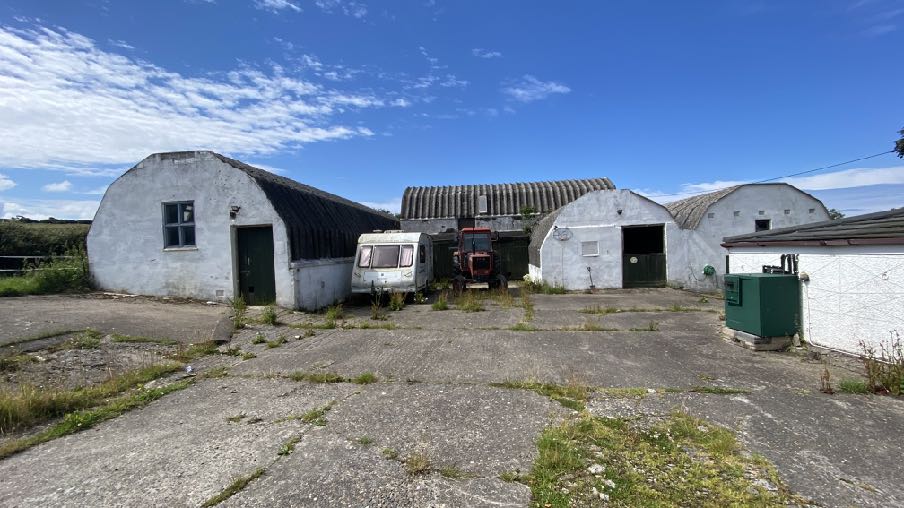
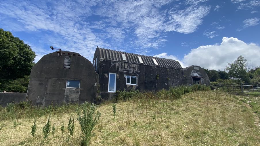
1.3 The site accommodates a range of buildings: there is a dwelling which takes the form of a largely traditional Manx farmhouse albeit with modern windows and a catslide roof to the rear (south east). To the south of the house is a range of single storey outbuildings which all take a similar form of masonry walls and a seven sided angled roof each covered in corrugated sheeting. The central section has a small lean to addition to the front. The building at the rear of the group is taller and contains a mezzanine level within. In front of the outbuildings is a concrete hardstanding which leads to the gated entrance onto the Ballaleigh Road.
1.4 The Ballaleigh Road is generally narrow, single width with natural hedges on both sides. The land is undulating between the Barregarrow end which is higher, and the coast road to the north west.
2.0 Planning policy
2.1 The site lies within an area not designated for development on the Isle of Man Planning Scheme (Development Plan) Order 1982 which is the only adopted land use development plan for the area. The 1982 Plan is in the process of being replaced by an Area Plan for the North and West which is to be the subject of a public inquiry starting 16.07.24. In this document, the site also lies within an area not designated for a particular purpose. This draft Plan also has plans which illustrate constraints - environmental and infrastructural and it also includes the recommendations of the Landscape Character Assessment.
2.2 The area of the site where the buildings are located is not shown as being subject to any constraints although there are areas of Registered Trees directly alongside the buildings, within the site, and opposite.
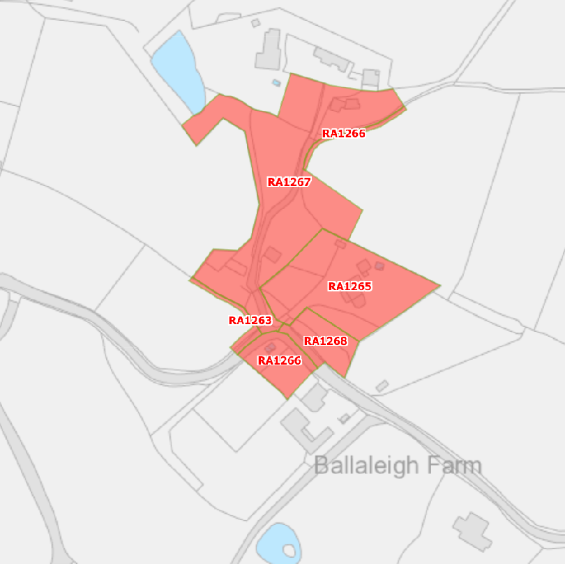
A site location map showing a red-shaded area with reference codes (RA1265-RA1268) situated near Ballaleigh Farm.
2.3 The site is not shown on the national flood risk maps as being at risk of flooding and the site is not within a Conservation Area. None of the buildings on the site is Registered.
2.4 Trees are generally protected under Environment Policy 3. Where development proposes work within close proximity to trees, it is generally expected that accurate surveys of the trees and where appropriate, mitigation and protection measures to demonstrate that there would not be an unacceptable impact thereon.
2.5 Ecology is protected under Environment Policies 4 and 7. Applications for conversion of existing buildings to another use or for works to outbuildings where they may be breeding or nesting birds or protected species are generally required to be accompanied by a Preliminary Ecological Survey for such species and if any are found, mitigation and protection thereof to demonstrate that the impact on ecology is acceptable.
2.6 There is a general presumption against development in undesignated areas, as set out in General Policy 3 of the Strategic Plan (see Appendix One). Environment Policies 1 and 2 presume against development which would be harmful to the character and appearance of the countryside, EP 2 placing even more weight on the protection of the character and quality of the countryside. Environment Policy 2 refers to the areas of high landscape value and scenic significance but these will be replaced in the Area Plan for the North and West with the Landscape Character Assessment designations which characterise the countryside by the type of landscape rather than by its perceived quality.
2.7 This site lies within an area on the Landscape Character Assessment as part of the an area of Incised Slopes - D6 - Cronk y Voddy - where the overall strategy should be “to conserve and enhance the character, quality and distinctiveness of the area, with its patchwork of upland fields fringed by valley bottom woodland and moorland and its enclosed and intimate rural road network, a tranquil and remote character with traditional hamlets, scattered farm buildings and nucleated settlements built in a vernacular style.”
2.8 Whilst there is a presumption against development in this area according to General Policy 3, there is provision for extensions of existing rural properties (Housing Policies 15 and 16) and also for the replacement of some rural dwellings (Housing Policies 12 and 14). There are also policies which support the conversion of existing buildings of interest to other
uses, subject to a number of criteria. Housing Policy 11 deals with the conversion of such buildings into residential units:
Housing Policy 11: Conversion of existing rural buildings into dwellings may be permitted, but only where:
(a) redundancy for the original use can be established;
(b) the building is substantially intact and structurally capable of renovation;
(c) the building is of architectural, historic, or social interest;
(d) the building is large enough to form a satisfactory dwelling, either as it stands or with modest, subordinate extension which does not affect adversely the character or interest of the building;
(e) residential use would not be incompatible with adjoining established uses or, where appropriate, land-use zonings on the area plan; and
(f) the building is or can be provided with satisfactory services without unreasonable public expenditure.
Such conversion must:
(a) where practicable and desirable, re-establish the original appearance of the building; and
(b) use the same materials as those in the existing building.
Permission will not be given for the rebuilding of ruins or the erection of replacement buildings of similar, or even identical, form. Further extension of converted rural buildings will not usually be permitted, since this would lead to loss or reduction of the original interest and character
Environment Policy 16 provides guidance on the conversion of such buildings to other uses.
Environment Policy 16: The use of existing rural buildings for new purposes such as tourist, or small-scale industrial/commercial use may be permitted where:
a) it is demonstrated that the building is no longer required for its original purpose and where the building is substantially intact and structurally capable of renovation;
b) the reuse of the building will result in the preservation of fabric which is of historic, architectural, or social interest or is otherwise of visual attraction;
c) it is demonstrated that the building could accommodate the new use without requiring extension or adverse change to appearance or character;
d) there would not be unacceptable implications in terms of traffic generation;
e) conversion does not lead to dispersal of activity on such a scale as to prejudice the vitality and viability of existing town and village services; and
f) the use of existing buildings involves significant levels of redevelopment to accommodate the new use, the benefits secured by the proposal in terms of impact on the environment and the rural economy shall outweigh the continued impact of retaining the existing buildings on site.
Proposals to convert rural buildings to residential accommodation will be considered along with the advice given at Section 8.10 of this document.
2.9 In respect of tourism, the Government’s relatively recently adopted Strategy - Our Island Our Future is considered to be a material consideration. This sets out the Government’s objective of increasing tourism and the key areas of work required to achieve this. This refers to the Island’s very seasonal tourist market and also that its accommodation is lagging behind its competitors in terms of quality, choice and innovation and that in its view, the Island is not making the most of its key unique selling points - its seas, coastline, countryside, heritage, culture, arts and food and drink. The principal objective of the strategy is to grow the annual visitor numbers to 500,000 by 2032 and increase the annual economic contribution of the Island’s Visitor Economy to £520m.
2.10 Development should also take account of Climate Change and aim to support the Island’s target of reducing its carbon emissions to net zero by 2050.
2.11 Finally, development is expected to result in Biodiversity Net Gain - avoiding any loss of biodiversity and where there is to be such, mitigation which at least results in an equal replacement in quality and value of habitat lost.
3.0 Planning history
3.1 The site has been the subject of a number of applications as follows:
IDO 6520 - erection of agricultural buildings - permitted 90/00953/B - installation of lpg tank - permitted 04/01058/B - first floor extension to dwelling - permitted
3.2 Other examples of conversions of structures to new uses include 20/01058/B and 24/00493/B both of which saw approval granted to the conversion of two disused bunkers to a dwelling.
3.3 Three further examples of conversions which involved raising of the roof of the existing buildings are 23/00679/B at East Britney Farm in Jurby, 23/00711/B for the former mill building at Ballacuberagh Cottage, Sulby and 16/00329/B for Crossag Farm outbuildings near Ramsey.
4.0 The proposal and planning assessment
4.1 The application proposes the conversion of the existing buildings, other than one, to either residential or tourist accommodation. Also proposed is the installation of a new sewage treatment system for the new accommodation, a very small extension to the residential curtilage of the existing dwelling and building group and minor alterations to the access to improve visibility.
4.2 Whilst the site lies within an area not designated for development, there are policies which support the retention and conversion of existing interesting buildings in such areas, to other uses to ensure their continued retention and maintenance. In order to be considered positively for conversion to another use, it needs to be demonstrated that:
a) the building or buildings are of historic, social or architectural interest
b) the building is redundant for its original purpose
c) the building is structurally sound and capable of the conversion works
d) the works can be achieved without adversely or significantly affecting the interest in the buildings, whatever that may be and without significant increase in size/area
e) the building can be satisfactorily serviced - electricity, access, water, parking, drainage
f) if a non residential use is proposed, that there will not be an adverse impact on adjacent settlements through dispersal of activity on such a scale as to prejudice the vitality and viability of them
g) the use would not be incompatible with adjacent land uses and not generate an unacceptable level of additional traffic.
4.2 Interest
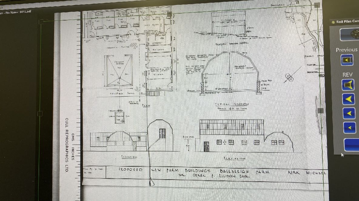
4.2.1 The buildings were approved in February 1950 under IDO 6520 for agricultural purposes (see next page for the drawings). There is no information on the corresponding microfiche other than the submitted drawings but they show the buildings largely as they appear today (other than the small addition in front of the central section and with all of the building conjoined) and the annotation describes the nature of the buildings. The roof
section is described as “Universal Asbestos Cement Co 180 degrees span ‘Handcraft” Hut units” and with a note that “the three sheets forming the unit are bolted together and require no purlins”.
4.2.2 The Universal Asbestos Cement Co Handcraft Units were manufactured by the Universal Asbestos Manufacturing Company Ltd of Watford for use as airfield accommodation from 1942 onwards. Some still exist on old wartime airfields around the UK including RAF Beaulieu and Portmaculter and there is a similar structure at Ballaquine Farm and like Ballaleigh, the building appears to have been repurposed as an agricultural building
as the iconic roof structure sits on supporting walls which did not appear on the original buildings. Each of the 7 sides is an asbestos sheet, which are then bolted together to form the unique and recognisable shape and as they are quick and easy to assemble, it has been assumed that they are called handcrafts huts because a team of men at the airfield could have taken the sheets and rapidly built an accommodation hut.
Architectural drawings displaying floor plans, sections, and elevations for proposed farm buildings at Ballaleigh Farm.
4.2.3 An academic dissertation by Cambridge University titled “Wartime huts: the development, typography and identification of temporary military buildings in Britain 1914-1945” includes reference to the Handcraft huts and suggest that they appear to have come informed production from May 1942 and used predominantly for barrack accommodation.
4.2.4 The importance of World War structures to the Island is manifest in the various Registrations which have been implemented: all of the Registered Buildings in Jurby have an historical association with the WWII and as noted above, planning approval has recently been granted for the conversion of two WWII bunkers to residential accommodation, on the basis that the history of these structures complied with the requirement in HP11 for such buildings to have historical interest (or social or architectural).
4.2.5 Such structures are becoming more rare as they age and those that remain seem to have been preserved due to their private ownership or an acknowledgement by Government of their historic interest. Finding a use for them will ensure their continued existence, particularly if the buildings are not protected through Registration (or Listing in the UK) or Conservation Area status.
4.2.6 In this case the buildings is clearly visible from the highway and anyone passing the site and seeing them would immediately recognise them or wonder at their iconic appearance and perhaps (as we did) research what they might have been. Whilst many people are familiar with the Nissen hut and may mistake what is on site for these, the Nissen huts had a 210 degree cylindrical corrugated iron roof and appeared earlier, used in the First World War but also continued to be used in WWII.
4.2.7 The buildings currently have “Barton Hall” painted on the front which could identify a link wit RAF Barton Hall although no information has been found to confirm such an association.
4.2.8 The Landscape Character Assessment requires that development seeks to “conserve and enhance the character, quality and distinctiveness of the area” and we would submit that these distinctive buildings form an important part of this character, quality and distinctiveness and merit retention and conversion under HP11 and EP16. Reference has
been made above to other WWII structures that are either Registered or which have been permitted for conversion.
4.3 Redundancy
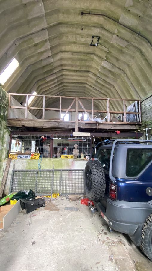
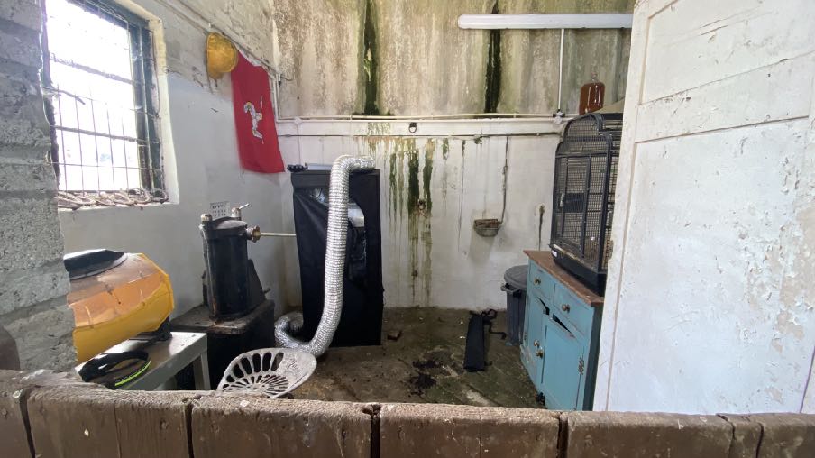
4.3.1 The buildings to be converted are currently used to store scrap wood and there are pieces of old furniture, unused small animal hutches and there is currently a vehicle stored in part of the buildings which is to be retained as a garage.
4.3.2 Part of the building group - that on the south eastern edge is currently used as stabling/animal accommodation and for animal feed. This is to be retained as an agricultural building as it is the only building which is level with the field at the rear.
4.3.3 The space within the existing buildings to be converted is not actively used and iscertainly redundant for its original purposes which included pigs and calves accommodationwhich suggests that the farm was more intensively used than it currently is.
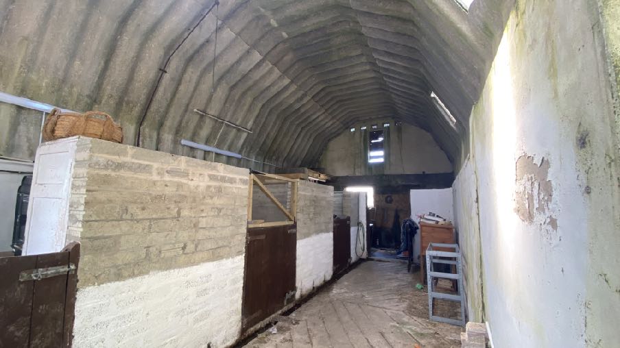
Interior view of a rustic outbuilding or utility room featuring a wood-burning stove, a blue cabinet, and a barred window.Interior photograph of a large outbuilding featuring a corrugated arched roof and brick stall partitions.
4.3.4 The land associated with the site is 1.4 acres compared with significantly more land on the other side of Ballaleigh Road when the buildings were permitted. 1.4 acres is sufficient for a small flock of sheep or one or two horses all of which could be, and indeed are, accommodated in the existing building which is to be retained for agricultural purposes.
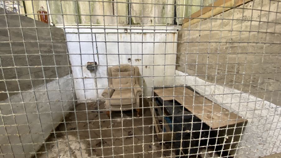
A photograph showing the interior of a derelict concrete block outbuilding viewed through a wire mesh fence, containing an armchair and a wooden table.A photograph showing a large, dark concrete agricultural building with a curved roof, likely a Nissen hut, situated in a grassy field with new windows installed.
The remaining accommodation in these outbuilding is not required for agricultural purposes nor is it being used for such purposes.
4.4 Structural condition
4.4.1 The application is accompanied by a Structural Engineer’s Report which demonstrates that the building is not only structurally stable but is capable of the conversion works which are proposed. The report, prepared by AB Consulting concludes that
“Whilst the buildings are in a poor state of repair, there is no evidence of significant structural movement or distortion. The cracking and movement is due to the age of the buildings and a result of the deterioration of the material, resulting from thermal movement, exposure and the lack of maintenance.
The existing walls are stable and suitable for retention. The new structural frame proposed will further stabilise the existing structure and maintain the structural integrity for perpetuity. The gable walls will require temporary works during the conversion to maintain their structural integrity.”
4.5 Changes proposed to the buildings
A close-up photograph of a weathered dark exterior wall featuring a newly installed white-framed door and window, surrounded by overgrown vegetation.
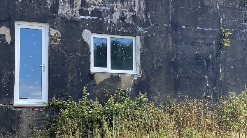
4.5.1 The proposed conversion looks to not increase or change the footprint of the building
at all. Existing openings will largely be retained and openings which existed previously will be opened up.
4.5.2 There is to be a rear terrace area to provide a very modest external amenity area but more importantly, access from the rear of the building round to the side and main amenity area without going through the building. This will take the form of masonry walling beside which will be planted a new native hedge to soften its impact and will also have the benefit of improving the appearance of the rear elevation which currently has a door opening part way up the wall.
4.5.3 The existing roof, as noted on the original plans, is asbestos and cannot be retained in situ. It is proposed to replace the existing roofing with new profiled sheeting which matches the existing in profile and the colour we believe the original sheeting was when first installed (black). The new roof will match the existing in profile and a sample of the proposed roofing material which will be used will be provided.
4.5.4 Whilst the north western section of the building will see its eaves level raised to enable optimisation of the internal space, this will not significantly affect the appearance of the group and the central building alongside will remain higher. The finished buildings will be very similar to what exists, retaining the character and interest of the buildings. Anyone seeing them will still be able to appreciate the iconic roof shape and material and the
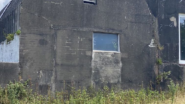
A close-up photograph of the weathered dark exterior wall of an existing outbuilding, featuring a window and vegetation growing at the base.
proportions and appearance of the buildings which are not to change and which are all the distinctive elements of these buildings and on what their historic interest is based.
4.5.5 All new windows will be framed in grey coloured material and doors of a matching colour. This is considered to be more appropriate than the existing white uPVC units within the building.
4.6 Servicing
4.6.1 The building has electricity supplied and will have a new Air Source Heat Pump installed for heating and hot water. Information is provided to demonstrate that the noise levels emitted therefrom are acceptable.
4.6.2 The site has adequate car parking for both the existing and proposed users in the existing hard surfaced farmyard which is not to change. The existing garaged car parking spaces are to be retained for the new unit along with two spaces immediately in front. Three further spaces are available for the existing dwelling within the yard together with sufficient turning space for all of the vehicles to be able to enter and exit the site in a forward gear..
4.6.3 No changes are proposed to the means of access other than the lowering of the height of the two gate pillars either side. Visibility splays are shown on the submitted drawings and are should be considered acceptable for the lightly trafficked highway alongside.
4.6.4 Whilst access to the right of the exit will take a vehicle to the Barregarrow crossroads which is closed during times of TT and Manx Grand Prix/Festival of Motorcycling racing and practising, access to the left will take a vehicle onto the coast road and access is available in these periods to the rest of the Island via Peel.
4.6.5 The proposed unit will be provided with a new biodisc to deal with foul wastewater from the property. Details of this are shown on the drawings and the site has been amended to include this and a small area where the rear terrace is to be added to the back of the building.
4.7 Impact on settlements
4.7.1 Whilst residential development is generally directed towards existing settlements (Housing Policy 5), there is provision within Housing Policy 11 for new dwellings to be created within the countryside where the relevant criteria are met. The creation of a single
dwelling on this site should not considered to adversely affect the vitality or viability or interest of any nearby settlement.
4.8 Compatibility with adjacent land uses
4.8.1 The proposed use is residential and the two adjacent land uses are residential and agricultural. The residential uses are the applicant’s home, Ballaleigh Farmhouse and there is also a dwelling, Langdale, to the south which is separated from the buildings to be converted by the agricultural building which is to be retained, and a distance of 72m. The limited floor area and distance between these two properties are considered to be sufficient to prevent any adverse impact or conflict between the two properties.
4.8.2 The proposed dwelling will be close to Ballaleigh Farmhouse and the access and parking area will, to some extent be shared. The application demonstrates the curtilage of the proposed dwelling, how will it be distinguished from that of the existing house and where will the amenity space for each be provided, resulting in an acceptable and comfortable living environment for the occupants of both properties regardless of whether the proposed unit is used for tourist or permanent living accommodation. Both units of accommodation will have at least two parking spaces available to them and both have their own private amenity space.
4.9 Other matters
4.9.1 A survey report by the Manx Bat Group was undertaken on 24.07.24 and revealed that there was no evidence of bats using the buildings and as such the conversion of the buildings to a dwelling or tourist accommodation would have no impact on bats. Two active bird nests were found - one of robins and the other swallows.
4.9.2 The Bat report recommends the installation of two bat boxes on the south west elevation and lighting is kept to a minimum and follows the professional industry guidance. Mitigation that is recommended is shown on the plans. The impact on nesting birds may be dealt with through the avoidance of works during the nesting season and the provision of alternative nesting opportunities in the form of four swallow nest boxes on the shed to be retained for agricultural use. Two open fronted robin suitable nest boxes should be installed in a thick hedgerow out of the sun or in a secluded cavity in the retained shed. This mitigation is shown on drawing 24 1820 12.
4.9.3 The proposal does not increase the footprint so does not have any impact on trees, Registered or otherwise.
4.9.4 Additional planting of native trees and shrubs is proposed as shown on the drawings although the works should not result in any biodiversity net loss. Overall there should be biodiversity net gain.
5.0 Conclusion
5.1 We believe that the proposal sensitively regenerates existing buildings which are historically interesting and functionally redundant for their original purpose (agriculture).
5.2 Information has been provided to demonstrate the wartime history of the buildings and other existing structures of the same era which have either been Registered for their historic interest or approved for conversion to other uses.
5.3 The buildings are not being used for agricultural purposes nor is there a need for them to be used for these purposes given the reduced land holding. The only existing building which is currently used for agriculture, in association with the sheep which are kept on the land to the rear, is to be retained for this purpose. This building is physically attached to the others but has its own four walls and separate roof system. As such this will be capable of agricultural use whilst the adjoining buildings are used for either residential or tourist accommodation.
5.4 The Structural Report provided demonstrates that the buildings are structurally sound and capable of the proposed renovation works which do not alter the existing walling, do not extend or alter the buildings in any way other than the replacement of the roofing which needs to be removed for safety reasons, and the slight increase in the height of the eaves of one of the buildings which still remains lower than the building alongside, retaining the historical and visual integrity of the group.
5.5 The conversion does not extend or significantly alter the existing buildings and no new services are required to facilitate these new uses. The uses will not generate significant amounts of additional traffic, the existing access is being improved as part of the proposals and the highway network is lightly trafficked and will not be adversely affected by the proposal.
5.6 The use of these buildings for residential or tourist accommodation is compatible with the adjacent uses of agriculture and residential accommodation as there can be a functional separation of all three uses without compromising the visual or historical interest of the site, and without the need for the introduction of fencing or walling or any physical demarcation.
5.7 The availability of the converted building for tourist accommodation would support the Tourism Strategy which seeks the creation of new visitor accommodation which is of good
quality and innovative and which makes the most of the Island’s Unique Selling Points including its heritage. The location of the site in a rural location, close to the public footpath network, beaches and settlements makes it an ideal location for visitors. The D17 footpath is only 550m to the south east and leads to the Cooil Dharry Nature Reserve and the Raad ny Foillan is 650m to the north west. Glen Mooar and Glen Wyllin are both within easy walking to cycling distance and Kirk Michael with its shops, church and beach are only 2km to the north.
5.8 In the UK the Landmark Trust has a number of current and future sites whose origins are based in the Second World War and which now or in the future do or will offer unique places to stay, including RAF Ibsley Watch Office, West Blockhouse, Fort Clonque on Alderney, Winsford Cottage Hospital. Around the world, former World War structures are being converted to tourist accommodation, attracting those with an interest in that period of our history and the buildings associated with it and many destinations are drawing attention to the part they played in the Wars in their advertising literature.
5.9 We believe that there are no adverse impacts from the proposed works which will provide a new unit of tourist or residential accommodation whilst retaining interesting buildings which contribute to the sense of place of this site within its countryside reflecting the objectives of the Landscape Character Assessment. The development accords with all of the relevant planning policies and supports the Tourism and Economic Strategies for the Island.
Sarah Corlett 06.09.24
Appendix One - policies
Strategic Plan
General Policy 3: Development will not be permitted outside of those areas which are zoned for development on the appropriate Area Plan with the exception of:
(a) essential housing for agricultural workers who have to live close to their place of work; (Housing Policies 7, 8, 9 and 10);
(b) conversion of redundant rural buildings which are of architectural, historic, or social value and interest; (Housing Policy 11);
(c) previously developed land(1) which contains a significant amount of building; where the continued use is redundant; where redevelopment would reduce the impact of the current situation on the landscape or the wider environment; and where the development proposed would result in improvements to the landscape or wider environment;
(d) the replacement of existing rural dwellings; (Housing Policies 12, 13 and 14);
(e) location-dependent development in connection with the working of minerals or the provision of necessary services;
(f) building and engineering operations which are essential for the conduct of agriculture or forestry; (g) development recognised to be of overriding national need in land use planning terms and for which there is no reasonable and acceptable alternative; and (h) buildings or works required for interpretation of the countryside, its wildlife or heritage.
Environment Policy 1: The countryside and its ecology will be protected for its own sake. For the purposes of this policy, the countryside comprises all land which is outside the settlements defined in Appendix 3 at A.3.6 or which is not designated for future development on an Area Plan. Development which would adversely affect the countryside will not be permitted unless there is an over-riding national need in land use planning terms which outweighs the requirement to protect these areas and for which there is no reasonable and acceptable alternative.
Environment Policy 2: The present system of landscape classification of Areas of High Landscape or Coastal Value and Scenic Significance (AHLV’s) as shown on the 1982 Development Plan and subsequent Local and Area Plans will be used as a basis for development control until such time as it is superseded by a landscape classification which will introduce different categories of landscape and policies and guidance for control therein.
Within these areas the protection of the character of the landscape will be the most important consideration unless it can be shown that:
(a) the development would not harm the character and quality of the landscape; or
(b) the location for the development is essential.
Environment Policy 3: Development will not be permitted where it would result in the unacceptable loss of or damage to woodland areas, especially ancient, natural and seminatural woodlands, which have public amenity or conservation value.
Environment Policy 16: The use of existing rural buildings for new purposes such as tourist, or small-scale industrial/commercial use may be permitted where:
a) it is demonstrated that the building is no longer required for its original purpose and where the building is substantially intact and structurally capable of renovation;
b) the reuse of the building will result in the preservation of fabric which is of historic, architectural, or social interest or is otherwise of visual attraction;
c) it is demonstrated that the building could accommodate the new use without requiring extension or adverse change to appearance or character;
d) there would not be unacceptable implications in terms of traffic generation;
e) conversion does not lead to dispersal of activity on such a scale as to prejudice the vitality and viability of existing town and village services; and
f) the use of existing buildings involves significant levels of redevelopment to accommodate the new use, the benefits secured by the proposal in terms of impact on the environment and the rural economy shall outweigh the continued impact of retaining the existing buildings on site.
Proposals to convert rural buildings to residential accommodation will be considered along with the advice given at Section 8.10 of this document.
Housing Policy 11: Conversion of existing rural buildings into dwellings may be permitted, but only where:
(a) redundancy for the original use can be established;
(b) the building is substantially intact and structurally capable of renovation;
(c) the building is of architectural, historic, or social interest;
(d) the building is large enough to form a satisfactory dwelling, either as it stands or with modest, subordinate extension which does not affect adversely the character or interest of the building;
(e) residential use would not be incompatible with adjoining established uses or, where appropriate, land-use zonings on the area plan; and
(f) the building is or can be provided with satisfactory services without unreasonable public expenditure.
Such conversion must:
(a) where practicable and desirable, re-establish the original appearance of the building; and
(b) use the same materials as those in the existing building. Permission will not be given for the rebuilding of ruins or the erection of replacement buildings of similar, or even identical, form.
Further extension of converted rural buildings will not usually be permitted, since this would lead to loss or reduction of the original interest and character.
Consideration may be given to proposals which result in a larger dwelling where this involves the replacement of an existing dwelling of poor form with one of more traditional character, or where, by its design or siting, there would be less visual impact.
Appendix Two
Landscape Character Assessment D6 - CRONK-Y-VODDY Key Characteristics
• Rolling to steep undulating land, which slopes gently upwards to the east.
• V-shaped river valley with dense deciduous wooded valley bottoms.
• Fragmented field pattern fringed by fragmented woodland.
• Hill farming, rough pasture, heathland vegetation, pastoral and arable fields.
• An evocative sense of abandoned fields on upper slopes.
• Dramatic backdrop of the rising Northern Uplands to the east contributes to a strong sense of place. • Semi-open character overall.
• Settled character with small nucleated settlements, scattered dwellings, farm houses with outbuildings, using vernacular materials.
• Archaeological sites such as keeills, cairns and standing stones.
• Relatively strong sense of tranquillity throughout character area.
• Presence of Manx Milestones.
• Lhergydhoo Sandpit
Overall Character Description Rolling to steep land descends from the upland areas down to the coast with a variety of steeply sided wooded river valleys such as the National Glen of Glen Mooar cutting into the undulating plateau. Mature hedgerow trees, a variety of Manx hedges and gorse hedgerows separate areas consisting of fragmented fields of rough grazing and patches of moorland vegetation on the higher inland slopes from the more larger rectilinear pastoral and arable fields that cover the lower slopes closer to the sea where extensive views along the coastline are gained in places. A semi-improved landscape overall but more open in the west.
Settlement pattern is dispersed, consisting of clusters of buildings or scattered isolated farmsteads of traditional Manx style. Wooded valley bottoms, hedgerow trees and tree planting around the various scattered farmsteads and building clusters create a fragmented wooded horizon. The grass banks of the Manx hedges that line the various small lanes, tracks and roads in the area enclose views in places while extensive views across the Island and out to sea are gained in the western portion of the Character Area, such at the northern
end of Bayr ny Staarvey where the remains of Keeill Pharick are also located. Other ruined Keeills such as Cabbal Pherick Chapel in Glen Mooar, earthworks such as Manannan’s Chair and various cairns reveal the age/history of human habitation in this area.
Key Views
• Open views, in the west up to the upland peaks of Sartfell and other Upland peaks.
• Open views over fields to ever-changing seascape in the west of the area.
• Kirk Michael Church north of this character area is a dramatic landmark in views from northern parts of this area.
Historic Features
• Keeill Pharick and Cabbal Pherick Chapel.
• Long Cairn – Giant’s Grave.
• Numerous cairns including the Crosh Mooar Site.
• Earth works including Manannan’s Chair.
Ecological Features
• Mature network of hedgerows at field boundaries.
• Numerous small streams with aquatic and waterside habitats.
• Marginal farmland grassland habitats.
• Fragmented deciduous woodland habitats.
Evaluation of Inherent Landscape Sensitivities
• Network of winding small-scale rural roads, lanes and tracks most enclosed by trees and vegetation with grassed Manx hedges and associated trees/shrubs.
• Fragmented field patterns areas of fragmented woodland and moorland.
• Wooded valley bottoms.
• Ecological value of the aquatic ecosystem and riparian habitats.
• Dispersed settlement pattern of traditional farms, hamlets and small nucleated settlements.
• Manx Milestones by roadside.
• Sites of archaeological importance.
• Sense of tranquillity and remoteness in some areas.
Landscape Strategy The overall strategy should be to conserve and enhance the character, quality and distinctiveness of the area, with its patchwork of upland fields fringed by valley bottom woodland and moorland and its enclosed and intimate rural road network, a tranquil and remote character with traditional hamlets, scattered farm buildings and nucleated settlements built in a vernacular style.
Copyright in submitted documents remains with their authors. Request removal