Loading document...
| Property ID: | 5 Bridge Street |
| Owner/Tenant occupied: | Owner |
| Owner name: | Eleanor Heywood-Jones |
| Owner address (if different to above): | N/A |
| Type of property: | Mid Terrace |
| Foul drainage system: | Public sewer |
| Has the property been affected by flooding (including curtilage)? | Yes – Cellar Only |
| Flood protection survey date: | 10th January 2018 |
| Surveyed by: | C Lucas & M Harvey |
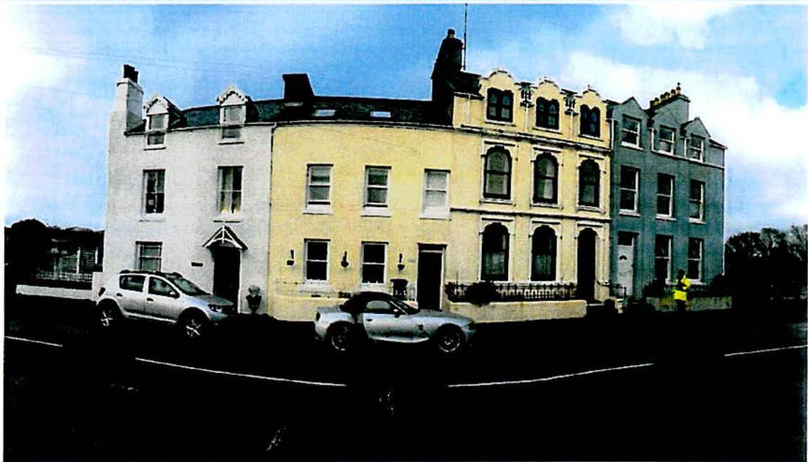
01, 03, 05, 07 Bridge Street

It should be noted that it is not possible to completely prevent flooding. Flood resilience and resistance measures are designed to mitigate flood risk and reduce damage and adverse consequences. They will help you to recover more quickly following a flood event. Any alterations conducted to the property after the installation of flood protection measures may lead to barriers no longer being able to be installed or to protect the property as designed and/or may create routes for water to bypass the measures installed. Flood resilience and resistance measures are explained further in sections 1.2,7 and 8 of this report. It is very important that you prepare your emergency flood plan, documenting the actions to be taken if there is a risk of flooding. These should also address any residual flood risk remaining once any measures have been deployed. It is important to recognise that flood protection measures can be overwhelmed by a bigger flood event. Information on preparing a personal flood plan is provided in section 10.2. Please refer to the Isle of Man Government website for further information: https://www.gov.im/transport/floodwatch/floodprepare.xml
Flood resistance measures aim to reduce the amount of floodwater entering the property, such as door barriers and automatic airbricks. Flood resilience measures aim to reduce the damage caused by floodwater which has entered the property, such as tiled floors and raised electricity sockets. Annual Exceedance Probability (AEP): The likelihood of a flood happening is best described as the chance or probability of a particular flood occurring in any one year. For example, "there is a 1 in 100 chance of flooding in any given year." This is usually described as a annual exceedance probability (AEP) flood. Metres above Ordnance Datum (mAOD): Frequently used to record and compare river levels and the relative height of objects above the mean sea level.
This report presents the findings from the survey of number 5, Bridge Street, Castletown, Isle of Man and outlines the core package of flood resilience and resistance measures which may be considered appropriate for this property. The property survey was restricted to such locations as were reasonably apparent by inspection from ground level from both inside and outside the property. No excavations were made to try to locate other entry points.
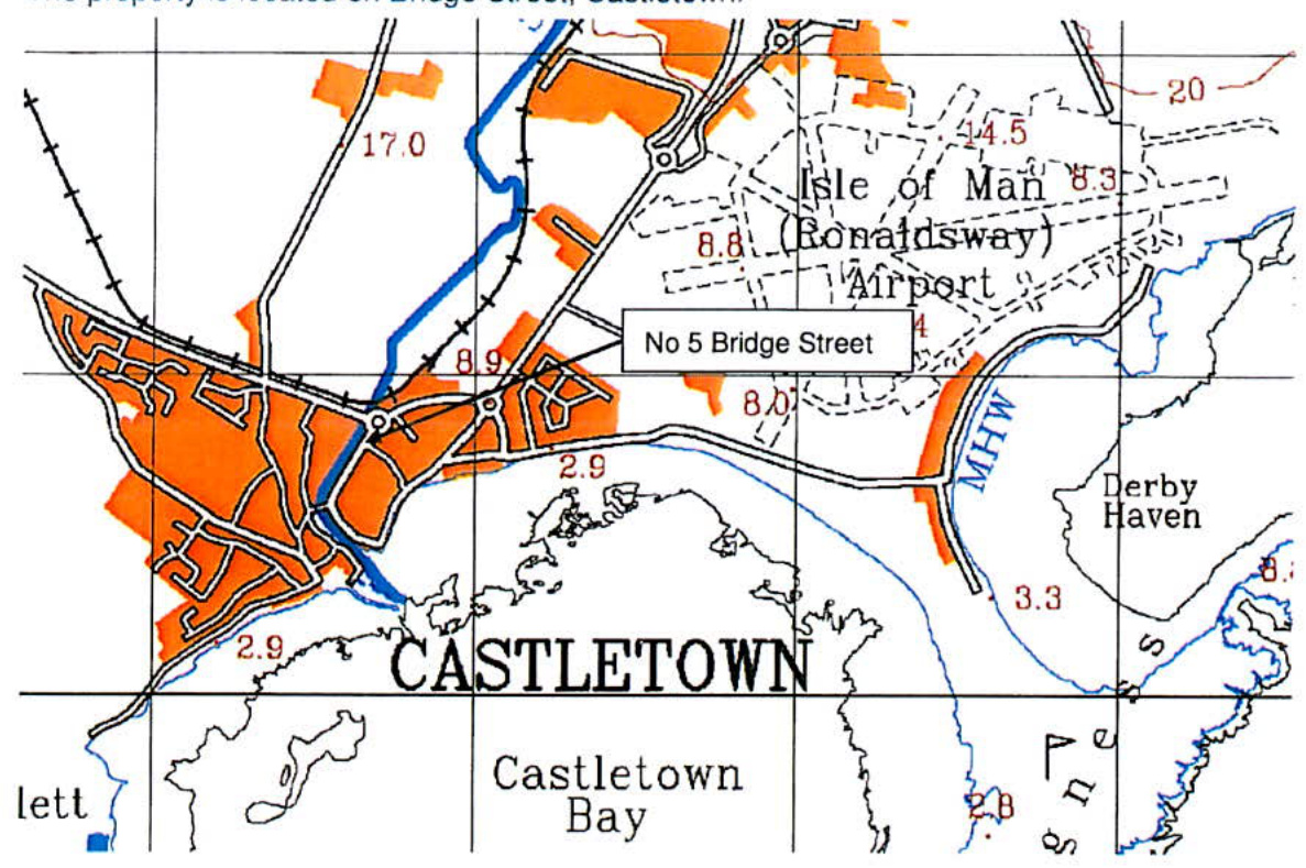
The property is located on Bridge Street, Castletown.
The property is mid-terraced constructed in the 1860's. Where visible, the stonework and mortar is in good condition. The house has been rendered and painted so stonework and pointing is not visible. The ground floor is constructed with suspended wooden flooring, however, the kitchen floor at the rear of the property is formed in concrete. The kitchen floor is set 200 mm lower than the rest of the ground floor. The property has a cellar and the cellar floor is formed as a concrete slab. The cellar does not extend under the kitchen but is set at a level potentially prone to inundation or seepage from the river. The gas meter for the property is located in the cellar, approximately 1.5 m above the ground. There are also a number of electric sockets in the cellar located around the perimeter approximately 1.7 m above the ground. The house is situated on the left bank of the Silverburn River. The external kitchen wall is constructed on top of the river's retaining wall.
The geology of the surrounding area is defined as Sandstone from the Santon Member of the

These sedimentary rocks are permeable and allow for the storage and movement of groundwater. The bedrock is overlain by superficial deposits of sand and gravel formed up to 2 million years ago during the Quaternary Period.
Copyright in submitted documents remains with their authors. Request removal
View as Markdown