Lower Douglas Masterplan Interim Planning Guidance
13/00841/REM·18 pages·PDF
Reports›Planning Statement
35 of 105use ← → arrow keys
Loading document...
Lower Douglas Masterplan Interim Planning Guidance
Appendix 2
Lower Douglas Masterplan <br> Interim Planning Guidance for Key Town Centre Sites in Douglas <br> October 2012
Lower Douglas Master Plan - Interim Planning Guidance for Key Town Centre Sites in Douglas
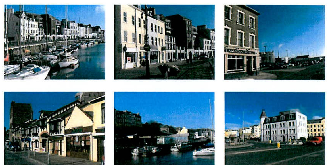
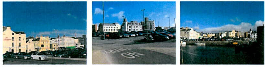
A collage of six photographs depicting existing street scenes, harbor views, and buildings in a town centre environment.
October 2012
Isle of Man Government
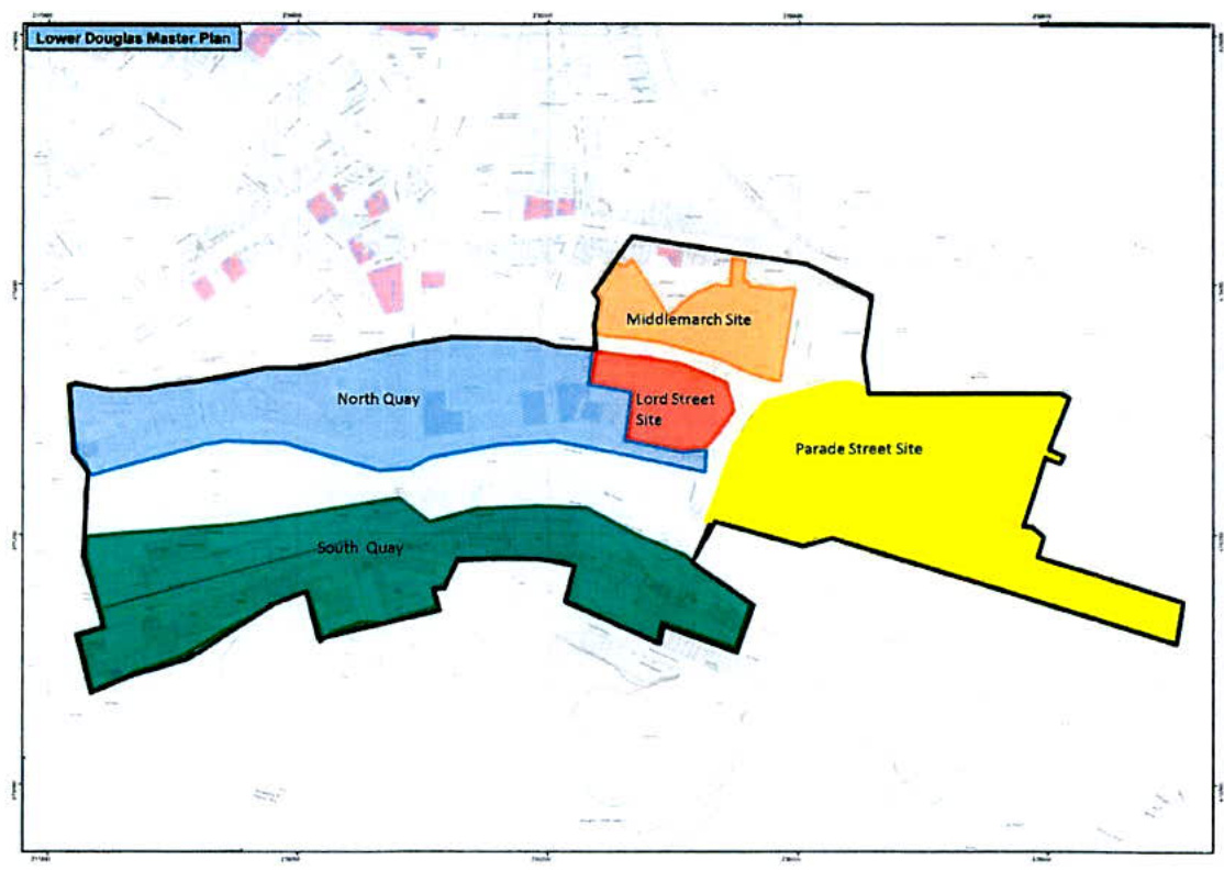
Lower Douglas Master Plan
A master plan map titled 'Lower Douglas Master Plan' displaying color-coded development zones including North Quay, South Quay, and various street sites.
Interim Planning Guidance for Key Town Centre Sites in Douglas
Minister's Introduction
I am pleased to introduce the 'Lower Douglas Master Plan – Interim Planning Guidance for Key Town Centre Sites in Douglas', which aims pending the preparation of the Area Plan for the East, to provide guidance to developers and the public alike on our vision for the key gateway area to the Island and Douglas.
Over the next few years the Centre of Douglas has the potential to be radically transformed through a number of major initiatives centred upon the Douglas Town Centre Regeneration activity and the refurbishment of the Promenade. The development opportunities identified in Lower Douglas will play a key complementary role in helping to deliver this transformation, whilst complementing other uses in adjoining areas such as the financial / Government quarter centred on Athol Street, Victoria Street and Prospect Hill; the retail quarter based on Strand, Duke and Castle Streets and the cultural quarter based around Victoria Street, the Promenade and the Villa Marina / Gaiety Theatre complex.
David Cretney MHK
Minister for Infrastructure
1.0 Aim
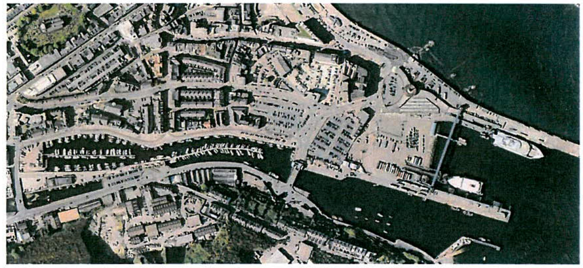
High-angle aerial view of a coastal harbor area featuring boats, parking lots, and surrounding town buildings.
To encourage and influence the development of underused sites in Lower Douglas with the right mix of leisure, retail, residential and other associated uses to form a vibrant, well designed gateway to the town centre and the island; and to complement other uses in the adjoining areas.
2.0 Key Objectives:
1) To set out clear interim planning policy guidance in advance of the Area Plan for the East to assist in bringing forward innovative and achievable proposals on 3 important opportunity sites known as the Lord Street Site, the Middlemarch Site and Parade Street Site. 2) To build on recent public realm improvements along North Quay and South Quay which have stimulated the regeneration of these areas, particularly along North Quay. By the formulation of clear policy guidance, the intention is to encourage further investment and stimulate interest in these areas particularly the development of vacant and underused sites which will help improve the general appearance and vitality along one of the key routes into Douglas from the South. 3) To set out strong design principles, this will be vital in both the preparation of schemes and the successful delivery of these development opportunities. Proposals will have to:
demonstrate consideration of the historic character of the quayside;
achieve strong physical links between the various sites and adjacent areas including the Port, the Sea Terminal and the established retail, residential and business areas; and
address public and private vehicle circulation, pedestrian permeability and parking arrangements and facilities.
4) Pending the publication of the Area Plan for the East, it intended that this document will provide interim planning policy guidance that will be used as a material consideration by those determining planning applications and planning appeals.
3.0 The Existing Situation
3.1 Whilst this is intended as standalone interim policy guidance, it is important to set the Lower Douglas area into the context of central Douglas. The overarching land uses proposed for Lower Douglas area, including North Quay and South Quay are leisure/retail/car parking/operational for port and some residential. These uses will complement other uses in adjoining areas such as the financial / Government quarter centred on Athol Street, Victoria Street and Prospect Hill; the main retail quarter based on Strand, Duke and Castle Streets and the cultural / leisure quarters based around Victoria Street, the Promenade and the Villa Marina / Gaiety Theatre complex and the links between these uses and areas. 3.2 With the exception of the freight marshalling area, the 3 key sites at Middlemarch, Lord Street and Parade Street are currently used for public and contract car parking. This has resulted in a generally undeveloped area, devoid of buildings other than the Police Station, Steam Packet Company offices and the Sea Terminal Building and characterized by a vision of gable ends and rear elevations of buildings fronting onto Victoria Street, Fort Street and North Quay. Wooden fencing provides some screening around the Lord Street car park but there remains a clear sense of openness. There exists a close physical relationship between the sites which are separated by a busy road network, which is currently home to the main bus stop in the town. North Quay and South Quay are close by and each have a different character and mix of uses, north and south of the marina. South Quay is used as one of the main routes out of Douglas from Parade Street to the South of the Island. 3.3 The area to the west of the inner harbour has seen an increased interest in regenerating the area through the development of mixed use proposals. There have been a number of planning applications in recent years for predominantly residential based developments, some of which have already been partly developed, such as Quay West complex. This document does not intend to provide any further guidance for this area, as these relevant planning approvals already give sufficient clarity on what this area will be like in the future.
4.0 Vision for the Future
4.1 Any vision statement needs to be realistic and achievable. Government, as well as developers and investors on the Island continue to face tough choices about current financial commitments and future spending. However, this Statement identifies the area around Lord Street, Middlemarch and Parade Street (for the purposes of this Guidance to be known as 'Lower Douglas') as an area which, with a little innovative thinking, has the
Lower Douglas Master Plan <br> - Interim Planning Guidance for Key Town Centre Sites in Douglas
potential to make sound economic sense with inevitable knock on effects for environmental and social improvements. The identified sites, both individually and together can readily exploit the regeneration successes of North Quay and the initial developments of Quay West, the excellent location close to the Port, the marina, the established commercial centre, which all have good transport links, and the apartments to increase the number of people living, working and relaxing close to Douglas Town Centre. Now is the time to renew the interest in Lower Douglas, to set out some development principles and to encourage a collaborative approach to bring forward a mix of exciting uses on these sites. 4.2 The area centred on the Lord Street site can be more vibrant and distinctive. Striving for high quality developments to complement the historic areas close by which have undergone recent improvements is a must. North Quay is already home to a mix of thriving businesses and positive changes are continuing. People live, work and spend time in the area. There is the opportunity now to improve the environment for both new and existing businesses and residents and create an area where marine, wholesale, trade counter / specialist retailing, residential, leisure, tourism and other commercial and employment uses can sensitively co-exist and complement each other. Linking all the sites should be high quality public spaces and pedestrian walkways which connect seamlessly with surrounding areas. 4.3 This area cannot be seen in isolation; it has great connections with the Port, Douglas Promenade, the main shopping street which themselves are close to other areas primed for regeneration and development such as Market Street and the Villiers site. The Lord Street site is synonymous with the main bus terminal in Douglas and its long term future and location must be a key consideration in any proposals in this area. However, this may all change, if the main bus interchange is relocated to Victoria Street. The operation of the buses and current road network needn't be a barrier to development and priority must be given to safe, direct and convenient routes for pedestrian, cyclists and other road vehicles. 4.4 The need for good, sustainable design cannot be over emphasised. There are opportunities to create real landmarks for the future and give life back to landmarks of the past. It is easy at the moment to overlook the presence of the Bridge Control Tower, but the opportunities presented by this Registered Building should not be forgotten in the future. Negotiation between the planning officers, developers, Douglas Borough Council and other key organisational bodies will be vital. 4.5 In summary, the Middlemarch, Parade Street and Lord Street sites and the areas of North and South Quay are prime locations for further investment. Government is keen to support the redevelopment of sites in its ownership and be a key motivator in bringing parties together for scheme preparation. These are challenging times and challenging sites and whilst this guidance is now being devised to help bring forward development proposals, there is no intention to put a timeframe on development.
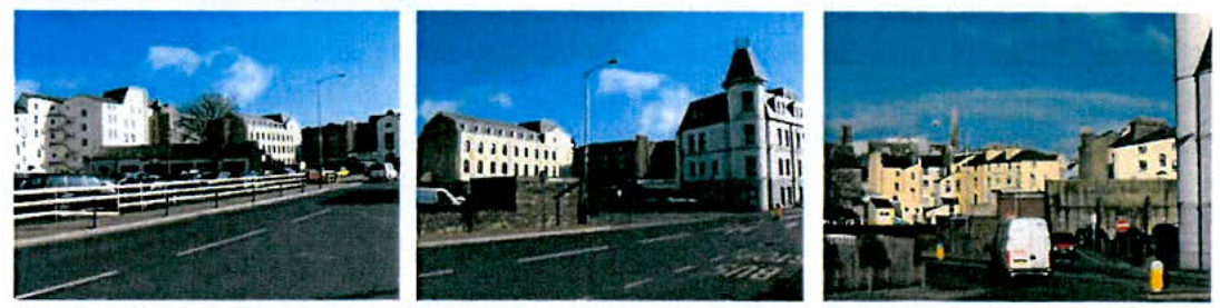
A triptych of street-level photographs showing the existing town centre context, including buildings, roads, and vehicles.
4.6 The Area Plan for the East will address the wider issues of development in Douglas alongside other matters. This interim advice will not prevent further consideration of these sites and areas as part of the normal plan making or planning application processes. 4.7 This Statement, which will be known as "Interim Policy Guidance" will be used, where appropriate, as a material consideration by decision makers to help determine the outcome of any planning proposals. Developers will be expected to take heed of this advice in the preparation of their schemes.
5.0 The Sites
Middlemarch
5.1 This site is currently characterised by the existing Lord Street Police Station and a large surface car park situated over the majority of the site. Views out of the site are to the rear elevations of the buildings on Victoria Street, Walpole Avenue and out over the Lord Street site.
5.2 Policy Background
The Douglas Local Plan 1998: The existing land use designation as set out by the Douglas Local Plan is "Predominantly Offices"
5.3 Development Opportunities
The creation of a mixed use scheme on a well placed site which could feature a range of uses including leisure, small scale retail, hotel, office and associated uses. It is known that that there is a desire to include a multi-storey car park, library and offices on part of the site (know as Cambrian Place) to the south west of Fort Street. On the rest of the site a mix of leisure, small scale retail and hotel uses is envisaged to support opportunities associated with the high quality 'night time' economy. There is also the opportunity to relocate the Police Station either away from the site (to a suitable location) or as part of the mixed use new build proposals. There is an opportunity to
Lower Douglas Master Plan
Interim Planning Guidance for Key Town Centre Sites in Douglas
realign the junction of Fort Street and Lord Street. This could improve traffic flows and allow a greater provision of public open space.
It should be noted the eastern part of the site was subject of an application back in 2005 for an approval in principle for the erection of a 190 bedroom hotel and casino, which was granted permission on 10th April 2006. This permission was not renewed and has now expired.
This area has great links with other areas including the Lord Street and Parade Street sites, and the existing retail and business core areas in Strand Street / Duke Street / Victoria Street / Prospect Hill / Athol Street, plus the Promenade.
5.4 Development Issues/Constraints
The long term future of the Lord Street Police Station must be considered. The development will need to consider how the existing building is either successfully integrated into the scheme or the Police Station is relocated and subsequently the existing building is demolished / redeveloped or remodelled. There is a risk that the existing building could detract from an overall scheme. There is a clear preference to demolish the police station and incorporate the site into an enlarged public realm area, which can provide a focal point in Lower Douglas.
Car parking provision – the loss of existing spaces must be measured against the number to be provided as part of any scheme. There may need to provide alternative car parking elsewhere to make up for existing provision displaced from redevelopment of the site or provide a commuted payment to the Department to provide car parking provision elsewhere.
The Douglas Development Partnership has long sought a Public Square for Douglas. The redevelopment of this site could provide the opportunity for the creation of new public realm and pedestrian link through to Victoria Street, the Promenade and the Town Centre.
Relationship with the Lord Street Site. Both sites are currently of generally poor environment which gives a poor visual impression on approach from Lord Street.
Road network and traffic flows - Currently the road layout and traffic flows through and between Middlemarch, Lord Street and Parade Street sites play a key role in the traffic management of Douglas and access to the Port facilities. However they also currently form barriers to the effective interaction of the sites. The challenge is to provide / improve means of pedestrian access between the various sites whilst supporting the flow of traffic on these primary transport routes. Potential developers are encouraged to discuss this issue in more detail with the Department of Infrastructure Highways Division.
Lower Douglas Master Plan
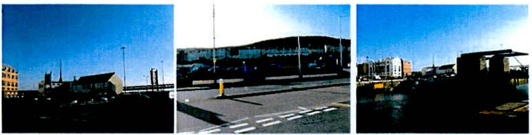
A triptych of photographs showing the existing site context, including street views with buildings and parked cars, a parking area with road markings, and a waterfront view.
Interim Planning Guidance for Key Town Centre Sites in Douglas
There is a need for high quality design on this prominent gateway site. It will be important that any future development proposed for the present vacant site to the west of Walpole Avenue, is of a form and quality of design that will complement the scale and detail of existing buildings.
Archaeology – Manx National Heritage have indicated that the site is considered to be within an area of Douglas being built up prior to 1580 and likely to contain evidence of this underground. Early archaeological investigation will be necessary followed by any appropriate further investigation ahead of any redevelopment. However, this must be done in a way that does not compromise the ability to bring forward this site for and the viability of any redevelopment. Potential developers are encouraged to discuss this issue in more detail with Manx National Heritage.
Lord Street
5.5
The Lord Street site is formed by what was Douglas Bus Station. The site has been cleared of buildings and currently provides a pay and display car park. The Lord Street boundary of the site borders the lay-by which currently provides the main bus stop in Douglas. The site is situated on a corner facing onto the Parade Street site, North Quay and Middlemarch.
5.6 Policy Background
The Douglas Local Plan 1998:
Existing land use designation as set out by the Douglas Local Plan is "Mixed Use - Town Centre"
5.7 Development Opportunities
This site has the potential to be developed for mixed use including, leisure/retail, hotel, residential development. In particular to support opportunities associated with the 'high quality' night time economy. Tynwald has agreed to enter into a development agreement with a private sector developer to deliver this.
Superb harbour side location with good pedestrian links to North Quay and the Marina developments
Lower Douglas Master Plan <br> - Interim Planning Guidance for Key Town Centre Sites in Douglas
Central, prominent gateway site.
5.8 Development Issues/Constraints
Relationship with Middlemarch development will be important as the existing Lord Street environment gives a poor visual impression on a gateway route into Douglas and onwards to the West of Island.
There is a need for high quality design on this prominent gateway site.
Flood risk implications need to be taken into account.
Car parking provision - the loss of existing spaces must be measured against the number to be provided as part of any scheme. There may be a need to provide alternative car parking elsewhere to make up for existing provision displaced from redevelopment of the site or provide a commuted payment to the Department to provide car parking provision elsewhere.
Road network and traffic flows - Currently the road layout and traffic flows through and between Middlemarch, Lord Street and Parade Street sites play a key role in the traffic management of Douglas and access to the Port facilities. However they also currently form barriers to the effective interaction of the sites. The challenge is to provide / improve means of pedestrian access between the various sites whilst supporting the flow of traffic on these primary transport routes. Potential developers are encouraged to discuss this issue in more detail with the Department of Infrastructure Highways Division.
Archaeology - Manx National Heritage have indicated that the site may have some archaeology on the site. Early archaeological investigation will be necessary followed by any appropriate further investigation ahead of any redevelopment. However, this must be done in a way that does not compromise the ability to bring forward this site for and the viability of any redevelopment. Potential developers are encouraged to discuss this issue in more detail with Manx National Heritage.
Parade Street / Freight Marshalling Area
A triptych of street-level photographs showing the existing urban context, including buildings, roads, and street furniture in a town centre setting.
5.9 The Parade Street site includes a car park and office building (currently used by Isle of Man Steam Packet Company) and is set in a prominent position. The Freight Marshalling area is accessed via the roundabout adjacent to the Sea Terminal and via the entrance to the existing Parade Street car park. The site includes the freight marshalling area, the King Edward VIII Pier, and the historic Red Pier.
5.10 Policy Background
The Douglas Local Plan 1998: Existing land-use designations are "Predominantly Offices" for the car park area and office building and "Harbour Related Use".
5.11 Development Opportunities
This is a prominent gateway site to the Island.
A superb opportunity to present the right welcoming message to the Isle of Man for both ferry users and cruise passengers.
Development of a mixed use scheme but one which must incorporate a ground floor area for freight marshalling / overflow lorry parking.
Opportunity to investigate the changing of the priority of the existing main Port access away from the Peveril Square roundabout (which must be retained as a readily available alternative access particularly for emergency access. A new main access to the marshalling area would be created via Parade Street roundabout.
To demolish and redevelop existing Isle of Man Steam Packet Company offices as part of redevelopment of site.
Lower Douglas Master Plan <br> - Interim Planning Guidance for Key Town Centre Sites in Douglas
Car parking provision - the loss of existing spaces must be measured against the number to be provided as part of any scheme. There may be an opportunity to provide alternative additional car parking in the form of a multi storey car park on this site to make up for existing provision displaced from redevelopment of the Lord Street and Middlemarch sites.
5.12 Development Issues/Constraints
There is a need to ensure that the round the clock operational needs of the port (including freight) are not compromised - development of the site presents an opportunity to make more effective use of the site.
Relationship with the Lord Street and Middlemarch Sites. All sites currently have a generally poor environment, dominated by open car parking which gives a weak visual impression on approach from all directions.
There is a need for high quality design on this prominent gateway site: any design scheme must take into account the iconic Sea Terminal Building. Furthermore, any proposal needs to take into account the context and existence of the Red Pier, which is a Registered Building.
Flood risk implications need to be taken into account.
Currently the road layout and traffic flows through and between Middlemarch, Lord Street and Parade Street sites play a key role in the traffic management of Douglas and access to the Port facilities; however they also currently form barriers to the effective interaction of the sites. Challenge is to provide / improve means of providing pedestrian access between the various sites whilst supporting the flow of traffic on these primary transport routes. Potential developers are encouraged to discuss this issue in more detail with the Department of Infrastructure Highways Division.
Archaeology - Manx National Heritage have indicated that the site may have some archaeology on the site. Early archaeological investigation will be necessary followed by any appropriate further investigation ahead of any redevelopment. However, this must be done in a way that does not compromise the ability to bring forward this site for and the viability of any redevelopment. Potential developers are encouraged to discuss this issue in more detail with Manx National Heritage.
Lower Douglas Master Plan
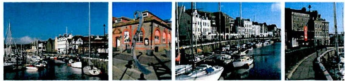
A collage of four photographs depicting a harbor scene with moored boats, quayside buildings, and streets in Douglas.
Interim Planning Guidance for Key Town Centre Sites in Douglas
North Quay
5.13 North Quay is designated as a Conservation Area and has recently been the subject of improvement works including a redesigned road and parking layout, new street paving, railings and street furniture. There has been an increase in cafes and restaurants complemented by small scale specialist retailers along the quayside in recent years; the area has become more popular as a destination for social activities and complements improvements in the marina facilities.
5.14 Policy Background
Douglas Local Plan 1998:
"Predominantly Shopping", "Predominantly Offices", "Predominantly Residential", "Town Centre (Mixed Use)", "Worship" and "Public Open Space".
5.15 Development Opportunities
This is an opportune time to build on existing regeneration activity which has led to the re-use and improvement of many buildings in the area. Opportunities remain to exploit the increasingly vibrant mix of uses which feature cafes, restaurants, bars and pubs, leisure uses as well as small scale specialist retailing. The area has a good environment for pedestrians and has activity during the day and evening.
This area has strong links to the past. It is essential to make best use of the historic built heritage and its traditional quayside culture.
This area has great links with other areas including the Marina, the Railway Station, Lake Road, Quay West, the Middlemarch, Lord Street and Parade Street sites, and the existing retail and business core areas in Strand Street / Duke Street / Victoria Street / Prospect Hill / Athol Street.
There is the opportunity to provide a cycle route between North Quay and the Promenade.
Lower Douglas Master Plan
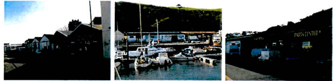
A triptych of photographs showing a harbor or marina area with boats, waterfront buildings, and a structure labeled 'PARTS CENTER'.
Interim Planning Guidance for Key Town Centre Sites in Douglas
5.16 Development Issues/Constraints
Any new development must preserve or enhance the character and appearance of the Conservation Area.
There is a need to revitalize the facades of the existing buildings when opportunities arise. New uses at ground and first floor level are important but the appearance of buildings and views across from South Quay are also important matters for consideration.
Relationship with other key development sites.
Flood risk implications need to be taken into account.
South Quay
5.17 South Quay has a different character to North Quay. It has a predominantly commercial based range of existing land uses, the majority of which are accommodated in industrial type buildings. Currently there is a mix of light industrial, office, car parking and trade counter wholesale/bulky goods retailing alongside a number of vacant/underused sites. The area is not within a Conservation Area. South Quay provides one of the main traffic routes into and out of Douglas Town Centre. As such this area of Douglas is an extremely important part of the Island's capital as it offers the Gateway connections for visitors to the Isle of Man whether travelling via the ferry or airport.
5.18 Policy Background
Douglas Local Plan 1998: "Light Industrial" and "Residential"
5.19 Development Opportunities
Sites on South Quay are alongside one of the main access routes into Douglas from the South.
Lower Douglas Master Plan <br> - Interim Planning Guidance for Key Town Centre Sites in Douglas
As opportunities arise and sites are proposed for redevelopment/re-use of buildings, it is envisaged that suitable future uses be for mix of office, residential and bulky goods retailing uses. Some parts of South Quay are currently used for car parking, some formal, some informal/temporary. The challenge is to inject further life into this area, balanced with the need to provide and retain practical and convenient areas of car parking.
Redevelopment projects in the area are signs that the area is becoming more attractive for investors and end users. Ongoing development is likely to raise the quality of the area through the development of unattractive sites.
South Quay is a prime area for development. There are planning approvals in place for residential development. Implementation of these approvals can only add to the confidence in the area generally which will have knock on effects elsewhere in terms of environmental, visual and economic improvements.
South Quay is in a Harbour side location. Whilst there is a mix of uses, well designed, new schemes will make the most of the good transport routes, the regeneration being undertaken along North Quay and the redevelopment opportunities presented by the sites centred on the Lord Street site. Opportunities should be taken to screen and improve the appearance of more industrial type uses in this area.
There is potential for the re-use of former Bridge Control Tower (Registered Building) which could form an important visual link between the North and South Quays. Any proposal for the building would have to be sensitively done and in consultation with the Department's Conservation Officer.
There is also the potential to link up with opportunities in the Outer Douglas Harbour area.
5.20 Development Issues/Constraints
Some existing residential apartment planning approvals have not yet been implemented. This may be a result of current state of housing market. It may be being compounded by the environment of South Quay. The challenge will be to get the right form of development on these sites. The Department will be supportive of any need for further negotiation on these sites.
Some sites along South Quay are constrained by site depths back from the road frontage.
The mix of uses in the area needs to be carefully considered in order to avoid detrimental effects on neighbouring uses.
Flood risk implications will need to be considered.
The height and mass of buildings will need to be carefully considered and schemes should be mindful of the impact on the character and appearance of the North Quay Conservation Area.
Archaeology - Manx National Heritage have indicated that the sites within the area may have some archaeology on the site. Early archaeological investigation will be necessary followed by any appropriate further investigation ahead of any redevelopment. However, this must be done in a way that does not compromise the ability to bring forward this site for and the viability of any redevelopment. Potential developers are encouraged to discuss this issue in more detail with Manx National Heritage.
Land Contamination implications will need to be considered on existing/previous industrial land and sites adjacent to the former Manx Gas works site. Potential developers are encouraged to discuss this issue in more detail with the Environmental Protection Unit at the Department of Environment, Food and Agriculture.
6.0 General Development Principles
Proposals must:
Be the subject of pre-application discussions with the officers in the Planning and Building Control Division of the Department of Infrastructure which must take account of any previous planning applications on and around the site.
Where appropriate, be the subject of pre-application discussions with the following organisations:
Isle of Man Water and Sewerage Authority
Isle of Man Post Office
Isle of Man Fire and Rescue Service
Architectural Liaison Officer of the Isle of Man Constabulary
Harbours and Highways Divisions of the Department of Infrastructure
Environmental Protection Unit of the Department of Environment, Food and Agriculture.
Manx National Heritage
Design
Proposals must be accompanied by a Design Statement which shall:
Demonstrate a scheme with a clear identity and landmark potential, which uses the proximity of the waterside as an asset. This should incorporate an assessment of the character of the site and the area with identified key views and demonstrate an awareness of the historic connections to the past.
Lower Douglas Master Plan <br> - Interim Planning Guidance for Key Town Centre Sites in Douglas
Include a full breakdown of proposed uses and phasing.
Include section drawings showing the relationship with adjacent sites.
Include drawings/illustrative material to clearly indicate scale and massing and retention/enhancement of identified and agreed key views.
Include a statement regarding materials and finishes.
Include, where appropriate, Public Art in any final scheme and a mechanism as to how this can be achieved.
Demonstrate of a scheme based upon the principles of sustainability and 'lean' construction, with minimal use of energy in construction and use. In doing so the design of the building should make use of building width, depth and orientation to maximize the active frontage, daylight and ventilation etc.
Include signage and interpretation where appropriate.
Show a clear strategy to increase activity in the area - places and spaces for walking, cycling and even local events. This should address how integration and connectivity issues, including public realm provision.
Include details to show a clear strategy to increase (legitimate activity) in the area and how proposals have designed out crime. This should also include details on how proposals impact on policing resources.
Flood Risk
Proposals must include:
A Flood Risk Assessment and mitigation measures where necessary in line with the Flood Risk PPS.
Transport and car parking
Proposals must:
Include evidence that public transport matters have been taken into account.
Provide transport choices - e.g. visible cycle parking close to building entrances, and promote alternative modes of transport through Green Travel Plans.
A proper assessment of car parking and servicing needs, access and road implications and any required improvements.
Archaeology
Proposals must:
Include details of early archaeological investigation and include details of any further investigation, where appropriate, ahead of any redevelopment. However, this must be done in a way that does not compromise the ability to bring forward sites and the viability of any development.
Consultation
There must be:
A mechanism to involve key stakeholders.
Respect people / existing businesses and their local environment - with this in mind the local community should be involved in projects as early as possible.
Plan for the East
There must be an awareness of the Plan for the East (whatever stage it has reached)
7.0 Interim Planning Guidance and the Area Plan for the East
This Interim Guidance is being produced in advance of work on the Area Plan for the East. It provides an interim statement of planning policy for the area pending its eventual incorporation within the Area Plan for the East.
This guidance has been endorsed across Government and will help to guide development in the areas discussed above in advance of the Area Plan for the East.
Copyright in submitted documents remains with their authors. Request removal