Land to the South of Cooil Road Full Travel Plan Client: Eden Park Developments Ltd i-Transport Ref: BT/LJ/ITB211024-001A Date: 02 April 2026
Land to the South of Cooil Road Full Travel Plan Client: Eden Park Developments Ltd
i-Transport Ref: BT/LJ/ITB211024-001A Date: 02 April 2026 i-Transport LLP Building 1000 Lakeside North Harbour Western Road Portsmouth PO6 3EZ
Tel: 0331 6300 366
www.i-transport.co.uk
COPYRIGHT The contents of this document must not be copied or reproduced in whole or in part without the written consent of i-Transport LLP
If this report is to be placed on any approved website for planning purposes, this should comply with data protection principles, please seek our permission and you must ensure that all the private and personal information and data within this report is redacted.
Quality Management
Report No.
Comments
Date
Author
Authorised
ITB211024-001
Draft
27/03/2026
LJ
BT
ITB211024-001A
Issue
02/04/2026
LJ
BT
File Ref: T:\Projects\210000 Series\211024ITB - Land To The South Of Cooil Road IoM\Admin\Report and Tech Notes\ITB211024-001A Full Travel Plan.docx
Land to the South of Cooil Road Full Travel Plan
Contents
SECTION 1 Introduction 1
SECTION 2 Policy and Objectives 3
SECTION 3 Site Assessment 7
SECTION 4 Measures 12
SECTION 5 Targets 18
SECTION 6 Management 19
SECTION 7 Monitoring and Review 21
SECTION 8 Summary and Conclusions 23
Appendices
APPENDIX A. Site Masterplan
APPENDIX B. Detailed Design Drawings – Off-site Improvements
APPENDIX C. Example Travel Survey Questionnaire
Date: 02 April 2026 Ref: BT/LJ/ITB211024-001A
Land to the South of Cooil Road Full Travel Plan
SECTION 1 Introduction
1.1 Overview
1.1.1 Eden Park Developments Ltd has appointed i-Transport LLP to prepare a full Travel Plan (TP) for an industrial and business park on land south of Cooil Road, known as site BE002(a)g.
1.1.2 The site is located to the south of A6 Cooil Road within the Parish of Braddan approximately 3.5km to the west of Douglas town centre.
1.1.3 This TP focuses on promoting sustainable travel to the development amongst new employees and potential visitors by providing non-car mode travel options for local journeys and in particular reducing single occupancy car journeys and influencing modal choice.
1.2 The Development
1.2.1 In July 2023, planning approval was granted for the development of an industrial and business park, including full approval for access and Zone A (application ref: 22/00416/B). All matters apart from access were reserved for the development within Zones B, C and D.
1.2.2 The description of the consented development is as follows:
“Combined approval in principles and full approval for phased development for industrial and business park uses including Class 2.1, 2.2, 2.3 and 2.4 together with access and associated infrastructure. Full approval for the access, estate road, strategic drainage infrastructure, structural landscaping, and biodiversity enhancement areas and with Phase 1 of the employment units (Zone A). All matters apart from access reserved for the development within Zones, B, C and D.”
1.2.3 In total, the development will comprise up to 28,400sqm which will be brought forward on a phased basis. The Parameters Plan, a copy of which is provided in Appendix A, shows the location of each zone, as well as the site access and internal estate road. The schedule of development for the various phases is set out in Table 1.1.
Table 1.1: Development Schedule
Phase
Proposed Use
Floor Area (sqm)
Zone A (Phase 1)
Class 2.2: Light Industry and Research & Development, and Class 2.4: Storage or Distribution
2,540
Zone B
Class 2.2: Light Industry and Research & Development, Class 2.3: General Industrial, and Class 2.4: Storage or Distribution
11,860
Zone C
Class 2.2: Light Industry and Research & Development, Class 2.3: General Industrial, and Class 2.4: Storage or Distribution
5,000
Date: 02 April 2026 Ref: BT/LJ/ITB211024-001A Page: 1
Land to the South of Cooil Road Full Travel Plan
Phase
Proposed Use
Floor Area (sqm)
Zone D
Class 2.1: Office
9,000
Total
-
28,400
Source: Eden Park Developments Ltd
1.2.4 Construction of the approved employment units within Zone A are due for completion in April 2026, and construction of the access and estate road that serves Zone B-D is currently under construction Further, in January 2026, Reserved Matters planning approval was granted for the development of Zone B within Eden Park for a storage / distribution building (Use Class 2.4).
1.2.5 A Reserved Matters Application has now been submitted for the construction of a wholesale distribution warehouse with associated office functions (Use Class 2.4) within Zone C.
Framework Travel Plan
1.2.6 A Framework Travel Plan (i-Transport report reference ITB14273-004A) was prepared as part of the original hybrid planning application. Condition 18 of the planning application is as follows:
“Prior to occupation of any commercial unit or group of units within Zone A, B, C or D, a Detailed Travel Plan for that unit(s) shall be submitted to and approved in writing by the Department in general accordance with the i-Transport Framework Travel Plan dated 18th March 2022 submitted with the application and shall be implemented thereafter in accordance with the measures set out therein.”
1.2.7 In accordance with the outline decision notice, this Full Travel Plan has been prepared to discharge the condition.
1.3 Definition
1.3.1 A Travel Plan (TP) is defined in the Isle of Man Travel Plan Policy as
“A Travel Plan is a strategy and action plan of site-specific practical measures and initiatives to minimise the number of single occupancy motor vehicles visiting the site. Its main objective is to achieve a modal shift from the car to more sustainable forms of transport such as walking, cycling, using public transport and car sharing, and to improve the availability of these modes.”
1.3.2 This TP has been prepared in accordance with the DoI Travel Plan Policy and DoI Travel Plan Guidance. This TP has been prepared for all future employees and visitors of the development and provides a single source of information about the purpose, preparation and implementation of the transport related proposals relating to the development.
1.3.3 Given the overall quantum of development and phased nature, any measures will be kept under review as the development progresses and the final phasing of the development emerges.
Date: 02 April 2026 Ref: BT/LJ/ITB211024-001A Page: 2
Land to the South of Cooil Road Full Travel Plan
SECTION 2 Policy and Objectives
2.1 Overview
2.1.1 This section sets out the policy against which the Travel Plan has been prepared, and identifies the aims, objectives, and benefits of the TP. These cover a range of outcomes encompassing sustainability, environmental and health consideration.
2.2 Isle of Man Travel Plan Policy
2.2.1 It is the policy of both Highway Services and the Planning Authority for a TP to be submitted as part of the planning application for a proposed development.
2.2.2 Section 5.13 of The Isle of Man Strategic Plan 2016 refers to the need.
“to work corporately in seeking to incorporate the key elements of Integrated Transport for the Island into a draft Sustainable Transport and Travel Plan”
2.2.3 This policy document has been based on guidance and best practice which is described below:
• The Isle of Man Strategic Plan 2016, which is approved and adopted, sets out the Highway Services general policies for new developments, together with a reasoned justification of those policies.
• The Manual for Manx Roads (MMR) states that “In all cases where a Transport Assessment is needed, Highway Services will require an agreed Travel Plan with clearly defined targets and monitoring proposals.” It goes on to say, “For smaller sites a Travel Plan Statement may be required.”
2.2.4 It is the responsibility of the developer, or the highway / transport consultant acting on behalf of the developer, to produce a TP to support a planning application for a proposed development.
2.3 Isle of Man Travel Plan Guidance Document
2.3.1 The Highway Services Travel Plan guidance document sets out the criteria for which developments require a TP. It also represents best practice when assessing the highway implications of new developments.
2.3.2 The main objective of a TP is to achieve a modal shift from the car to more sustainable forms of transport such as walking, cycling, using public transport and car sharing, and to improve the availability of these modes. It may also promote practices or policies that reduce the need for travel and help improve accessibility to development sites and to local amenities and services.
Date: 02 April 2026 Ref: BT/LJ/ITB211024-001A Page: 3
Land to the South of Cooil Road Full Travel Plan
2.3.3 The success of a TP in influencing travel patterns is dependent upon the commitment of the master developer and the subsequent occupiers of the development.
2.3.4 Table 1 sets out the threshold for each land use class that requires a Transport Assessment and a Travel Plan. The proposed development is above the maximum threshold and is therefore accompanied by a Transport Assessment and a Travel Plan.
2.3.5 This Travel Plan has been prepared in line with the requirements set out in the DoI travel plan guidance document, including the assessment of the existing site for all sustainable modes of travel, travel plan proposed measures and targets, and monitoring of the travel plan.
2.4 Aims
2.4.1 The aim of this TP is to promote sustainable travel alternatives via a number of measures aimed at reducing the reliance on the private car in line with national guidance. The headline aims are as follows:
• To reduce the need to travel;
• To reduce the number of single occupancy car journeys to and from the site;
• To improve accessibility to the site by non-car modes of transport;
• To promote healthy lifestyles, an accessible environment, and sustainable vibrant communities, through the promotion of sustainable travel modes; and
• To minimise the impact of traffic-related activities (noise, pollution, parking, and congestion) on the local highway network.
2.5 Objectives
2.5.1 This TP sets out a sustainable transport strategy for the development to support future staff in making informed decisions about their travel and promote sustainable modes of travel to the site. The primary purpose of this TP is to promote shared car use, walking, cycling, and public transport as alternatives to single occupancy car travel to work.
2.5.2 To focus the approach, the key objectives of the TP are to:
• Promote a range of measures that will encourage and support the use of sustainable modes of travel (e.g. walking, cycling, public transport);
• Inform staff and visitors of the local public transport facilities available;
Date: 02 April 2026 Ref: BT/LJ/ITB211024-001A Page: 4
Land to the South of Cooil Road Full Travel Plan
• Promote the sustainability of the site using a range of promotional measures, such as a ‘Travel Pack’ containing information that encourages businesses based at the site to use alternative modes of travel. This will be handed out to the occupiers at the beginning of their occupation; and
• Monitor the performance of the TP against its targets by collecting accurate travel information from staff.
2.5.3 The anticipated outcomes of these objectives include the following:
• Opportunities for active, healthy travel;
• Improved travel choices and accessibility of the site by means other than single occupancy car use;
• Less congestion on local roads; and
• Local environmental improvements from reduced congestion, pollution, and noise.
2.5.4 The TP promotes measures which will help ensure that the objectives and outcomes are met. The measures will assist in minimising single occupancy car travel to and from the site and will help bring environmental benefits to local businesses and residents.
2.5.5 All the measures will look to reduce the dependence on single occupancy private car use for travel to work and enable smarter choices, where this is feasible.
2.6 Benefits
2.6.1 The development of the TP has several benefits for the businesses based at the site, their staff, the local community, and the surrounding environment.
Benefits to Businesses
• Improved car park management enabling the most efficient use of the car parking space available;
• EV parking and charging;
• Improved staff satisfaction and retention by improving ease of travel to work;
• Benefits to staff recruitment due to creation of a larger potential labour pool and the ability to recruit workers without access to travel by private car; and
• A healthier and more productive workforce. The Department for Transport (DfT) considers that:
Date: 02 April 2026 Ref: BT/LJ/ITB211024-001A Page: 5
Land to the South of Cooil Road Full Travel Plan
“Improved health as a result of extra exercise by those walking and cycling can reduce absenteeism and increase productivity. In addition, the stress and fatigue of driving can be reduced through increased travel by public transport.”
Staff Benefits
2.6.2 The TP offers the following benefits to staff:
• Increased opportunities for accessing the workplace by non-car modes;
• Individual cost savings, for example through reduced motoring costs through the ability to car share with another member of staff and to charge EVs at the workplace;
• Improved health levels through increased walking and cycling and reduced stress levels in terms of travel to work;
• Greater convenience in terms of travel choice and information availability;
• The TP will help to reduce the cost of travel to work for staff and may, for certain staff, bring about savings in travel time by offering a wider choice of travel modes;
• Staff will benefit from a healthier lifestyle through improved opportunities to build exercise into their daily routine as well; and
• The TP will provide greater convenience to staff in terms of travel choice and information availability.
Community and Environmental Benefits
2.6.3 The TP will provide the following benefits to the local community and environment:
• Reduce the impact of traffic generated by the development on the local highway network;
• Reduce the impact of the site on the environment by reducing CO2 emissions through fewer car journeys. This will help to contribute to both local air quality management and national climate change reduction targets; and
• Reduce the impact of transport related noise from vehicular movements into and out of the site.
2.6.4 Overall, it is anticipated that the TP, combined with the package of infrastructure measures designed to promote sustainable transport, will result in benefits for staff of the site and the wider community.
Date: 02 April 2026 Ref: BT/LJ/ITB211024-001A Page: 6
Land to the South of Cooil Road Full Travel Plan
SECTION 3 Site Assessment
3.1 Introduction
3.1.1 The Framework Travel Plan set out a review of the existing facilities for sustainable travel modes in the vicinity of the site that were available at the time. Following the submission of the original hybrid application, there have been some changes to transport network adjacent in the vicinity of the site.
3.1.2 For complete this assessment has been reproduced and updated where necessary.
3.2 Site Location
3.2.1 The site is located to the south of A6 Cooil Road within the Parish of Braddan approximately 3.5km to the west of Douglas town centre and extends to approximately 17.6ha (gross). It comprises of former agricultural land with traditional sod and stone hedge banks and hedgerows with mature trees along field boundaries.
3.2.2 The site includes land to the west and south of Riley’s Garden Centre and the existing Eden Park Business Park units and land to the south of Robinson’s food distribution facility and Jackson’s car dealership up to and including the recently constructed access to the car dealership.
3.2.3 In addition to the main development area, the site includes two strips of land extending in a south-westerly direction (one at the western and the other at the eastern edge) towards a brook, known locally as Middle River.
3.2.4 There is also an existing private sewerage treatment plant located to the south-western edge of the site. An agricultural access track/path, which connects to Cooil Road adjacent to the Jackson’s roundabout, provides access to the former barn and sewerage treatment works and to the wider countryside beyond.
3.3 Walking and Cycling
3.3.1 A continuous lit footway is present on the northern side of the A6 Cooil Road between the junctions with the A5 New Castletown Road and Isle of Man Business Park. In the vicinity of the Jacksons car showroom, the footway various in width between 1.85m and 2.2m wide. There are cut throughs provided across the grass verge to provide a link to industrial roads within the Isle of Man Business Park.
Date: 02 April 2026 Ref: BT/LJ/ITB211024-001A Page: 7
Land to the South of Cooil Road Full Travel Plan
3.3.2 To the east of the junction with Springham Park (i.e. the access to Currys PC World and Pets at Home) the footway on the northern side narrows to approximately 1.85m in width and is separated from the carriageway by a 1.2m wide grass verge. These provide a link to Cooil Drive, Close Fletcher, and Bayr Cam which form direct and convenient pedestrian access to the residential areas of Anagh Coar and Farmhill. These are lightly trafficked, slow speed residential roads subject a 20mph speed restriction and typically have good quality footways on both sides of the carriageway.
3.3.3 In Spring 2023, the DoI installed a Toucan crossing on Cooil Road between the access to Eden Park and the Isle of Man Business Park. This provides enhanced pedestrian access between the employment facilities on the northern side of the carriageway and Rileys Garden Centre.
3.3.4 There is a 3.0m wide shared/use footway cycleway located on the southern side of Cooil Road in the vicinity of Jacksons car showroom. This extends along the access serving Jacksons where there is also a 3.0m wide shared/use footway cycleway located on the western side of the access road.
3.3.5 There is 1.8m wide footway located within Eden Park on at least one side of the carriageway. There are generally dropped kerbs and tactile paving provided at all the side road junctions within Eden Park, as well as other uncontrolled crossings complete with dropped kerbs and tactile paving on the main access road within the site to accommodate the principal desire lines.
3.3.6 There are also generally good quality footways located on both sides of the industrial roads located within the Spring Valley Industrial Estate and Isle of Man Business Park.
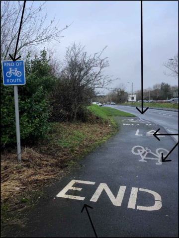
3.3.7 In addition, a new cycle lane through Pulrose Golf Club to the east of the site between the A5 New Castletown Road at the junction with Annacur Lane and Springfield Road has now been implemented by the DoI (planning application reference 20/00454/B). This provides enhanced cycle facilities between the site and future employees living in the Pulrose residential area, as well as a quicker route to/from Douglas town centre.
3.3.8 The Isle of Man Active Travel Investment Plan states the majority of Anagh Coar and Spring Valley are relatively flat with shallow gradients typically less than 3% and therefore concludes they are suitable for walking and cycling. It is noted that the PERS audit for Douglas identifies the pedestrian provision on Cooil Road to the east of the Jackson’s car showroom roundabout as ‘poor’ and ‘average’ to the west.
Date: 02 April 2026 Ref: BT/LJ/ITB211024-001A Page: 8
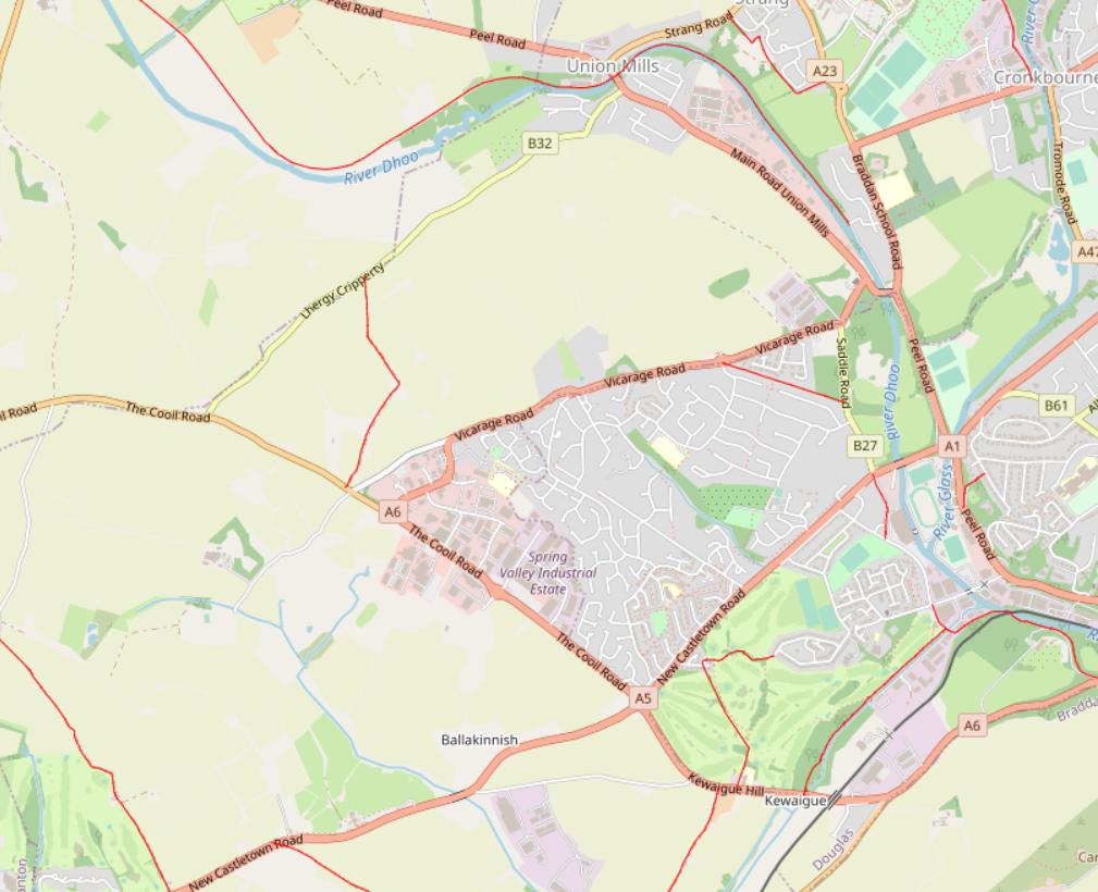
Land to the South of Cooil Road Full Travel Plan Public Rights of Way (PROW) Image 3.1: PROWS
3.3.9 There are not any Public Rights of Way (PROW) within the immediately vicinity of the proposed development site. The nearest PROW is located to the north of the site, connecting Cooil Road to Lhergy Cripperty. Additionally, there is a PROW to the east of the site, connecting Kewaigue Hill to the surrounding residential areas and into Douglas.
3.4 Public Transport
Bus
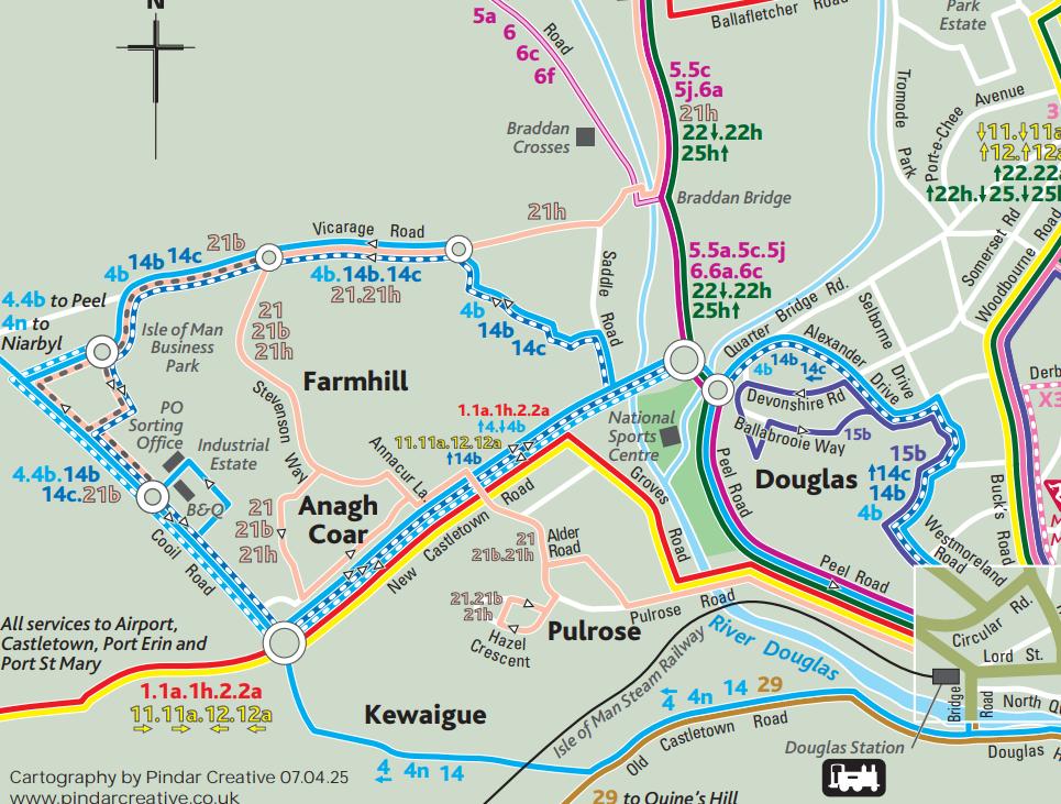
3.4.1 Cooil Road forms a public transport corridor and there are a number of bus stops located along the route. The closest bus stops are located on Cooil Road some 65m and 175m from the existing Robinson’s access for the westbound and eastbound services respectively and are therefore a very short walking distance from the site. Additional bus stops are also located to the west of Jacksons Roundabout, approximate one-minute additional walking time and these bus stops are complete with separate laybys, bus shelters, and timetable information. These stops are both served by the same bus services, and these services and their frequencies are outlined in Table 3.1 below. There is also an eastbound bus stop located approximately 70m to the west of the junction with the Isle of Man Business Park.
Date: 02 April 2026 Ref: BT/LJ/ITB211024-001A Page: 9
A topographical location map showing the site area near Union Mills and the River Dhoo, highlighting surrounding roads like Peel Road and Vicarage Road.A map legend titled 'Right of Way' displaying color-coded lines for various public paths including footpaths, bridleways, and byways.
Land to the South of Cooil Road Full Travel Plan
Table 3.1: Bus Routes and Frequency
Stops
Service
Route
Service Frequency (Typical morning and evening peak)
Stops
Service
Route
Mon-Fri
Cooil Road (B & Q, Robinson’s and ‘Roundabout)
1
Port St Mary – Railway Station – Colby – Airport – New Town Estate – DoI Business Park - Douglas
Morning service only
Cooil Road (B & Q, Robinson’s and ‘Roundabout)
4
Douglas - White Hoe - Foxdale - St Johns - Peel
3 morning services and 1 afternoon service
Cooil Road (B & Q, Robinson’s and ‘Roundabout)
4B
Douglas - Westmoreland Road Ballaughton - Foxdale - Peel
3 services to Douglas, 1 to Peel
Cooil Road (B & Q, Robinson’s and ‘Roundabout)
13
Douglas - Westmoreland Road Ballaughton - Cooil Road - Douglas
3 return services per day
Cooil Road (B & Q, Robinson’s and ‘Roundabout)
14b
Douglas – Ballaughton – Cooil Road
5 return services per day
Cooil Road (B & Q, Robinson’s and ‘Roundabout)
14c
Douglas - Westmoreland Road Ballaughton – IOM Business Park
1 service per day
Cooil Road (B & Q, Robinson’s and ‘Roundabout)
21B
Douglas - Anagh Coar - Farm Hill - DoI Business Park - Douglas
Every 30 mins
Source: Traveline (Accessed January 2022)
3.4.2 Table 3.1 demonstrates that the principal bus route serving the Cooil Road corridor is the 21B, which provides a regular 30-minute frequency between Douglas town centre and the surrounding residential areas, and the employment uses located on Cooil Road.
3.4.3 There are approximately three no. buses, on average, per hour operating along the Cooil Road corridor to the north of the site throughout the day, Monday – Saturday.
3.4.4 The first available service from Douglas town centre and the surrounding residential areas arrives at the bus stops nearest the site at 06:35 and the last return journey is at 18:26. The earliest service from Peel arrives at the bus stop at 08:30 and the last return journey is at 17:33. As a result, the current bus services accommodate commuting trips to and from the site from both Douglas and Peel.
Date: 02 April 2026 Ref: BT/LJ/ITB211024-001A Page: 10
Land to the South of Cooil Road Full Travel Plan
Image 3.2: Bus Routes
3.4.5 Once the proposed residential developments at Land East of Braddan Road (allocated as site DBH002g in the adopted Area Plan for the East), and Land adjacent Vicarage Road, Braddan (site BM006g) come forward it will provide the opportunity for a greater number of employees to live locally. All of site BM006g and much of site DBH002g will be within a reasonable walk distance from the site, whilst both sites will be within a comfortable cycle distance of the site.
Date: 02 April 2026 Ref: BT/LJ/ITB211024-001A Page: 11
A transport map displaying bus routes and road networks across the Douglas and Braddan area, highlighting locations like Farmhill and the Industrial Estate.
Land to the South of Cooil Road Full Travel Plan
SECTION 4 Measures
4.1 Infrastructure Measures
4.1.1 The Framework Travel Plan associated with application 22/00416/B proposed a number of measures, as follows:
• Short and long stay cycle parking across all phases;
• Provision of cycling facilities; and
• Off-site Pedestrian / Cycling Improvements
▪ Provision of 3.0m wide shared footway / cycleway along the site frontage to the west of Eden Park access to the pedestrian / cycle access located in the northwest corner of the site, opposite the existing footpath link to the rear of the International Financial Group Limited (IFLG) car park.
▪ Provision of uncontrolled pedestrian crossing complete with dropped kerbs and tactile paving to the east of Eden Park access to tie in with a connection to the Isle of Man Business Park on the northern side of Cooil Road
▪ Provision of a 3.0m wide shared footway / cycleway on the southern side of Cooil Road from where it currently ends at Jacksons Car Showroom to the junction with Eden Park
▪ Provision of dropped kerb crossings with tactile paving at side road junctions on the northern side of Cooil Road
4.1.2 It was agreed with the DoI that the continuation of the existing shared-use footway/cycleway eastwards along Cooil Road, i.e. to ensure continuity with the existing/proposed facilities, can be delivered either via the DoI as part of the their Active Travel Strategy or via the delivery of the adjacent sites BE002(b)g / BE006g, which are also zoned for industrial and business park uses. In combination with the existing facilities and the fair and proportionate infrastructure that the proposed development will bring forward, there will be a continuous pedestrian and cycle route on the southern side of Cooil Road for a distance of approximately 1.0k along the identified Enterprise Way corridor. It is envisaged this would tie into the planned cycle link that the DoI will deliver within the existing green space on the eastern side of Anagh Coar Road which will tie into the existing Pulrose Golf Course Cycle Route via the Toucan Crossing on New Castletown Road at the junction with Annacur Lane.
Date: 02 April 2026 Ref: BT/LJ/ITB211024-001A Page: 12
Land to the South of Cooil Road Full Travel Plan
4.2 Approved Measures
Off-Site
4.2.1 As master developers for the site, Eden Park Developments Ltd is in the process of implementing the various agreed off-site infrastructure measures as follows:
• Provision of a new westbound bus stop on Cooil Road approximately 50m to the west of the access to Eden Park
• Provision of 3.0m wide shared-use footway / cycleway along the site frontage to the west of Eden Park access to the proposed pedestrian / cycle access located in the NW corner of the site.
• Provision of uncontrolled pedestrian crossing complete with dropped kerbs and tactile paving to east of Eden Park access to tie in with connection to Isle of Man Business Park on the northern side of Cooil Road
• Provision of dropped kerb crossings with tactile paving at the following side road junctions on the northern side of Cooil Road at:
▪ Springham Road
▪ Barleyfield Road
▪ Cooil Drive
▪ Cloose Fletcher
▪ Bayr Cam
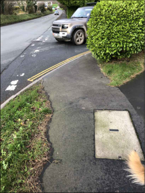
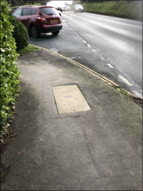
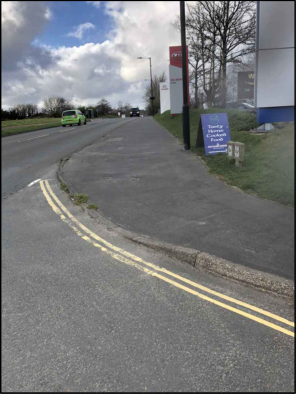
4.2.2 The majority of the above improvements are currently under construction and are due to be finished in April 2026. The detailed design drawings of the above improvements are provided at Appendix B.
On-Site
4.2.3 It will be the responsibility of each individual occupiers through subsequent reserved matters applications to provide appropriate on-site cycle parking and other facilities.
4.2.4 To date the following measures have been delivered:
Zone A
4.2.5 The detail for Zone A was secured as part of the original hybrid application ref: 22/00416/B).
• A covered and secure cycle store comprising 10 no. Sheffield Stands
Date: 02 April 2026 Ref: BT/LJ/ITB211024-001A Page: 13
Land to the South of Cooil Road Full Travel Plan
• Further short-stay cycle parking will be provided alongside Block 1 in the form of 7 Sheffield Stands (i.e. equating to 14 cycle parking spaces).
Zone B
4.2.6 Reserved Matters planning approval was granted for the development of Part of Zone B within Eden Park for a storage / distribution building (Ref: 25/90887/REM). The scheme will bring forward the following:
• 41 car parking spaces with three electric vehicle charging spaces.
• Covered cycle store for 10 bikes and a further eight cycle parking spaces for visitors.
4.2.7 Further Reserved Matters planning applications are planned for the balance of the area of Zone B.
Zone C
4.2.8 A Reserved Matters Application for the development of a wholesale distribution warehouse with ancillary trade-only cash and carry use together with associated office functions was submitted in March 2026 (Ref: 26/00151/OLA) and will provide the following:
• 44 car parking spaces with five electric vehicle charging spaces.
• 10 covered cycle parking spaces for staff
Zone D
• No Reserved Matters Planning Application yet submitted.
4.2.9 Each unit will also provide lockers, showers and changing rooms for employees to encourage the uptake of walking and cycling to work.
Summary
4.2.10 On the basis of the agreed improvements, future employees living in the area will therefore have the opportunity to walk and / or cycle to the proposed development.
4.2.11 Furthermore, along with the current shared footway / cycleway under construction, there will be a continuous pedestrian / cycle route on the southern side of Cooil Road for a distance of approximately 1.0km along the identified Enterprise Way Corridor. It is envisaged this would tie into the planned cycle link that the DoI will deliver within the existing green space on the eastern side of Anagh Coar Road which will tie into the existing Pulrose Golf Course Cycle Route via the Toucan Crossing on New Castletown Road at the junction with Annacur Lane.
Date: 02 April 2026 Ref: BT/LJ/ITB211024-001A Page: 14
Land to the South of Cooil Road Full Travel Plan
4.3 Soft Measures
4.3.1 It is important to note that the site will be occupied by a number of separate end users, and the owner will have limited influence over the travel habits of the businesses located in the buildings. The key measure promoted as part of this TP will therefore be information provision.
Measures to Promote Walking and Cycling
4.3.2 Information on the walking and cycling routes and facilities within the site will be made available to employees during their staff inductions and via information packs which will also be displayed on both the occupant’s website and around the staff communal areas on noticeboards. These will include maps of local walking and cycling routes and information on available incentives and will promote the health benefits of walking and cycling. Free health apps will be promoted to staff such as Strava or Map my Ride. The TPC will also include details of local cycle maintenance companies in the travel information packs issued to the future occupiers / staff.
4.3.3 The TPC will assist with the dissemination of information regarding the user group and will help employees get in contact with one another.
4.3.4 The TPC will also promote the benefits of Salary Sacrifice Schemes which companies could develop to offer interest free loans to help buy a bicycle or cycling equipment for cycling to work.
Travel Information Packs
4.3.5 All new occupiers will be provided with a travel information pack with enough copies for each of their employees. The pack will clearly set out information on the objectives of the TP, non-car mode travel options; and promote a range of incentives to encourage use of non-car modes of transport. It is proposed that the following items will be included:
• An information leaflet about the TP, its aims, and objectives, how travel will be monitored and reported;
• A location plan of the new development, highlighting the local facilities nearby, the local walking and cycling routes and the location of bus stops;
• Bus and rail maps and timetable information;
• Information about journey planning services;
• Information about car sharing: https://hub.liftshare.com/regional/isle-of-man
• Details of websites, which will contain travel information; and
Date: 02 April 2026 Ref: BT/LJ/ITB211024-001A Page: 15
Land to the South of Cooil Road Full Travel Plan
• Information on free to use pedometer apps to encourage walking amongst staff.
4.3.6 The master developer is committed to liaising with local cycle shops and public transport operators over the possibility of arranging discounts on equipment and / or services. The TPC will be able to continue these communications and include any discounts available within the Travel Information Packs.
Car Sharing Scheme
4.3.7 Car sharing will be promoted amongst employees. Not only does car sharing cut the costs of travel to work for the individual, but it reduces the number of employees making similar journeys at the same time, thereby reducing peak hour congestion on routes to the site. This in turn helps reduce vehicle emissions and contributes to meeting local air quality targets. Employees will therefore be provided with information about car sharing via the car share website (https://hub.liftshare.com/regional/isle-of-man), along with a leaflet explaining the benefits of the car share scheme and how to register will be included in the travel packs. This provides an easy and safe way for potential car sharers to identify people undertaking similar journeys.
4.3.8 The occupiers will be encouraged if deemed appropriate going forward to dedicate spaces closest to the main entrance to be prioritised for car sharers to act as an incentive to access more convenient car parking. This would be the equivalent of one to two spaces for each unit.
Notice Board / Newsletter
4.3.9 The owner of each unit will provide a staff noticeboard in a communal area of the site, including travel, car sharing information, walking, cycling, and public transport timetables. This information will also be shared in a newsletter as a method of sharing the survey results or any updates. Information will also include the health benefits of using active modes of transport.
Visitors
4.3.10 The TPC will encourage occupants to advertise sustainable modes of transport to access the site.
4.3.11 To assist in influencing the travel choices of less frequent visitors to the site, the following measures will also be implemented:
• The TPC will encourage each occupier to provide travel information on their individual company websites.
• Public transport timetables and cycle route maps will be provided to new occupiers.
Date: 02 April 2026 Ref: BT/LJ/ITB211024-001A Page: 16
Land to the South of Cooil Road Full Travel Plan
4.4 Marketing and Promotion
4.4.1 The TPC will hold annual staff feedback sessions to understand the effectiveness of the measures being promoted in the Travel Plan. This will allow the TPC to understand what the most effective measures are and if new measures could be explored to offer a more effective take up of measures in the future.
Date: 02 April 2026 Ref: BT/LJ/ITB211024-001A Page: 17
Land to the South of Cooil Road Full Travel Plan
SECTION 5 Targets
5.1 Overview
5.1.1 The key aim of the TP is to reduce the number of single occupancy vehicle trips generated by the site during the peak periods by 5 percentage points. This target follows the SMART principle (specific, measurable, adjustable, realistic, time-based) breakdown of how the 5% reduction in forecast traffic flows because of the TP measures, will be achieved, interim targets for each mode have been established.
5.2 Mode Split
5.2.1 At this stage (i.e., prior to occupation of the site / phases and baseline travel surveys), it is accepted practice to provide initial targets based on the estimated baseline trip generation and mode split set out in the Transport Assessment accompanying the planning application (report reference: ITB14273-003 R).
5.2.2 The indicative targets set out below in Table 5.1 can be updated and refined following baseline travel surveys which will be undertaken within the first six months or at 75% occupation, whichever is first.
Table 5.1: Estimated Baseline Mode Split
Method of Travel to Work
Proportion by Mode
Car or van driver
74.6%
Car or van passenger
10.3%
Walking
6.2%
Bicycle
4.1%
Bus
3.1%
Other
1.7%
Totals
100%
Source: TRICS Business Park and Consultants Estimates
5.2.3 The target of 5% reduction in forecast single occupancy vehicle trips would result in a modal shift for car drivers from 74.6% to 69.6% by year 5. Once the first travel survey has been undertaken, these targets will be reviewed.
5.2.4 Given the location of the site, the targets will focus on encouraging employees to travel on foot, cycle, and bus, as well as to lift share with other employees which will reduce the number of single occupancy vehicles.
Date: 02 April 2026 Ref: BT/LJ/ITB211024-001A Page: 18
Land to the South of Cooil Road Full Travel Plan
SECTION 6 Management
6.1 Overview
6.1.1 The TP is a continuous process requiring monitoring, review, and revision to ensure it remains relevant. This section sets out the strategy for monitoring and review over the occupations of the site.
6.2 Site Wide Travel Plan Co-ordinator
6.2.1 Eden Park Developments Ltd as master developer has appointed a Site Wide Travel Plan Coordinator (SWTPC) to ensure effective implementation of the TP.
6.2.3 The SWTPC will have responsibility for the full site and will be the sole point of contact for the DoI in regard to Travel Planning on the site. Should the site be occupied by multiple occupiers then the SWTPC will co-ordinate with all employers. If the employment units are occupied by one business, then the SWTPC will also co-ordinate with this occupier to ensure the measures are implemented and monitored.
6.2.4 The roles and responsibilities of the SWTPC include but will not be limited to:
• Assisting in the preparation of travel information for new starters;
• Ensure structure for the on-going management of the SWTPC is set up and running effectively;
• Liaising with public transport operators;
• Liaising with DoI to ensure a coordinated approach to measures and initiatives;
• Working with onsite businesses to promote active and more sustainable travel;
• Overseeing the monitoring reports including liaising with the DoI;
• Overseeing and monitoring the regular surveys and questionnaires, which will inform the ongoing development of the Travel Plan;
• Monitoring and where necessary, revising the site-wide Travel Plan targets; and
Date: 02 April 2026 Ref: BT/LJ/ITB211024-001A Page: 19
Land to the South of Cooil Road Full Travel Plan
• Administering the TP by implementing the necessary systems / protocols, data, and paperwork, consultation, and promotion.
6.2.5 The requirements of the TP will be highlighted to each business, and the TP will set out the sitewide initiatives for promoting and developing sustainable transport across the site.
Date: 02 April 2026 Ref: BT/LJ/ITB211024-001A Page: 20
Land to the South of Cooil Road Full Travel Plan
SECTION 7 Monitoring and Review
7.1 Monitoring
7.1.1 The monitoring programme of the development will be until some five years after first occupation of the site. Table 7.1 provides a summary of the timeframes and types of surveys to be undertaken each year of the Travel Plan.
Table 7.1: Survey Timetable
Baseline (Year 1)
Year 2
Year 3
Year 4
Year 5
Level of Report
Submitted after 1 year of first occupation – report to include baseline survey results
Travel Questionnaire and Monitoring Report
Travel Questionnaire and Full Surveys – Monitoring Reports
Travel Questionnaire and Monitoring Report
Travel Questionnaire and Full Surveys – Monitoring Reports
7.1.2 The surveys will be in the form of an electronic questionnaire to be issued to each business to complete on behalf of their employees, an example questionnaire is provided in Appendix C. The survey will monitor:
• Normal mode of travel to work
• Occasional mode of travel to work
• Ability to park on site and car park usage
• Number of car sharers
• Number of bicycles parked on site
• Awareness of travel plans & non-car mode options
• Uptake on measures, schemes, and initiatives
• Comments on the TP from staff.
7.1.3 The results of the surveys and the analysis will be included in an annual monitoring report when a minimum of 35% response rate has been achieved. Should this not be achieved, then the survey period will be extended, and a potential prize draw could be offered, to obtain a higher response rate.
7.1.4 The monitoring report will outline the measures put in place and the resources used over the previous year to achieve the targets. The TP targets may be revised or updated if necessary.
Date: 02 April 2026 Ref: BT/LJ/ITB211024-001A Page: 21
Land to the South of Cooil Road Full Travel Plan
7.1.5 The monitoring reports will be produced for five years following occupation and issued to DoI for review. The reports will also be issued to businesses based in each unit to provide feedback on how the TP is working and to ensure businesses feel involved in the process.
7.2 Remedial Measures
7.2.1 Should the TP targets not be met by the end of the monitoring period, the SWTPC will use reasonable endeavours to work with the DoI to identify a strategy and to agree further reasonable actions to achieve success.
7.3 Funding
7.3.1 The master developer (or any successor in title) will fund the preparation, implementation, and initial operation of the TP process, including the day-to-day site TPC role, the implementation and management of physical measures, the promotion of sustainable travel, and the coordination of the monitoring and review process.
Date: 02 April 2026 Ref: BT/LJ/ITB211024-001A Page: 22
Land to the South of Cooil Road Full Travel Plan
SECTION 8 Summary and Conclusions
8.1.1 In July 2023, planning approval was granted for the development of an industrial and business park on land south of Cooil Road (application ref: 22/00416/B). A Framework Travel Plan was prepared as part of the original hybrid planning application and this Full Travel Plan has been prepared to discharge Condition 18 from the planning permission.
8.1.2 This full Travel Plan focuses on promoting sustainable travel to the development amongst new employees and potential visitors by providing non-car mode travel options for local journeys and in particular reducing single occupancy car journeys and influencing modal choice.
8.1.3 The site is well located to the Cooil Road bus corridor. Bus route 21B provides a regular 30minute frequency between Douglas town centre and the surrounding residential areas and the employment uses located on Cooil Road.
8.1.4 The Framework Travel Plan associated with the original application proposed a number of hard and soft measures to facilitate and encourage the use of modes of travel other than single occupancy car use. As master developers for the site, Eden Park Developments Ltd is in the process of implementing the various agreed off-site infrastructure measures. The majority of the improvements are currently under construction and due to be finished in April 2026.
8.1.5 It will be the responsibility of each individual occupiers through subsequent reserved matters applications to provide appropriate on-site cycle parking and other facilities, with some Zones already granted reserved matters consent.
8.1.6 The targets set out in this Full Travel Plan focus on encouraging employees to travel on foot, cycle, and bus, as well as to lift share with other employees which will reduce the number of single occupancy vehicles.
8.1.7 Eden Park Developments Ltd have appointed a Site Wide Travel Plan Co-ordinator (SWTPC) who will have responsibility for the full site and will be the sole point of contact for the DoI in regard to Travel Planning on the site. Should the site be occupied by multiple occupiers then the SWTPC will co-ordinate with all employers. If the employment units are occupied by one business, then the SWTPC will also co-ordinate with this occupier to ensure the measures are implemented and monitored.
8.1.8 The TP will be monitored and reviewed from initial occupation to last. This will be in the form of travel questionnaires distributed to all employees to understand how they travel to / from the site. The results will be analysed and presented within a monitoring report issued to the DoI.
Date: 02 April 2026 Ref: BT/LJ/ITB211024-001A Page: 23
Land to the South of Cooil Road Full Travel Plan
8.1.9 Should the TP targets not be met by the end of the monitoring period then a strategy will be discussed with the DoI and implemented to best achieve the chances of success.
Date: 02 April 2026 Ref: BT/LJ/ITB211024-001A Page: 24
APPENDIX A. Site Masterplan
Stump
Stump
COOIL ROAD
ROBINSONS
522193
521917
GAREY ASHEN
ASHEN
522198
WICKHAM GAREY
521873
522191
522194 522190
A 6
521872
522195
522201
COLOONEYS
ZONE B
EDEN PARK GARDEN CENTRE
GP
ZONE A
BLOCK 2
BLOCK 1
ZONE D
BUSINESS PARK
ISLE OF MAN
JACKSONS
FUTURE DEVELOPMENT PLOT
3000
STOP
BUS
ZONE C
SEE PLANNING APPROVAL 25/90887/REM
EXISTING WOODLAND AREA RETAINED AND PROVIDE BAT BOXES LOCATION TO BE AGREED ON SITE WITH MANX WILDLIFE TRUST
ACCESS TO EXISTING AGRICULTURAL LANE AND HEDGING RETAINED
EXISTING ORCHID PATCH TO BE MANAGED AND EXTENDED AS AGREED WITH BY MANX WILDLIFE TRUST
EXISTING WILLOW AREA TO BE MANAGED TO PROTECT AND PROMOTE WILDLIFE BY MANX WILDLIFE TRUST, ONLY TREE UNDER 80mm dia MEASURED 1.5m ABOVE GROUND TO BE REMOVED STRUCTURED PLANTING TO
LANDSCAPE ARCHITECTS DETAILS
EXISTING POND RETAINED AND CLEANED AND ENHANCED PLANTING FOR WILDLIFE AS PROPOSED BY MANX WILDLIFE TRUST
EXISTING HEDGING TO FIELD BOUNDARIES
PROVIDE BOLLARDS TO EMERGENCY ACCESS
PRIOR TO EXCAVATION WORKS OVER GAS MAIN METHOD STATEMENTS TO BE AGREED WITH MUA
PEDESTRIAN AND CYCLE ROUTE
EXTEND CYCLEWAY TO SITE FRONTAGE
GATED ACCESS TO ADJOINING LAND
GATED ACCESS TO PUMPING STATION
ACCESS ROAD TO PUMPING STATION
TANKER PARKING FOR PUMP STATION ACCESS
EXISTING TREES AND HEDGING RETAINED, EXTRA TREE PLANTING TO LANDSCAPE ARCHITECTS DESIGN
PUMPING STATION
ACCESS TO EXISTING SUBSTATION TO BE MAINTAINED ROUTE TO BE DETERMINED AS PART OF RESERVED MATTERS APPLICATION
FORM FIELD ACCESS
FORM FIELD ACCESS
EXTEND CYCLEWAY TO EDEN PARK GARDEN CENTRE
EXISTING HIGH PRESSURE GAS MAIN EASEMENT
PROPOSED MICRO FOREST AND THICKET PLANTING TO BE AGREED WITH MANX WILDLIFE TRUST
EXISTING INVASIVE PLANT SPECIES TO BE REMOVED AND SPECIES OF INTEREST RETAINED AND MANAGED AS AGREED WITH MANX WILD LIFE TRUST
ROUNDABOUT TO HAVE PROVISION FOR SCULPTURE; SCUPLTURE DESIGN TO SEPERATE PLANNING APPLICATION AND TO NOT EFFECT HIGHWAY SAFETY
PUFFIN CROSSING UNDER CONSTRUCTION BY DOI
CYCLE / PEDESTRIAN LINK PROPOSED BUS STOP
PROPOSED SUB STATION PROVIDE TEMPORARY ACCESS UNTILL FUTURE DEVELOPMENT IS COMPLETED
5
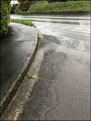
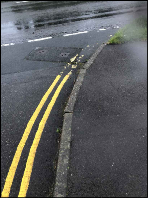
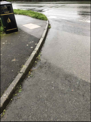
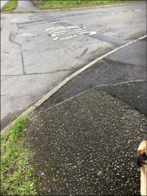
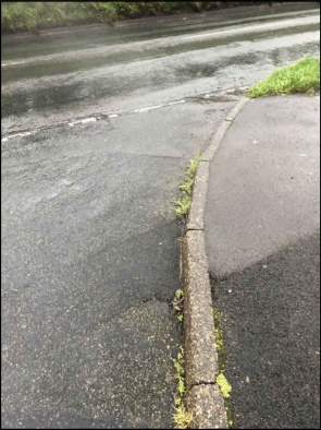
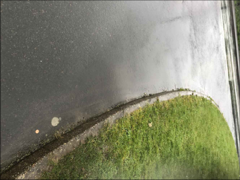
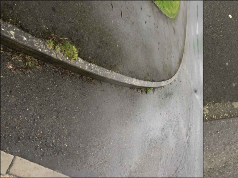
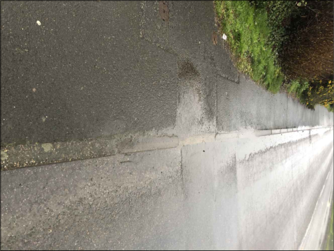
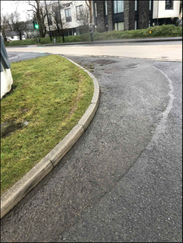
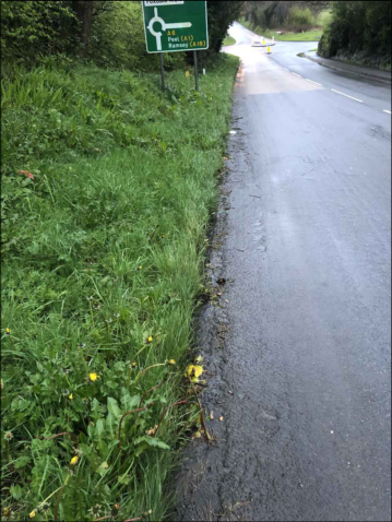
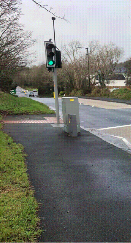
APPENDIX B. Detailed Design Drawings – Offsite
Improvements
522204
522162
INDUSTRIAL ESTATE
A 6
522198
524148
522202
522203
SPRING VALLEY
522201
CLOSE
KENNISH
COOIL DRIVE
COOIL CLOSE
---
---
524147
COOIL VIEW
522429
522428
524152
CLOSE
522425
MOORE
COOIL ROAD
CLOSE FLETCHER
COOIL DRIVE
ZONE D
JACKSONS
---
FUTURE DEVELOPMENT PLOT
BUS
STOP
COOIL DRIVE
AREA 1
AREA 2
AREA 3
AREA 4
AREA 5
---
MT SV
FORM 1600x2400mm TACTILE PAVING IN EXISTING PATHWAY ALL DISTURBED BITMAC TO BE MADE GOOD AND JOINTS TO EXISTING SEALED WITH LEOTACK
EXISTING STOP VALVE
EXISTING TELECOM BOX IN GRASS VERGE
GRASS VERGE
GRASS VERGE
PROVIDE DROPPED KERBS EITHER SIDE OF TACTILE PAVING
FOOTPATH
COOIL ROAD
FOOTPATH
BAYR CAM
IMAGE 1A
IMAGE 1B
PIN KERB AND GRASS VERGE ADJUSTED TO SUIT NEW LEVELS
MT
FORM 1600x2400mm TACTILE PAVING IN EXISTING PATHWAY ALL DISTURBED BITMAC TO BE MADE GOOD AND JOINTS TO EXISTING SEALED WITH LEOTACK
PIN KERB AND GRASS VERGE ADJUSTED TO SUIT NEW LEVELS
EXISTING TELECOM COVER CHANGED TO RECESSED TYPE AND LEVELS ADJUSTED TO SUIT DROPPED KERB
PROVIDE DROPPED KERBS EITHER SIDE OF TACTILE PAVING
IMAGE 2A IMAGE 2B
CLOSE FLETCHER
COOIL ROAD
GRASS VERGE
GRASS VERGE
FOOTPATH
FOOTPATH
---
MT
MT
FORM 1600x2400mm TACTILE PAVING IN EXISTING PATHWAY ALL DISTURBED BITMAC TO BE MADE GOOD AND JOINTS TO EXISTING SEALED WITH LEOTACK NOTE SIZE ADJUSTED TO SUIT ACCESS COVERS
PIN KERB AND GRASS VERGE ADJUSTED TO SUIT NEW LEVELS
EXISTING TELECOM COVER CHANGED TO RECESSED TYPE AND LEVELS ADJUSTED TO SUIT DROPPED KERB
PROVIDE DROPPED KERBS EITHER SIDE OF TACTILE PAVING
IMAGE 3A
IMAGE 3B
COOIL ROAD
COOIL DRIVE
FOOTPATH
FOOTPATH
GRASS VERGE
GRASS VERGE
---
---
SV
---
SV
Tel
Tel
FORM 1600x2400mm TACTILE PAVING IN EXISTING PATHWAY ALL DISTURBED BITMAC TO BE MADE GOOD AND JOINTS TO EXISTING SEALED WITH LEOTACK
TACTILE PAVING TO BE POSITION TO SUIT STOP VALVES
IMAGE 5A IMAGE 5B
WIDEN AND ADJUST EXISTING DROPPED KERBS EITHER SIDE OF TACTILE PAVING,
FOOTPATH
FOOTPATH
COOIL ROAD
ISLE OF MAN
BUSINESS PARK
---
RS
LP
LP
MT
MT
MT
MT
RS
SV
SV SV
WM
MT
FORM 1600x2400mm TACTILE PAVING IN EXISTING PATHWAY ALL DISTURBED BITMAC TO BE MADE GOOD AND JOINTS TO EXISTING SEALED WITH LEOTACK
HIGHWAY AREA SHADED TO HAVE EXISTING SHRUB PLANTING TO BE REMOVED AND REPLACED WITH GRASS TO IMPROVE VISION SPLAYS BETWEEN PEDESTRIANS AND VEHICLES
GRASS VERGE
PROVIDE DROPPED KERBS EITHER SIDE OF TACTILE PAVING
COOIL ROAD FOOTPATH
FOOTPATH
SPRING VALLEY
IMAGE 4A
IMAGE 4B
PIN KERB AND GRASS VERGE ADJUSTED TO SUIT NEW LEVELS
---
0-6
---
0-6
25
150 min
150
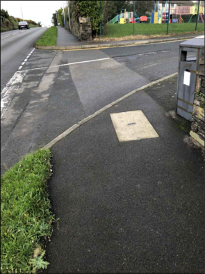
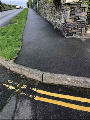
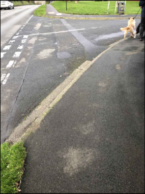
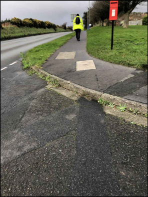
AREA 1 COOIL ROAD / BAYR CAM IMPROVEMENTS AREA 2 COOIL ROAD / CLOSE FLETCHER IMPROVEMENTS
---
---
IMAGE 1A IMAGE 1B
---
---
IMAGE 2A IMAGE 2B
AREA 3 COOIL ROAD / COOIL DRIVE IMPROVEMENTS
---
---
IMAGE 3A IMAGE 3B
AREA 4 COOIL ROAD / SPRING VALLEY IMPROVEMENTS AREA 5 COOIL ROAD / ISLE OF MAN BUSINESS PARK IMPROVEMENTS
IMAGE 4A IMAGE 5A
---
220x10mm STEEL DOWELS AT 600mm c/cs EMBEDDED IN KERB RACE 100mm
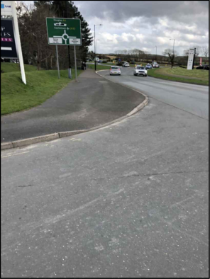
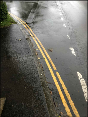
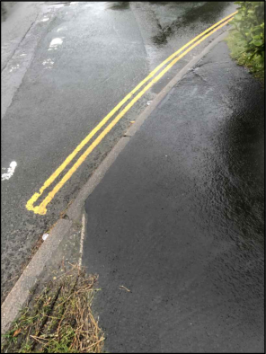
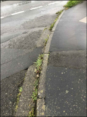
A photograph showing a paved path or driveway running alongside a road, bordered by a tall stone wall on the right.A photograph showing a paved road curving towards a roundabout with a green directional sign on the left and vehicles in the distance.A close-up photograph of a wet asphalt road surface featuring double yellow lines along the curb and white dashed lane markings.A close-up photograph of a wet asphalt road surface featuring double yellow lines painted along the curb edge.A close-up photograph showing a concrete curb separating a paved road from a footpath, with vegetation growing in the cracks.A low-angle photograph showing a wet asphalt road surface with a concrete curb and a hedge on the left side, likely depicting the site access or surrounding road.A close-up photograph of a wet asphalt road surface featuring double yellow lines curving along a concrete curb.A close-up photograph showing a wet asphalt road surface, a concrete curb, and faint yellow painted markings on the ground.A close-up photograph showing a wet asphalt road surface meeting a concrete curb and a patch of grass.A close-up photograph of a wet asphalt road surface featuring double yellow lines along the curb and a utility cover.A photograph showing a wet asphalt road surface next to a paved sidewalk with a concrete curb. A black litter bin is visible on the left side of the pavement.A photograph showing a paved road surface with faded white painted markings, a concrete curb, and a patch of fresh tarmac or gravel in the foreground.A close-up photograph showing a wet asphalt road surface meeting a concrete curb and paved area, with weeds growing in the gap.A photograph showing a paved driveway or path leading to a road, with a playground visible in the background behind a fence.A photograph showing a paved footpath running alongside a road, bordered by a stone wall on the right and a grass verge on the left.A ground-level photograph showing a paved road surface with white markings, a curb, and a grassy verge. A dog and part of a person are visible on the right side near the edge of the pavement.A photograph showing a paved footpath running alongside a road, with a person in high-visibility clothing walking away and a red post box on the grass verge.A street-level photograph showing a silver SUV parked on a road with double yellow lines next to a sidewalk and a large green hedge.A photograph showing a paved footpath or driveway entrance next to a road, featuring a rectangular concrete slab and a red car in the background.A street-level photograph showing a road with double yellow lines curving past a commercial building and a blue planning sign.
COOIL ROAD
ROBINSONS
EDEN PARK GARDEN CENTRE
BUSINESS PARK
ISLE OF MAN
3000
STOP
BUS
Gradient 2.8% (1/36)
100
100 200
2000 / 3000
Gradient 2.8% (1/36)
125 27 28 150
150
0-6 35 36 150 min
150
COOIL ROAD
ROBINSONS
3000
EXISTING CONCRETE CHAMFERED KERB
EXISTING HIGHWAY CONSTRUCTION
EXISTING SUB BASE
EXISTING CONCRETE KERB RACE
EXISTING CONCRETE HAUCHING
SUB BASE TO BE MIN 100mm THICK BELOW AND BEYOND KERB RACE
200x175mm CONCRETE SURROUND TO KERB
150x50mm PRECAST CONCRETE EDGING
25mm THICK DENSE BITMAC WEARING COURSE ON 50mm THICK DENSE BITMAC BASE
150mm THICK TYPE 1 COMPACTED SUB BASE
BITMAC TO BE 5mm OVERSET ABOVE KERBING
DETAIL SECTION 1 1:10
PROPOSED LOCATION PLAN 1:1250
DETAIL SECTION 2 1:10
EXISTING HIGHWAY CONSTRUCTION
EXISTING SUB BASE
EXISTING CONCRETE KERB RACE
CONCRETE HAUCHING BITMAC TO BE 5mm OVERSET ABOVE KERBING
EXISTING DROPPED KERB REMOVED AND REPLACED WITH 250x125mm CONCRETE CHAMFERED KERB BEDDED IN MORTAR
220x10mm STEEL DOWELS AT 600mm c/cs EMBEDDED IN TO EXISTING KERB RACE 100mm
25mm THICK DENSE BITMAC WEARING COURSE ON 50mm THICK DENSE BITMAC BASE
150mm THICK TYPE 1 COMPACTED SUB BASE BULT UP TO SUIT NEW KERB HEIGHT
DETAIL SECTION 3 1:10
EXISTING HIGHWAY CONSTRUCTION
EXISTING SUB BASE
EXISTING CONCRETE KERB RACE
CONCRETE HAUCHING
220x10mm STEEL DOWELS AT 600mm c/cs EMBEDDED IN TO EXISTING KERB RACE 100mm
150x125mm CONCRETE BULLNOSED BEDDED IN MORTAR
SEAL JOINT TO NEW KERB WITH LEOTACK
250x125mm CONCRETE DROPPED KERB EITHER SIDE OF TACTILE PAVING
25mm THICK DENSE BITMAC WEARING COURSE ON 40mm THICK DENSE BITMAC BASE TO MAKE GOOD AROUND NEW PAVING
FOOTWAY TO BE DISHED MAX GRADIENT 1:12 AND MAX RAMP LENGTH 1500mm
PLAN X 1:200
BICYCLE ROAD MARKINGS DIAGRAM 1057
EXISTING BUS STOP
FORM 800mm WIDE CORDUROY PAVING
SHELTER
PROVIDE 1600X1200mm BLISTER PAVING WITH DROPPED KERB EITHER SIDE. ALL DISTURBED SURFACES MADE GOOD SEE DETAIL 3
SEE DETAIL DRAWINGS H32-1-204, 205 & 206 FOR DETAILS OF WORKS
IMAGE 3
IMAGE 4
EXISTING ROAD GULLY TO BE REMOVED
LINE OF EXISTING KERB LINE TO BE GRUBBED UP
DIAGRAM 1003 ROAD MARKINGS
COOIL ROAD
EXISTING TELECOM BOX COVER ADJUSTED TO SUIT PATHWAY PROVIDE MIN 2000X1200mm BLISTER PAVING WITH DROPPED KERB EITHER SIDE. ALL DISTURBED SURFACES MADE GOOD FORM 800mm WIDE CORDUROY PAVING
EXISTING WALL
EXISTING MINI PILLAR LEVEL ADJUSTED TO SUIT PATHWAY
EXISTING EDEN PARK BROWN ROAD SIGN RELOCATED TO BACK OF PATHWAY
EXISTING PATH
EXISTING TELECOM BOX ADJUSTED TO SUIT PATHWAY PATHWAY WIDENED TO ACCOMODATE TELECOM BOX GREEN ROAD PAINT DEMARK PRIORTY CROSSING PROVIDE MIN 2000X1200mm BLISTER PAVING WITH DROPPED KERB EITHER SIDE. ALL DISTURBED SURFACES MADE GOOD, PROPOSED LINE MARKINGS DIAGRAM 1003 EXISTING ROBINSONS SIGNAGE
IMAGE 1
PROPOSED LINE MARKINGS DIAGRAM 1009 PROPOSED GIVE WAY MARKINGS DIAGRAM 1023 FORM 800mm WIDE CORDUROY PAVING
SIGN A PROVIDE 300mm DIA SIGN 956 MOUNTED ON GALV STEEL POLE MIN 2.3m ABOVE FOOTWAY. POLE ENCASED IN 450x450x450mm CONCRETE
A close-up photograph showing the edge of an asphalt road meeting a grassy verge separated by a concrete curb.A photograph showing a wet asphalt road surface curving along a grassy verge and curb.A close-up photograph showing a curved concrete curb and asphalt surface with some moss growth.A rotated photograph showing a paved road surface, a concrete curb, and a grassy verge with vegetation.A photograph showing a paved cycle path with a blue 'End of Route' sign and large white 'END' text painted on the ground.
COOIL ROAD
ROBINSONS
A 6
ZONE B
EDEN PARK GARDEN CENTRE
86.50
85.60
---
86.00
---
BUSINESS PARK
ISLE OF MAN
STOP
BUS
BUSINESS PARK
STOP
BUS
STOP
BUS
SECTION 109 AGREEMENT 1:500 PROPOSED LOCATION PLAN 1:1250
SECTION 4 AGREEMENT 1:500
---
STOP
BUS
DETAIL 2
3000
2000 5000
DETAIL 1
DETAIL 4
DETAIL 3
EXISTING ROAD GULLY TO BE REMOVED
EXISTING ROAD GULLY
EXISTING ROAD GULLY
EXISTING EASEMENT OVER GAS MAIN
FORM 2.4m WIDE DROPPED KERB AT CYCLE WAY END SEE DETAIL 3
DIAGRAM 1003 ROAD MARKINGS
BICYCLE ROAD MARKINGS DIAGRAM 1057
150mm CONCRETE BASE FOR SHELTER REINFORCED WITH A142 MESH 50mm COVER TO BOTTOM FUTURE BUS SHELTER BY OTHERS SEE DETAIL 5
EXISTING KERBS REMOVED AND REPLACED WITH 3m WIDE KESSEL KERBS AND 1m WIDE TRANSITION KERB EITHER SIDE SEE DETAIL 4
AREA HATCHED BLUE DENOTES 75mm GEOCELL ROOT PROTECTION
BUS STOP ROAD MARKINGS IN ACCORDANCE WITH DIAGRAM 1025.1
EXISTING ROAD MARKINGS TO PEDESTRIAN CROSSING
LINE OF EXISTING BANK CUT BACK TO SUIT
EXTEND EXISTING BLISTER PAVING TO NEW FOOTPATH WIDTH
EXTEND RIEYS SIGN RETAINED
EXISTING BLOCK PAVIER PATH WIDED TO 3m
EXISTING GATE PILLER RETAINED
EXISTING TREE TO BE REMOVED
EXISTING TREE RETAINED
75mm DEEP TERRAM GEOCELL TREE ROOT PROTECTION OR SIMILAR TO BE INFILL AND 25mm OVER TOP OF CELLS WITH GRADED ANGULAR STONE (20 / 40) WITH NO FINES ALL WORKS IN ACCORDANCE WITH MANUFACTURERS INSTRUCTIONS
EXISTING BANK CUT BACK TO FORM OPENING FOR BUS SHELTER
EXISTING BITMAC PATH WIDENED TO 3m WIDE
EXISTING WALL AND SIGN
EXISTING SERVICES IN THE ROAD
EXISTING SERVICES IN FOOTPATH
EXISTING CROSSING MINI PILLAR IN FOOTPATH RELOACTED TO BACK OF FOOTPATH ELECTRICAL WORK BY DOI IMAGE 3
EXISTING SERVICES IN PATHWAY
PROVIDE MIN 2000X1200mm BLISTER PAVING WITH DROPPED KERB EITHER SIDE. ALL DISTURBED SURFACES MADE GOOD
PROVIDE MIN 2000X1200mm BLISTER PAVING WITH DROPPED KERB EITHER SIDE. ALL DISTURBED SURFACES MADE GOOD
SIGN C PROVIDE 50mm HIGH TEXT SIGN 970 MOUNTED ON GALV STEEL POLE MIN 2.3m ABOVE FOOTWAY. POLE ENCASED IN 450x450x450mm CONCRETE
SIGN C
SIGN D PROVIDE 50mm HIGH TEXT SIGN 963.1 MOUNTED ON GALV STEEL POLE MIN 2.3m ABOVE FOOTWAY. POLE ENCASED IN 450x450x450mm CONCRETE
FORM 800mm WIDE CORDUROY PAVING
BICYCLE ROAD MARKINGS DIAGRAM 1057 AND 1059
---
A photograph showing a curved asphalt road surface with a concrete curb and grassy verge, with modern residential buildings visible in the background.A photograph showing a grassy roadside verge next to a paved road, with a green roundabout directional sign visible in the background.A blue rectangular sign featuring a white bicycle symbol and the text 'CYCLE LANES LOOK BOTH WAYS'.A photograph showing a pedestrian crossing signal with a green light and a control box on a paved path beside a road.
Gradient 2.5% (1/40)
3000
200
0-6
25
150 min
150
Gradient 2.5% (1/40)
200
2000 / 3000
160
25
Gradient 2.5% (1/40)
1500
50
CONCRETE CAST INTO GEOCELL
200x175mm CONCRETE SURROUND TO KERB
150x50mm PRECAST CONCRETE EDGING
25mm THICK DENSE BITMAC WEARING COURSE ON 50mm THICK DENSE BITMAC BASE
75mm THICK TYPE 1 COMPACTED SUB BASE OVER GEOCELL
DETAIL SECTION 1 1:10
DETAIL SECTION 3 1:10
EXISTING HIGHWAY CONSTRUCTION
EXISTING SUB BASE
EXISTING CONCRETE KERB RACE
CONCRETE HAUCHING
220x10mm STEEL DOWELS AT 600mm c/cs EMBEDDED IN TO EXISTING KERB RACE 100mm
150x125mm CONCRETE BULLNOSED BEDDED IN MORTAR
SEAL JOINT TO NEW KERB WITH LEOTACK
250x125mm CONCRETE DROPPED KERB EITHER SIDE OF TACTILE PAVING
25mm THICK DENSE BITMAC WEARING COURSE ON 40mm THICK DENSE BITMAC BASE TO MAKE GOOD AROUND NEW PAVING
FOOTWAY TO BE DISHED MAX GRADIENT 1:12 AND MAX RAMP LENGTH 1500mm
BANK RE PROFILED TO SUIT NEW PATHWAY WHERE POSSIBLE TO START 500mm FROM BACK OF PENCIL KERB
LINE OF EXISTING BANK
EXISTING TREES RETAINED
75mm DEEP TERRAM GEOCELL TREE ROOT PROTECTION OR SIMILAR TO BE INFILL AND 25mm OVER TOP OF CELLS WITH GRADED ANGULAR STONE (20 / 40) WITH NO FINES ALL WORKS IN ACCORDANCE WITH MANUFACTURERS INSTRUCTIONS
LINE OF EXISTING BANK
DETAIL SECTION 2 1:10
CONCRETE CAST INTO GEOCELL
200x175mm CONCRETE SURROUND TO KERB
150x50mm PRECAST CONCRETE EDGING
25mm THICK DENSE BITMAC WEARING COURSE ON 50mm THICK DENSE BITMAC BASE
75mm THICK TYPE 1 COMPACTED SUB BASE OVER GEOCELL
75mm DEEP TERRAM GEOCELL TREE ROOT PROTECTION OR SIMILAR TO BE INFILL AND 25mm OVER TOP OF CELLS WITH GRADED ANGULAR STONE (20 / 40) WITH NO FINES ALL WORKS IN ACCORDANCE WITH MANUFACTURERS INSTRUCTIONS
DETAIL SECTION 4 1:10
EXISTING HIGHWAY CONSTRUCTION CUT BACK TO SUIT NEW KERB AND JOINT SEALED WITH LEOTACK
EXISTING SUB BASE
EXISTING CONCRETE KERB RACE EXTENDED AS REQUIRED TO SUIT KERB
CONCRETE HAUCHING 220x10mm STEEL DOWELS AT 600mm c/cs EMBEDDED IN TO EXISTING KERB RACE 100mm
3m WIDE PRECAST CONCRETE STANDARD KASSEL KERB AND 1m TRANSITION KERB EITHER SIDE
FOOTWAY TO BE RAMPED UP AT TRANSITION KERB
75mm THICK TYPE 1 COMPACTED SUB BASE OVER GEOCELL
75mm DEEP TERRAM GEOCELL TREE ROOT PROTECTION OR SIMILAR TO BE INFILL AND 25mm OVER TOP OF CELLS WITH GRADED ANGULAR STONE (20 / 40) WITH NO FINES ALL WORKS IN ACCORDANCE WITH MANUFACTURERS INSTRUCTIONS
BANK RE PROFILED TO SUIT NEW PATHWAY WHERE POSSIBLE TO START 500mm FROM BACK OF PENCIL KERB
DETAIL SECTION 5 1:10
75mm DEEP TERRAM GEOCELL TREE ROOT PROTECTION OR SIMILAR TO BE INFILL AND 25mm OVER TOP OF CELLS WITH GRADED ANGULAR STONE (20 / 40) WITH NO FINES ALL WORKS IN ACCORDANCE WITH MANUFACTURERS INSTRUCTIONS
150mm CONCRETE REINFORCED WITH 1 LAYER A142 MESH WITH 50mm COVER TO BOTTOM
25mm THICK DENSE BITMAC WEARING COURSE ON 50mm THICK DENSE BITMAC BASE
75mm THICK TYPE 1 COMPACTED SUB BASE OVER GEOCELL
LINE OF 150x50mm PRECAST CONCRETE EDGING TO STOP EITHER SIDE OF BUS STOP SLAB
---
APPENDIX C. Example Travel Survey Questionnaire
Employee Travel Survey
This travel survey is designed to help us understand how you travel to work and your reasons for travelling in this way. This information can then be used to hopefully improve your journey to work.
The data that you submit in the following sections will only be used for this travel survey. Data will only be published in aggregated form, therefore no individual will be identifiable. No data will be kept for longer than is necessary for these purposes and none will be passed to third parties.
Please remember to return the completed survey via email.
1. Which organisation do you work for?
2. Gender Male Female Non-binary Transgender Intersex Prefer not to say Let me type (box provided below)
3. Age 16-19 20-29 30-39 40-49 50-59 60+
4. Home postcode - only the first half of your postcode is required
Create your own automated PDFs with Jotform PDF Editor- It’s free
5. Do you consider yourself to have a disability which affects the way in which you can travel to work? (If yes please provide details in the box below)
No Yes
6. Which of the following options best describes your working hours? Full time Part time (less than 37 hours per week) Part time (less than 3 days per week) Shift Work School term time only Weekend working Night working
7. What is your main mode of travel to work? (If you use mroe than one of the below options indicate which mode you spend the most time / furthest distance on)
Walk Car alone Car share (as a passenger) Car share (as the driver) Cycle Bus Staff minibus (if applicable) Train Walk then train Cycle then train Drive then train Lift then train Motorcycle Taxi Work from home Other (box provided below)
Create your own automated PDFs with Jotform PDF Editor- It’s free
How often do you travel this way? (If 'every day' only tick one mode)
Every day 2-3 times a week At least once a week Walk
Car alone
Car share (as a passenger)
Car share (as the driver)
Cycle
Bus
Staff minibus (if applicable)
Train
Walk then train Cycle then train Drive then train Lift then train
Motorcycle
Taxi
Work from home
Other
Create your own automated PDFs with Jotform PDF Editor- It’s free
9. What influences your travel choice (please enter an answer for each statement) Very important Important Not important
Lack of alternatives
Cost
Convenience and comfort Personal safety Environmental concerns Health and fitness
Parking issues
Avoiding congestion Need car for my work Additional journeys before / after work
10. How far is your place of work from your home? Less than a mile 1-2 miles 3-5 miles 6-10 miles 11-20 miles More than 20 miles
11. How long does your journey from home to your place of work usually take? Less than 15 minutes 15-30 minutes 30-45 minutes 45-60 minutes Over an hour
12. What time do you usually arrive at your place of work? Before 8am 8am-9am After 9am Work from home
Create your own automated PDFs with Jotform PDF Editor- It’s free
13. What time do you usually leave your place of work? Before 5pm 5pm-6pm After 6pm Work from home
14. If you travel by car to your place of work, where do you usually park? At your place of work Public car park On street (another location) Park and ride Other (box provided below)
15. If you were unable to drive to work on a given day, what would you do?
16. When you make a business journey (i.e. attending a meeting in another location or any journey for which you claim travel expenses) how do you usually travel? (If always only tick one mode)
Always Very Often Occasionally Bicycle
Bus
Train
Car (own)
Car (lease/hire)
Car share
Motorcycle
Taxi
Walk
Other
Create your own automated PDFs with Jotform PDF Editor- It’s free
17. Please indicate the extent to which you have used each of the following Always Sometimes Never Option not available to me
Working from home
Flexi time
Flexi leave
Compressed hours (e.g. 9 day fortnight)
Video/tele conferencing
18. Are you aware of any incentives or discounts offered through your employer to help with your travel to work? Yes No
19. If yes, do you make use of any of them? No Yes (please specify)
Please specify details
Create your own automated PDFs with Jotform PDF Editor- It’s free
i-Transport
i-Transport – Basingstoke | Manchester | London | Leeds | Solent
i-Transport
i-Transport – Basingstoke | Manchester | London | Leeds | Solent www.i-transport.co.uk www.i-transport.co.uk
Copyright in submitted documents remains with their authors. Request removal