**Document:** APL Planning Statement
**Application:** 22/00850/B — Conversion of retail space and existing residential units into a total of 5 self-contained apartments and the installation of replacement windows and doors, replacement pitched roofs and flat roofs to the rear, installation of balustrade to the rear, and removal of rear external staircase
**Decision:** Permitted
**Decision Date:** 2022-11-24
**Parish:** Braddan
**Document Type:** report / planning_statement
**Source:** https://planningportal.im/a/9180-braddan-58-60-strand-replacement-conversion/documents/954246
---
# APL Planning Statement
### Planning and Design Statement
#### Alterations to 58 & 60 Strand Street, Douglas.
JS Associates Ltd April 2022
###### Contents
- 1.0 Site and Surroundings
- 2.0 The Proposals
- 3.0 Planning History and Policy
- 4.0 Drainage & Services
- 5.0 Refuse
- 6.0 Environmental
- 7.0 Parking and Access
- 8.0 Fire
- 9.0 Regeneration
- 10.0 Summary
- 1.0 Site and Surroundings
- 1.1 The proposed development site includes two buildings, numbers 58 & 60 Strand Street, located on the main pedestrianised shopping Street in Douglas town centre. The site is owned by the applicant and previously operated as a public bar & nightclub across the ground floors of both buildings, until the more recent conversion to retail units.
- 1.2 The site presently operates as two independent retail units from the ground floor with public access from Strand Street. Number 58 Strand Street operates as a clothing retail outlet and number 60 Strand Street operates as the main Douglas Post Office.
- 1.3 Above ground floor, the first and second floors of number 58 is a self-contained, 4bedroom apartment with access available only from the rear Lane. The upper floors of number 60 were previously private living accommodation for the bar & nightclub manager, but are now largely redundant and unoccupied, apart from the rear annex which contains office, storage and welfare facilities, over three floors, for use by the Post Office.
- 2.0 The Proposals
- 2.1 The applicant would like to maximise the use of the available, redundant and unoccupied space to create three additional apartments, for private letting on the upper floors, whilst maintaining the existing retail units on the ground floors.
- 2.2 The proposed development work to number 58 Strand Street includes,
- o Internal alterations to convert the existing 4-bedroom apartment on the first and second floors, into two separate one-bedroom apartments. (Shown as apartments 1 and 5 on the floor plans)
- o The existing ground floor retail space will be slightly reduced to form a new entrance lobby, accessed from the rear lane, serving all five apartments across both buildings. Bin storage and a separate cycle store will also be included in this location together with mailboxes and utilities lockers.
- o The new entrance lobby will also contain the main staircase to the upper levels of both buildings, via a new stairwell and corridor extension up to first-floor level.
- o A new flat roof will be constructed over part of the rear annex to replace the existing deteriorating roof which frequently leaks into the ground floor retail unit.
- o No visual alterations will be made to the front Strand Street elevation.
- 2.3 The proposed development work to number 60 Strand Street includes,
- o Internal alterations to the Post Office rear annex ancillary rooms and staircase, which reduces the usable space to ground and first floors only.
- o Alterations to convert the existing redundant spaces on the first, second and third floors into two, 2-bedroom apartments and one, 3-bedroom apartment including the attic space. (Shown as apartments 2,3 and 4 on the plans)
- o The apartments are accessed from the rear lane, new internal entrance lobby, staircase and corridor, in 58 Strand Street.
- o The apartments will benefit from new energy efficient windows, which will be fitted within the existing window openings to the main Strand Street elevation. New windows and French doors, to maximise available daylight into the apartments, will be fitted to the rear lane facing elevation.
- o A new roof covering will be installed to replace and match the existing.
- o Two new roof lights will be installed in the attic bedroom of Apartment 4.
- 3.0 Planning History and Policy
- 3.1 Planning History - 58 Strand Street
- o 16/00844/C - Change of use of premises from food and drink to retail 58 Strand Street Douglas Isle of Man 1 Aug 2016 - Permitted
- o 16/00885/D - Installation of non-illuminated signage 58 Strand Street Douglas Isle Of Man 5 Aug 2016 – Permitted
- 3.2 Planning History - 58/60 Strand Street
- o 87/01314/B - Amalgamation of premises to form cafe/bar with manager's accommodation above New Strand Inn, Legs of Man Hotel & New Strand Inn, Strand Street, Douglas Strand 58 58 - 60 Strand Street Douglas Isle of Man IM1 2EL 6 Aug 1987 – Permitted
- o 96/01504/B - Installation of Cash Dispenser to front elevation of Abbey National Building Society, 58 Strand Street, Douglas. Strand 58 58 - 60 Strand Street Douglas Isle of Man IM1 2EL 13 Jan 1997 – Permitted
- o 98/00275/B - Alterations to public house, Casey’s, 58 Strand Street, Douglas. Strand 58 58 - 60 Strand Street Douglas Isle of Man IM1 2EL 11 May 1998 – Refused
- o 98/00764/B - Alterations to Public House, Casey’s, 58 Strand Street, Douglas. Strand 58 58 - 60 Strand Street Douglas Isle of Man IM1 2EL 27 Jul 1998 - Application Withdrawn
- o 98/01364/B - Alterations to ground floor facade, 58 Strand Street, Douglas. Strand 58 58 - 60 Strand Street Douglas Isle of Man IM1 2EL 2 Nov 1998 Application Withdrawn
- o 98/01481/D - Erection of advertising signage, 58 Strand Street, Douglas. Strand 58 58 - 60 Strand Street Douglas Isle of Man IM1 2EL 13 Nov 1998 – Permitted
- o 02/01117/B - Installation of larger replacement windows with cill lowered to floor level and railings at lower level, Ground Floor Strand 58 58/60 Strand Street Douglas IM1 2EL 29 Aug 2002 Permitted
- o 11/00708/B - Installation of replacement front fascia and entrance doors, and of new lighting and retractable awning 58 - 60 Strand Street Douglas Isle of Man IM1 2EL 11 Aug 2011 Permitted
- o 13/00667/D- Erection of illuminated advertising signage 58 - 60 Strand Street Douglas Isle of Man IM1 2EL 6 Jun 2013 Permitted
- o 16/00346/B - Removal of public house use, external alterations and conversion of 60 Strand Street to retail use 58 - 60 Strand Street Douglas Isle of Man IM1 2EL 1 Apr 2016 Permitted
- o 16/00685/D - Installation of illuminated and non-illuminated signage 60 Strand Street Douglas Isle of Man IM1 2EL 24 Jun 2016 Permitted
- 3.3 The buildings are not registered or located within a conservation area.
- 3.4 The proposal would be subject to general policy 2 of the Isle of Man Strategic Plan 2007 and the Douglas Local Plan of 1998.
- 3.5 Paragraph 8.13.4 of the Strategic Plan 2007, states that;
“In recent years, interest has grown in the development of residential dwellings from redundant commercial space, primarily above shops. In the United Kingdom, inspiration for such development came from the LOTS initiative (Living Over The
Shop) started in 1989 and the FOS programme (Flats Over the Shop), set up in 1991. The Department generally supports the conversion of redundant storage space above shops (which are often outside of residential areas), into residential development unless the occupants would suffer adverse noise, general disturbance or loss of residential amenity from other land uses.
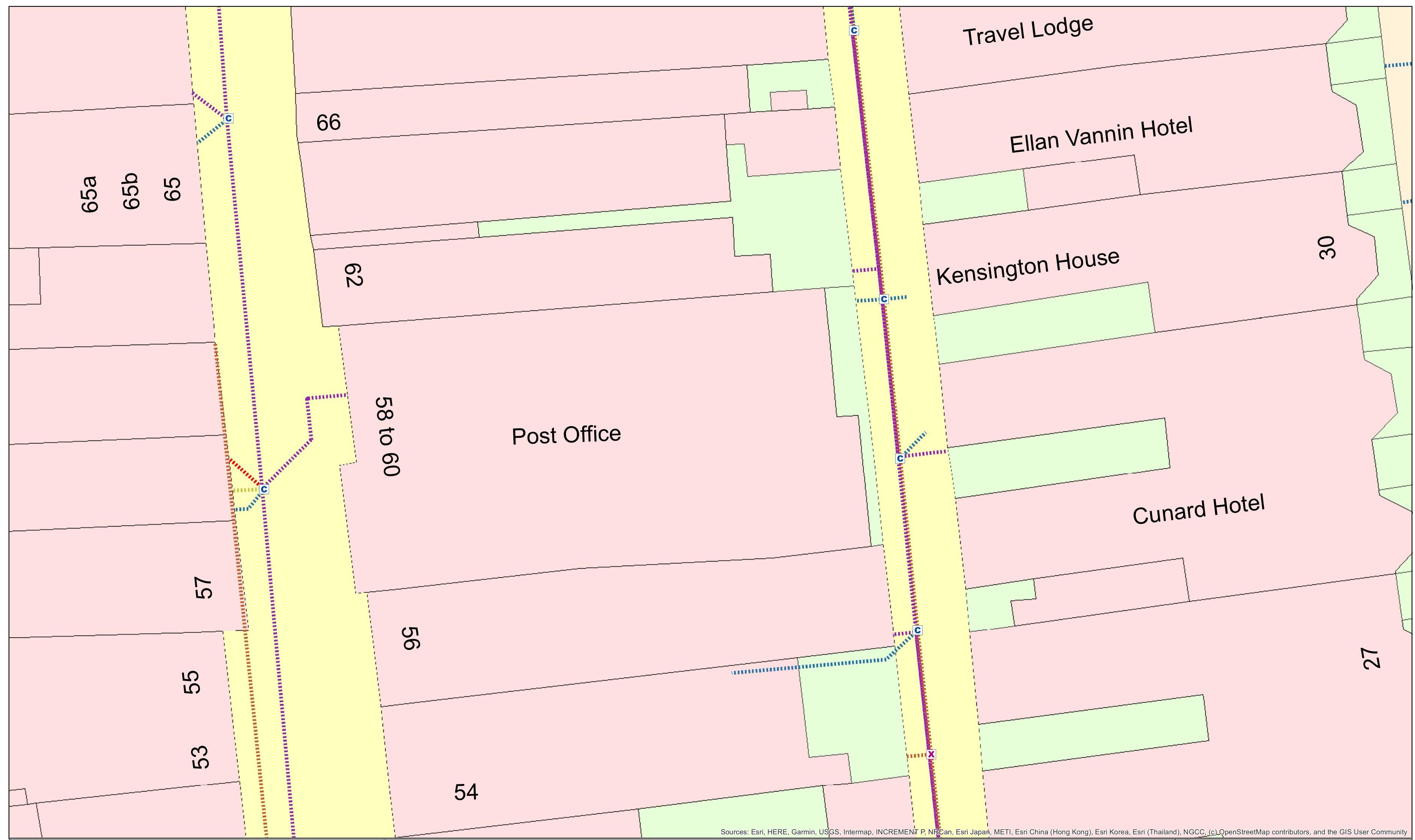
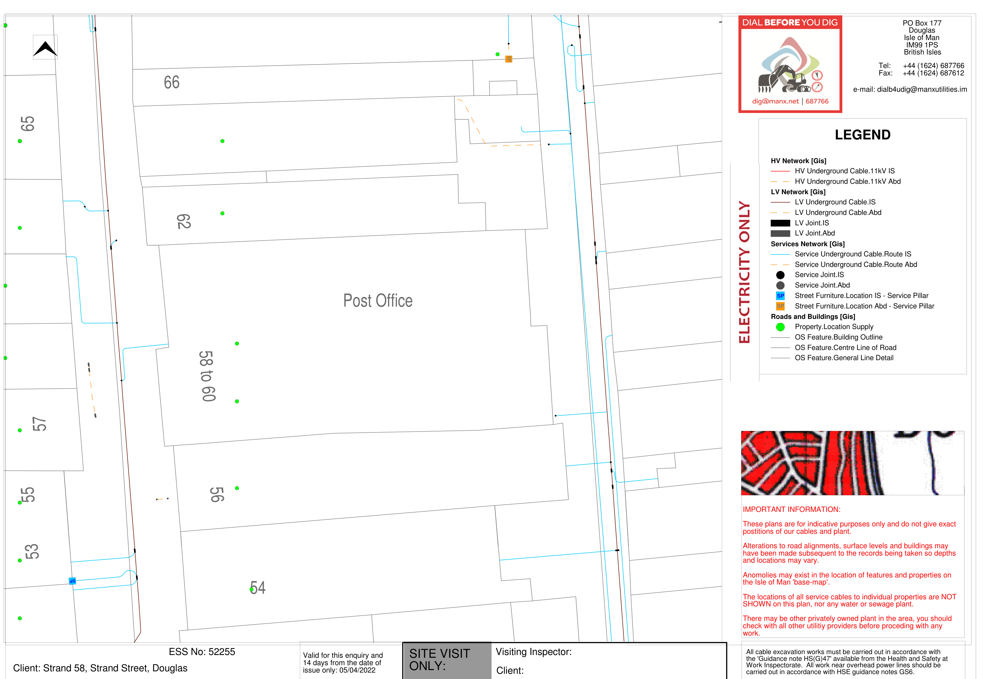
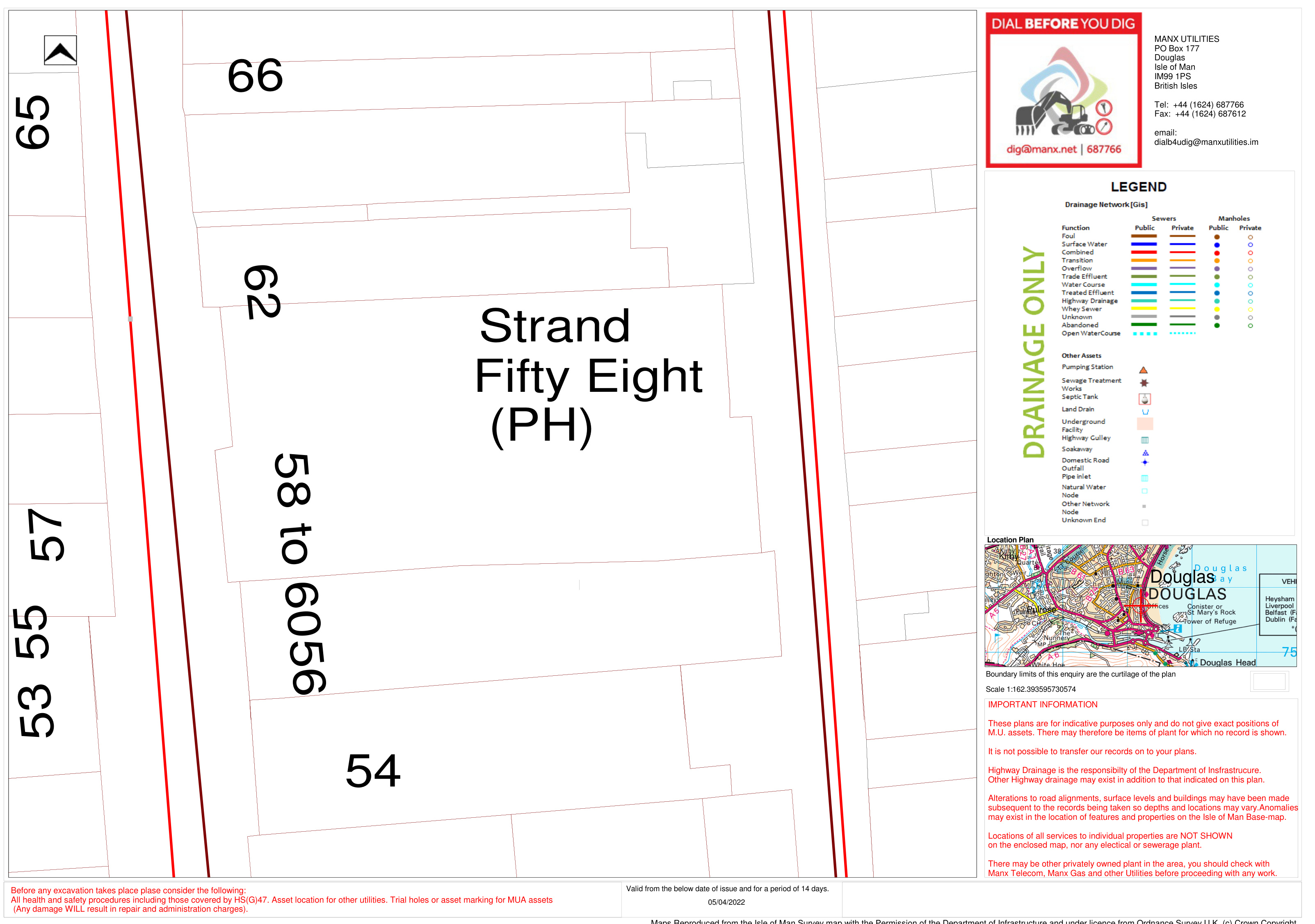
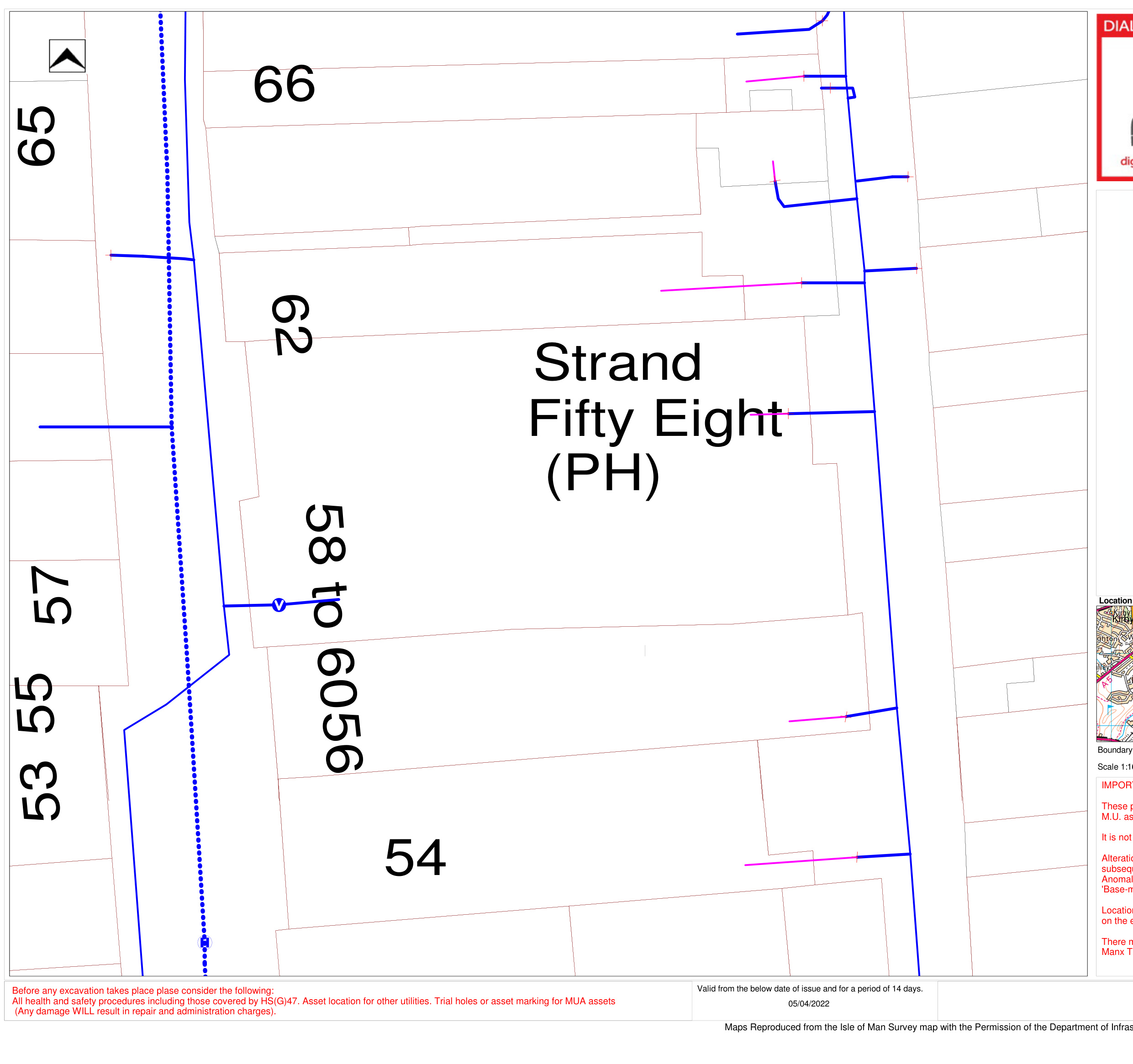
- 4.0 Drainage & Services
- 4.1 The existing Surface & Foul Drainage are presumed to be into a combined system (See Appendix 1).
- 4.2 The new Foul Drainage will be via a new external soil stack, with final connection into the Foul Drain serving the rear lane (See Appendix 1).
- 4.3 The Surface Water will continue to use the existing Combined Drain (See Appendix 1).
- 4.4 It is anticipated that all amended and new services will be via the existing mains service supplies within the Lane (See Appendix 1)
- 5.0 Bin Storage
- 5.1 Douglas Borough Council has been consulted and has requested the following;
- o Commercial: (Per Unit) 1x1100L for Refuse
- 1x1100L for Card
o Apartments: (Combined)
- 2x360L for Refuse 1x240L for Cans/Plastic 1x240L for Glass 1x240L for Paper/Card
- 6.0 Environmental
- 6.1 This application will result in the creation of five apartments in total, as follows.
- o 1, one-bedroom apartment for one person occupancy
- o 1, one-bedroom apartment for one- or two-person occupancy
- o 2, two-bedroom apartments for two-to-four-person occupancy, and
- o 1, three-bedroom apartment for three-to-six-person occupancy
- 6.2 The application includes storage space on the ground floor for 6 bicycles.
- 6.3 Clothes drying will be provided via electrical appliances in the kitchen of each apartment.
- 6.4 Each kitchen will incorporate 3 section bins, to promote recycling.
- 6.5 This application does not create any additional amenity space apart from a rear terrace area to Apartment 4. However, Douglas promenade is nearby with ample public open space, a playground and gardens. The Villa Marina public gardens are also just a short walk away.
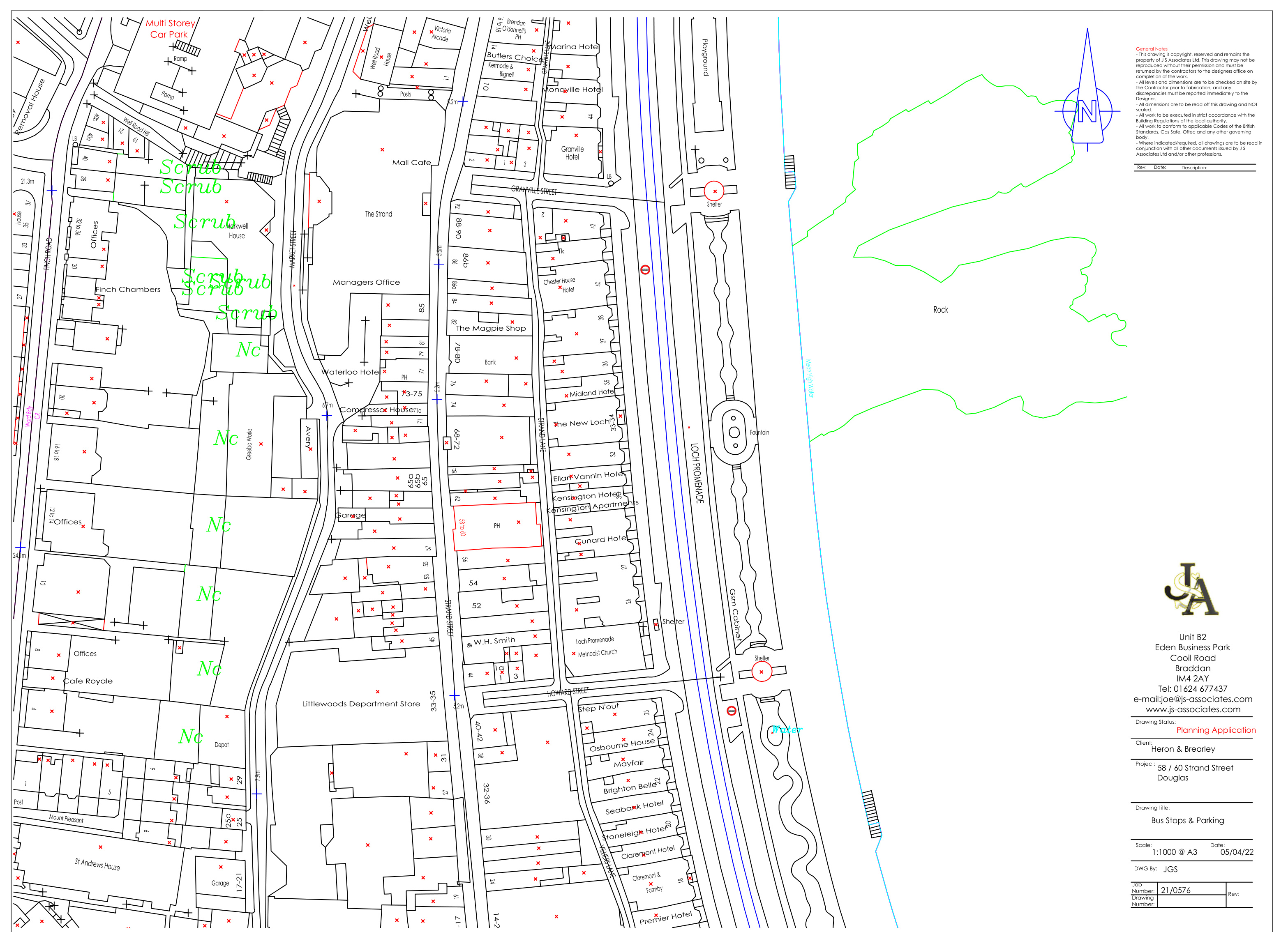
- 7.0 Parking and Access
- 7.1 There are no vehicle parking spaces provided on the site, nor has there ever been any on-site parking provision. However, the strategic plan states that “in general, the need to find a use for redundant buildings which are in sound condition will outweigh the drawback of any shortfall in parking provision”.
- 7.2 Public car parking is however available on the nearby promenade together with Chester Street car park which is near-by and only a short walk away. (See Appendix 2)
- 7.3 A cycle store has been provided on site for the exclusive use by the occupants, and several public bus routes operate frequently along the nearby promenade. (See Appendix2)
- 7.4 The Manual for Manx Roads 2 states,
“Achieving a greater uptake of walking and cycling, or ‘active travel’, leads to a wide range of benefits such as:
- o improvements in health and wellbeing
- o reduced costs to the health service in tackling issues such as obesity and
- o respiratory diseases a more efficient movement of vehicles within the road network leading to decongestion and improved air quality
Design solutions should give precedence to walking and cycling over motor vehicles wherever practicable. To maximise their uptake, designers should seek to create pleasant, inter-connected and overlooked places which deter anti-social behaviour, allowing people to feel safe when walking and cycling”.
- 7.5 Due to the restricted location of the site and the lack of pedestrian access to the upper floors from Strand Street, access to the apartments will only be possible from the rear lane, via a new entrance lobby and staircase located in the annex of number 58.
- 7.6 As the building is an existing structure and the existing floor levels and limited alterations are being undertaken. It has not been possible to incorporate a lift into the scheme.
- 8.0 Fire
- 8.1 All apartments will contain full sprinkler systems and will benefit from a single, compartmentalised emergency escape route to the rear lane.
- 9.0 Regeneration
- 9.1 The provision of additional apartments in this location will generate benefits for the town centre, by regenerating buildings that are presently redundant and unoccupied, and will support town centre initiatives to increase living accommodation in the area, to benefit the town’s economy.
- 10.0 Summary
- 10.1 This planning statement has been prepared on behalf of the applicant, in support of a full planning application to develop 58 & 60 Strand Street, Douglas.
- 10.2 The applicant would like to maximise the use of the available, redundant and unoccupied space to create three additional apartments, for private letting on the upper floors, whilst maintaining the existing retail units on the ground floors.
- 10.3 The buildings are not registered or located within a conservation area and the proposal would be subject to general policy 2 of the Isle of Man Strategic Plan, which states that “The Department generally supports the conversion of redundant storage space above shops (which are often outside of residential areas), into residential development”.
- 10.4 The strategic plan also states that “in general, the need to find a use for redundant buildings which are in sound condition will outweigh the drawback of any shortfall in parking provision”. Public car parking is however available on the nearby promenade together with Chester Street car park which is near-by and only a short walk away. A cycle store has been provided on site for the exclusive use by the occupants, and several public bus routes operate frequently along the nearby promenade.
- 10.5 The provision of additional apartments in this location will generate benefits for the town centre, by regenerating buildings that are presently redundant and unoccupied, and will support town centre initiatives to increase living accommodation in the area, to benefit the town’s economy.
- 10.6 Overall, the proposed development is in accordance with current planning policy, and we therefore respectfully request that the Planning Committee grants permission for this application.
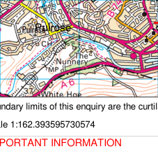
###### Appendix 1: Drainage & Services
|54
6
5
b
CunardHotel
Post Office
6
5
2
7
5
6
5 8 to
6 0
6
5
a
KensingtonHouse
66
5
3
5
7
3
0
6 2
TravelLodge
EllanVanninHotel
5
5
)C
")C
")C ")C
")X
")C
")C
Sources: Esri, HERE, Garmin, USGS, Intermap, INCREMENT P, NRCan, Esri Japan, METI, Esri China (Hong Kong), Esri Korea, Esri (Thailand), NGCC, (c) OpenStreetMap contributors, and the GIS User Community|54
6
5
b
CunardHotel
Post Office
6
5
2
7
5
6
5 8 to
6 0
6
5
a
KensingtonHouse
66
5
3
5
7
3
0
6 2
TravelLodge
EllanVanninHotel
5
5
)C
")C
")C ")C
")X
")C
")C
Sources: Esri, HERE, Garmin, USGS, Intermap, INCREMENT P, NRCan, Esri Japan, METI, Esri China (Hong Kong), Esri Korea, Esri (Thailand), NGCC, (c) OpenStreetMap contributors, and the GIS User Community|
|---|---|---|---|
|The position of Manx Telecom plant is shown as accurately as possible but the locations must be regarded as approximate. For an accurate location of our existing plant, please contact 625001 giving a minimum of 5 working
days before the commencement of the excavations. This is a free service, however Manx Telecom will charge for any damage caused to their plant where this procedure is not followed.
Note: This information is only valid for a period of 21 days from date of issue. Shown below:
Date: 04/04/2022
|LEGEND
Conduit
18 mm 25 mm
50 mm 75 mm 80 mm 90 mm 100 mm
29 mm
Buried Cable
Structure
")g Unknown
F Cabinet
²³ Building !( Pole
")J Joint Post ")C Carriageway ")F Footway
")X Coupling ")M Manhole
¢
Duct Tee (R) Duct Tee (L)
¢
Unknown Conduit
|³|1 inch = 19 feet
58-60 Strand Street|
[Table omitted in markdown export]
|S P|
|---|
58to 60
Post Office
PS
ESS No: 52255 Client: Strand 58, Strand Street, Douglas
Visiting Inspector: Client:
###### Site Visit Only:
Valid for this enquiry and 14 days from the date of issue only: 05/04/2022
Reproduced from the Isle of Man Survey map with the
- 6
- 5
Strand
5 8
(PH)
- 7
6 2
Fifty Eight


- 6
Strand
5 8
(PH)
- 7
6 2
Fifty Eight
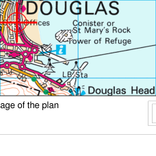
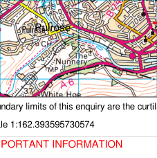

###### Appendix 2: Parking and Access (Transportation)
|| | |
|---|---|
| | |
| | |
|---|---|
| | |
| | |
|---|---|
| | |
| | |
|---|---|
| | |
| | |
|---|---|
| | |
| | |
|---|---|
| | |
| | |
|---|---|
| | |
| | |
|---|---|
| | |
Playground
| | |
|---|---|
| | |
| | |
|---|---|
| | |
| | |
|---|---|
| | |
Shelter
Tk
Multi Storey Car Park
24
33-34
30
22
20
Offices
Midland Hotel
Claremont Hotel
|
|---|
---
*Data sourced from the Isle of Man public planning register under the [Isle of Man Open Government Licence](https://www.gov.im/about-this-site/open-government-licence/).*
*Canonical page: https://planningportal.im/a/9180-braddan-58-60-strand-replacement-conversion/documents/954246*