**Document:** APL Planning Statement
**Application:** 22/00444/B — Erection of 2 detached dwellings with integral garages
**Decision:** Permitted
**Decision Date:** 2022-08-05
**Parish:** Lezayre
**Document Type:** report / planning_statement
**Source:** https://planningportal.im/a/8845-lezayre-st-olaves-jurby-road-dwelling/documents/949872
---
# APL Planning Statement
## Planning Statement
Penketh-Millar 23 West Quay
Ramsey IM8 1DL
5 April 2022
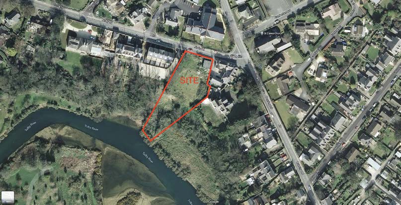
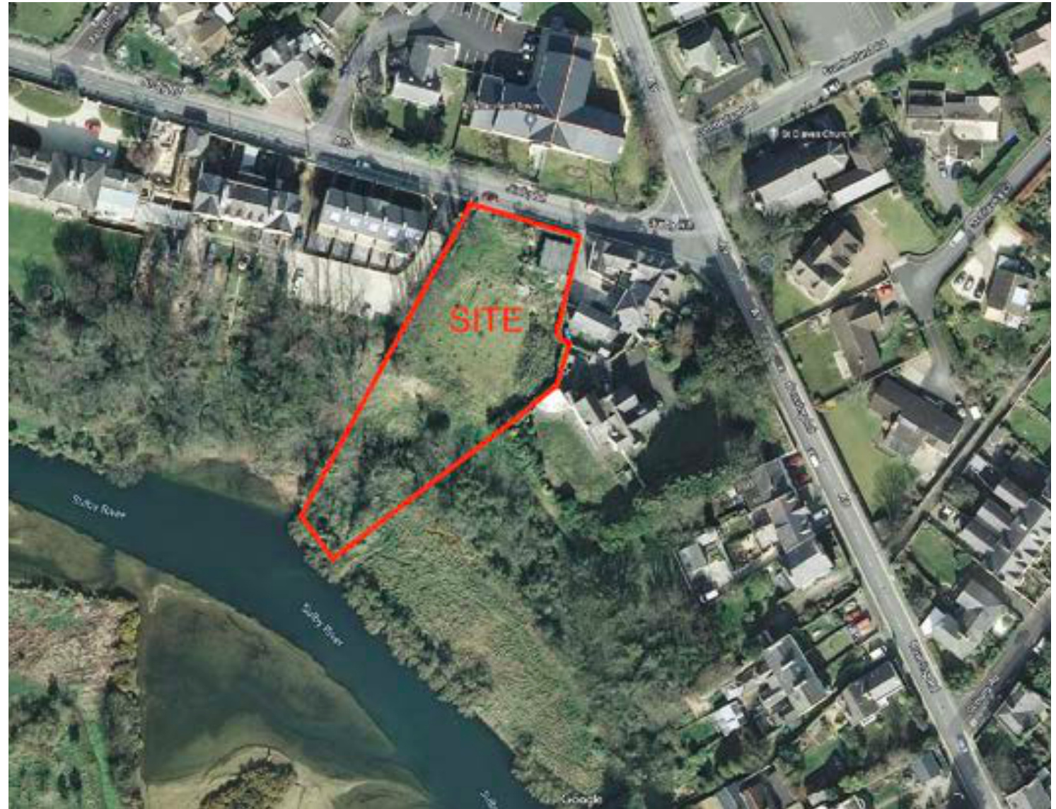
### Aerial Photograph Of Site
Erection of 2 detached dwellings with integral garages on land adjacent to St Olaves Kitchen Garden, Jurby Road, Ramsey.
1.0 PROPOSED SITE: The site is a proposed vacant plot located between “Appletree Grove” and “St Olaves” off the A13 Jurby Road in the boundary of Ramsey. We attach above an Aerial Photograph which indicates the overall site marked in red.
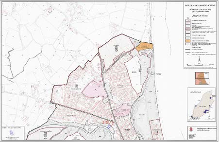
The site is located on the current Ramsey Area Plan as “Predominantly Residential Use”, extract copy attached below.
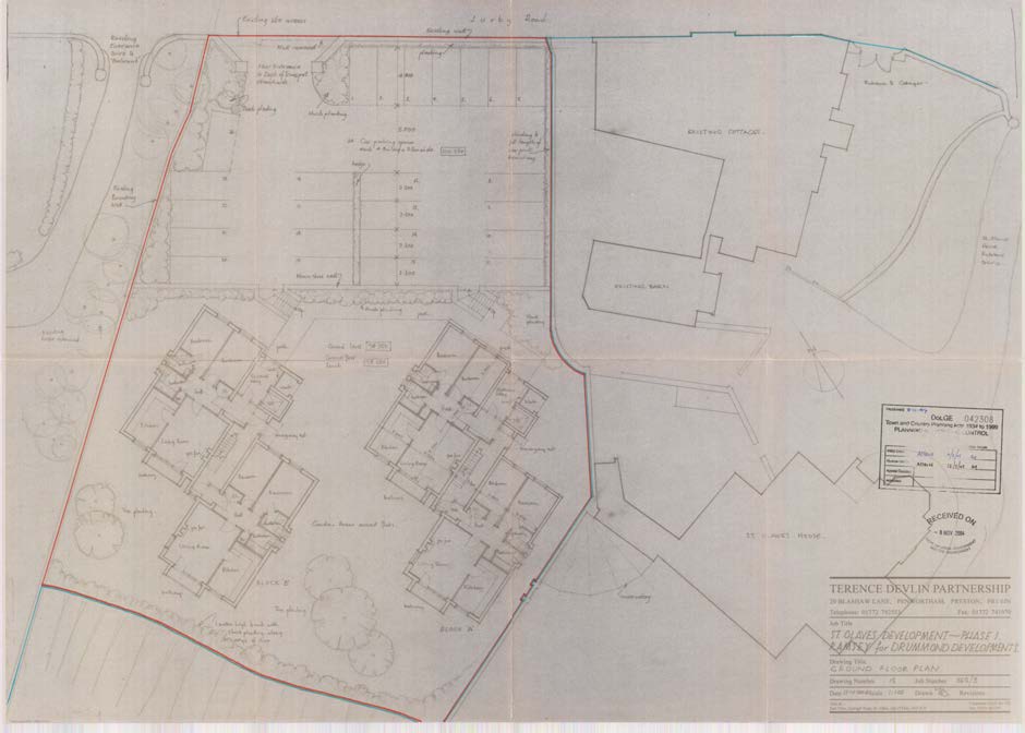
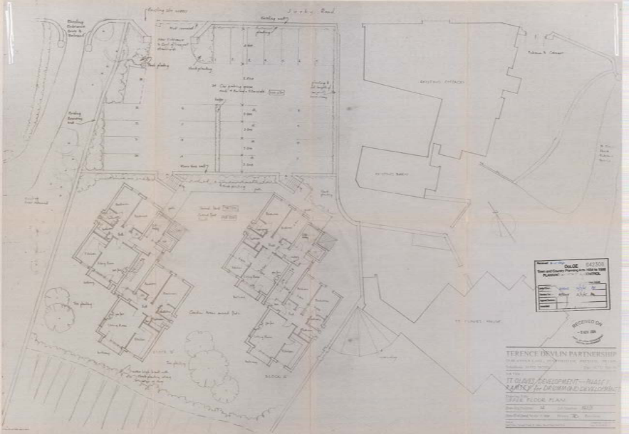
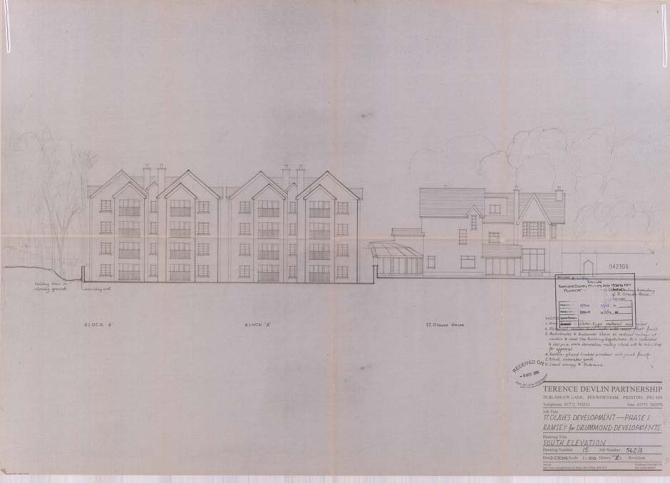
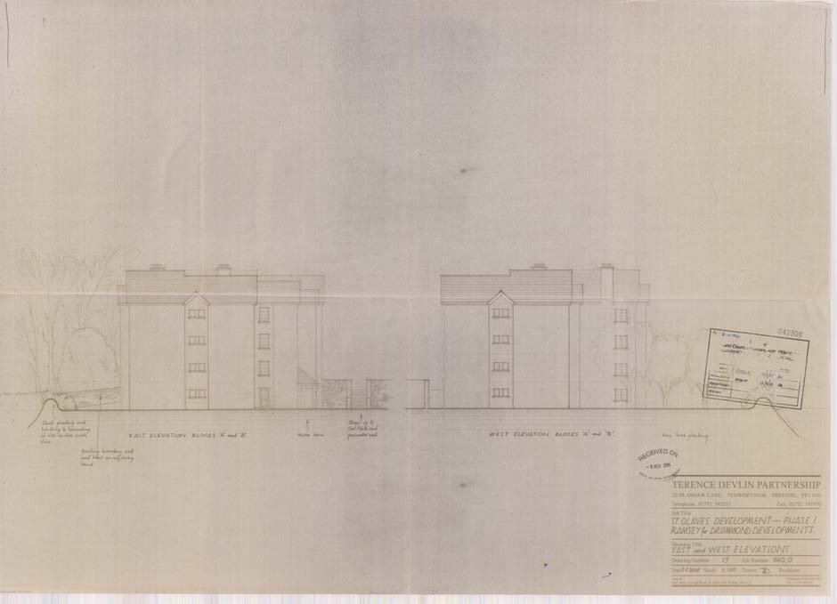
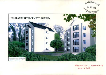
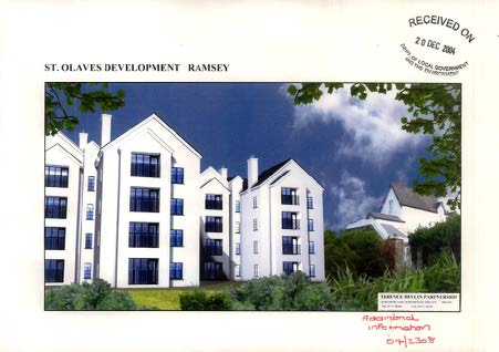
2.0 PREVIOUS APPLICATION: There is currently an active planning approval in place, under P.A. No- 04/02308/B, for the proposed erection of two four storey blocks, each containing eight flats.
This was originally approved on the 25th May 2005 and extended to 25th May 2012.
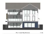
We attach extract copies of the approved drawings below.
APPROVED UPPER FLOOR PLANS
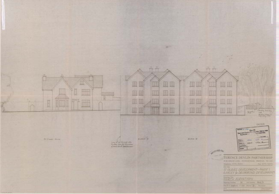
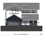
APPROVED SOUTH ELEVATION TO SULBY RIVER
## Approved 3D Renders
## Approval Notice 04/02308/B
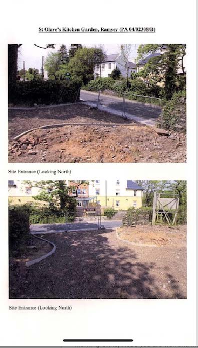
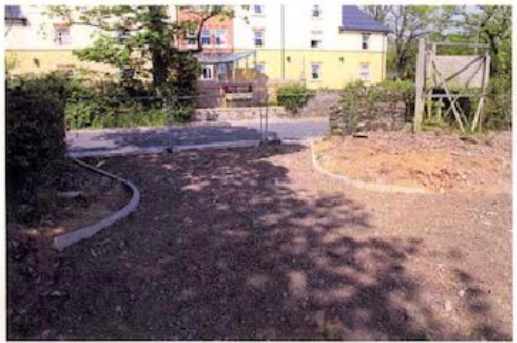
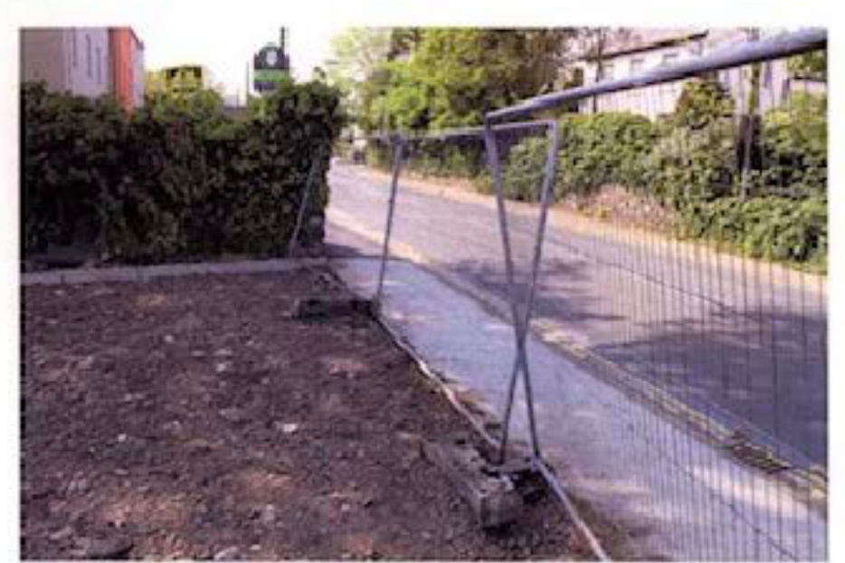
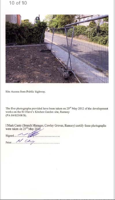
## Works to the approved access have commenced on site within the required expiry date of 25th May 2012 and P.A. No 04/02308/B is valid and active. See attached below correspondence between the original applicant and the Planning Department with regards to commencement of works on site.
## 9
## 10

## 11
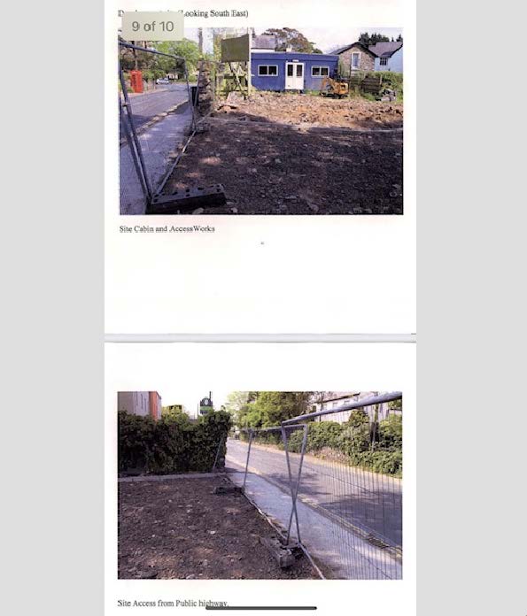
## 12
## 13
We provide a “Comparison Drawing”, number 21 1613/11, which shows the proposed footprint of the previously approved development indicated in blue in comparison to the footprint of the proposed scheme.
The total external floor area of the approved scheme, under P.A. No- 04/02308/B, is approximately 880 square metres per block, in comparison with 540 square metres per proposed dwelling.
The ridge height of the approved scheme, under P.A. No- 04/02308/B, is set approximately 2.8m higher than the proposed dwelling ridge level of 32.075.
- 3.0 VEHICLE ACCESS: The approved access under P.A,. No- 04/02308/B, which served 16 flats, and has commenced on site would be utilised to serve the proposed two dwellings.
We indicate on the submitted drawings numbered 21 1613/08 & 09 the proposed vehicle access and visibility splays afforded to the existing access.
The visibility splay looking in a easterly direction is 2.4m x 51m to the road junction with Bowring Road. The visibility splay looking in a westerly direction is 2.4m x 115m to the road junction with Ash Grove where the road levels start to dip. Any features that fall within the visibility splays are to be take down to and maintained to a maximum height of 1m. The internal vehicle access would be constructed to a minimum width of 6m.
There is ample space for a minimum of 2No on site car parking spaces per dwelling with space also to manoeuvre within the confines of each plot to allow vehicles to both enter and exit each site in a forward gear.
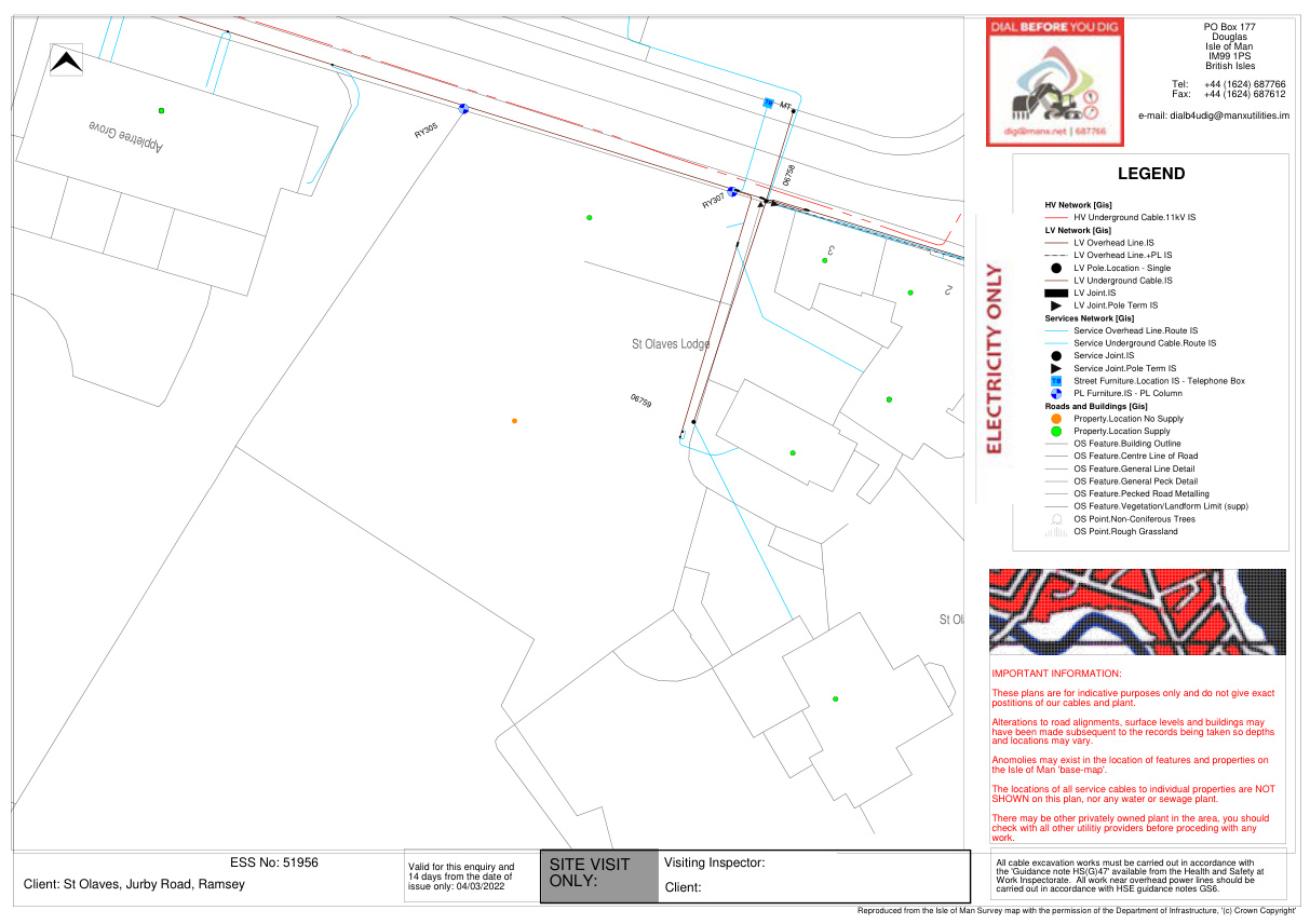
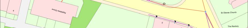
- 4.0 SITE PHOTOGRAPHS: We provide a series of site photographs numbered 1 to 13 on a separate document which provide further details of the existing vehicle access and proposed site.
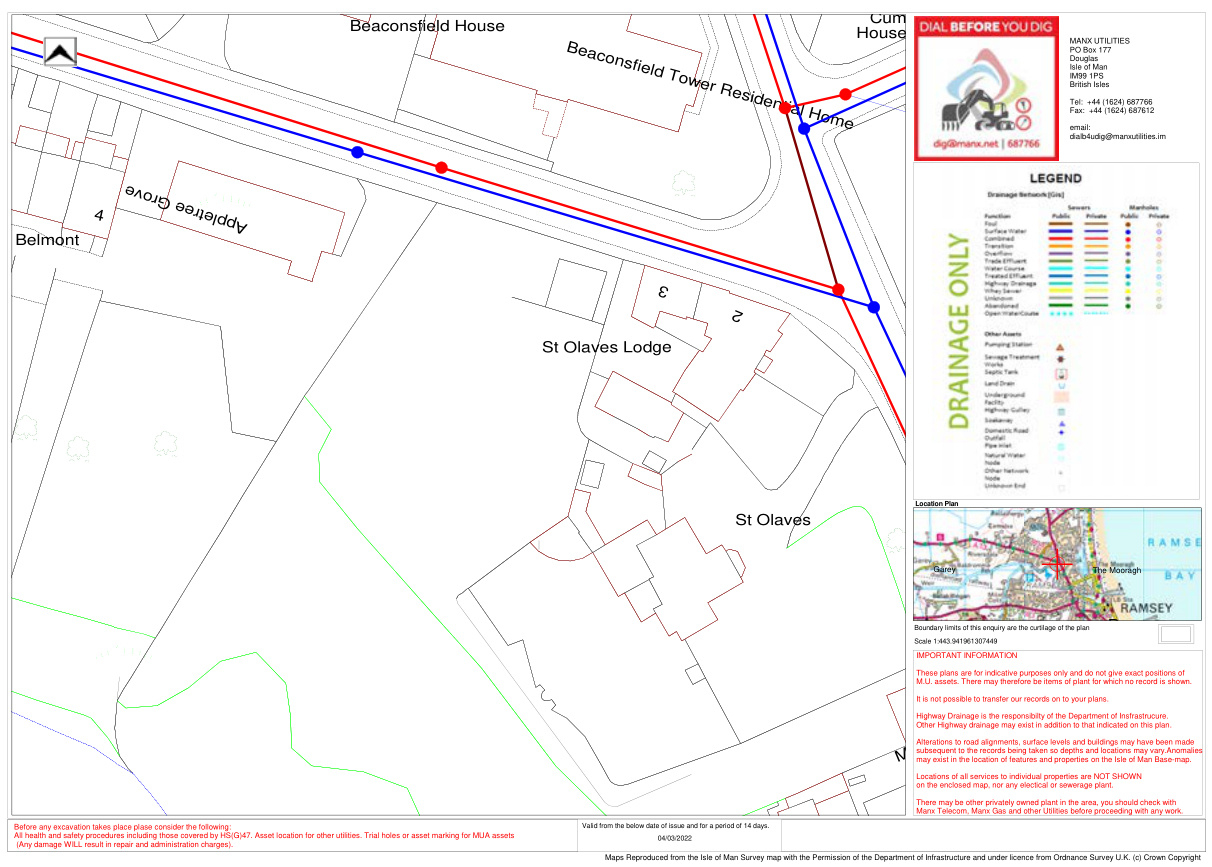
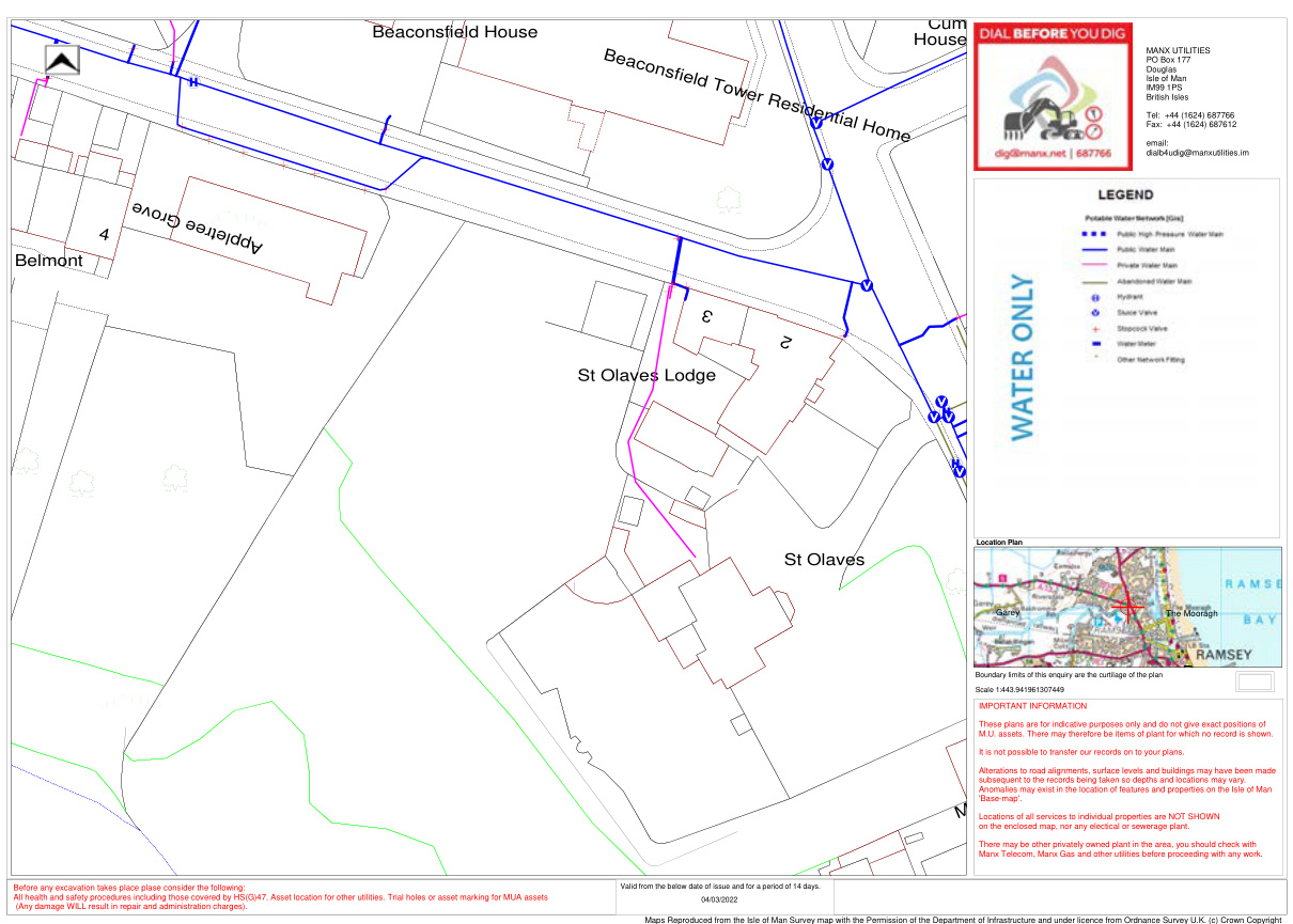
5.0 EXISTING SERVICES: The following services are available in the immediate area:
- • Foul and surface water drainage.
- • Electricity.
- • Water
- • Telecommunication.
We attach below a series of service maps that show the approximate location of the existing services.
|House
evorGeertelppA
BeaconsfieldTowerResidentialHome
3
2
Cumberland
Ma
|yfield
IMPORTANT INFORMATION These plans are for indicative purposes only and do not give exact positions of M.U. assets. There may therefore be items of plant for which no record is shown. It is not possible to transfer our records on to your plans. Highway Drainage is the responsibilty of the Department of Insfrastrucure. Other Highway drainage may exist in addition to that indicated on this plan. Alterations to road alignments, surface levels and buildings may have been made subsequent to the records being taken so depths and locations may vary.Anomalies may exist in the location of features and properties on the Isle of Man Base-map. Locations of all services to individual properties are NOT SHOWN on the enclosed map, nor any electical or sewerage plant. There may be other privately owned plant in the area, you should check with Manx Telecom, Manx Gas and other Utilities before proceeding with any work.|
|---|
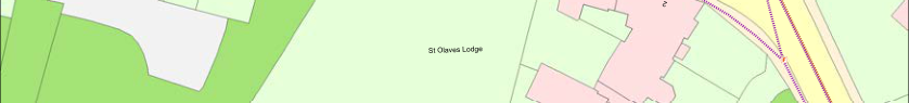
Beaconsfield House
St Olaves Lodge
St Olaves
Belmont
4
| |
|---|
|Garey
|
|---|
Ramsey
Location Plan
Boundary limits of this enquiry are the curtilage of the plan Scale 1:443.941961307449
MANX UTILITIES PO Box 177 Douglas Isle of Man IM99 1PS British Isles
Tel: +44 (1624) 687766 Fax: +44 (1624) 687612
email: dialb4udig@manxutilities.im|
|---|
|Before any excavation takes place plase consider the following: All health and safety procedures including those covered by HS(G)47. Asset location for other utilities. Trial holes or asset marking for MUA assets
(Any damage WILL result in repair and administration charges).|Valid from the below date of issue and for a period of 14 days. 04/03/2022| |
|---|---|---|
Maps Reproduced from the Isle of Man Survey map with the Permission of the Department of Infrastructure and under licence from Ordnance Survey U.K. (c) Crown Copyright
Foul and surface water drainage
evorGeertelppA
### Tb
MT
RY305
- 6
- 7
- 8
St Olaves Lodge PO Box 177 Douglas Isle of Man IM99 1PS British Isles
Tel: +44 (1624) 687766 Fax: +44 (1624) 687612
e-mail: dialb4udig@manxutilities.im
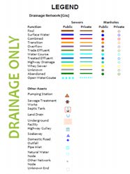
|LEGEND
HV Network [Gis]
HV Underground Cable.11kV IS
LV Network [Gis]
LV Overhead Line.IS
LV Overhead Line.+PL IS LV Pole.Location - Single LV Underground Cable.IS LV Joint.IS
LV Joint.Pole Term IS
Services Network [Gis]
Service Overhead Line.Route IS
Service Underground Cable.Route IS
Service Joint.IS
Service Joint.Pole Term IS
TB Street Furniture.Location IS - Telephone Box
| | |
|---|---|
| | |
PL Furniture.IS - PL Column
Roads and Buildings [Gis]
Property.Location No Supply
Property.Location Supply
OS Feature.Building Outline
OS Feature.Centre Line of Road
OS Feature.General Line Detail
OS Feature.General Peck Detail
OS Feature.Pecked Road Metalling
OS Feature.Vegetation/Landform Limit (supp)
OS Point.Non-Coniferous Trees
OS Point.Rough Grassland|
|---|
St Olaves
IMPORTANT INFORMATION: These plans are for indicative purposes only and do not give exact postitions of our cables and plant. Alterations to road alignments, surface levels and buildings may have been made subsequent to the records being taken so depths and locations may vary. Anomolies may exist in the location of features and properties on the Isle of Man 'base-map'. The locations of all service cables to individual properties are NOT SHOWN on this plan, nor any water or sewage plant. There may be other privately owned plant in the area, you should check with all other utilitiy providers before proceding with any work.
ESS No: 51956 Client: St Olaves, Jurby Road, Ramsey
Visiting Inspector: Client:
SITE VISIT ONLY:
All cable excavation works must be carried out in accordance with the 'Guidance note HS(G)47' available from the Health and Safety at Work Inspectorate. All work near overhead power lines should be carried out in accordance with HSE guidance notes GS6.
Valid for this enquiry and 14 days from the date of issue only: 04/03/2022
Reproduced from the Isle of Man Survey map with the permission of the Department of Infrastructure, '(c) Crown Copyright'
Electricity
|House
evorGeertelppA
BeaconsfieldTowerResidentialHome
3
2
Cumberland
Ma
|yfield
IMPORTANT INFORMATION These plans are for indicative purposes only and do not give exact positions of M.U. assets. There may therefore be items of plant for which no record is shown. It is not possible to transfer our records on to your plans. Alterations to road alignments, surface levels and buildings may have been made subsequent to the records being taken so depths and locations may vary. Anomalies may exist in the location of features and properties on the Isle of Man 'Base-map'. Locations of all services to individual properties are NOT SHOWN on the enclosed map, nor any electical or sewerage plant. There may be other privately owned plant in the area, you should check with Manx Telecom, Manx Gas and other utilities before proceeding with any work.|
|---|
Beaconsfield House
St Olaves Lodge
St Olaves
Belmont
4
| |
|---|
|Garey The Mooragh
|
|---|
Ramsey
Location Plan
Boundary limits of this enquiry are the curtilage of the plan Scale 1:443.941961307449
MANX UTILITIES PO Box 177 Douglas Isle of Man IM99 1PS British Isles
Tel: +44 (1624) 687766 Fax: +44 (1624) 687612
email: dialb4udig@manxutilities.im|
|---|
|Before any excavation takes place plase consider the following: All health and safety procedures including those covered by HS(G)47. Asset location for other utilities. Trial holes or asset marking for MUA assets
(Any damage WILL result in repair and administration charges).|Valid from the below date of issue and for a period of 14 days. 04/03/2022| |
|---|---|---|
Maps Reproduced from the Isle of Man Survey map with the Permission of the Department of Infrastructure and under licence from Ordnance Survey U.K. (c) Crown Copyright
Water
|evorGeertelppA
4
St OlavesChurch
TheRectory
3
2
St OlavesLodge
St Olaves
")F
f®
")X
F
")F
")F
¢
¢
¢
)C
¢
")C
Sources: Esri, HERE, Garmin, USGS, Intermap, INCREMENT P, NRCan, Esri Japan, METI, Esri China (Hong Kong), Esri Korea, Esri (Thailand), NGCC, (c) OpenStreetMap contributors, and the GIS User Community|evorGeertelppA
4
St OlavesChurch
TheRectory
3
2
St OlavesLodge
St Olaves
")F
f®
")X
F
")F
")F
¢
¢
¢
)C
¢
")C
Sources: Esri, HERE, Garmin, USGS, Intermap, INCREMENT P, NRCan, Esri Japan, METI, Esri China (Hong Kong), Esri Korea, Esri (Thailand), NGCC, (c) OpenStreetMap contributors, and the GIS User Community|
|---|---|---|---|
|The position of Manx Telecom plant is shown as accurately as possible but the locations must be regarded as approximate. For an accurate location of our existing plant, please contact 625001 giving a minimum of 5 working
days before the commencement of the excavations. This is a free service, however Manx Telecom will charge for any damage caused to their plant where this procedure is not followed.
Note: This information is only valid for a period of 21 days from date of issue. Shown below:
Date: 03/03/2022
|LEGEND
Conduit
18 mm 25 mm
50 mm 75 mm 80 mm 90 mm 100 mm
29 mm
Buried Cable
Structure
")g Unknown
F Cabinet
²³ Building !( Pole
")J Joint Post ")C Carriageway ")F Footway
")X Coupling ")M Manhole
¢
Duct Tee (R) Duct Tee (L)
¢
Unknown Conduit
|³|1 inch = 38 feet
St Olaves|
## Telecommunication


---
*Data sourced from the Isle of Man public planning register under the [Isle of Man Open Government Licence](https://www.gov.im/about-this-site/open-government-licence/).*
*Canonical page: https://planningportal.im/a/8845-lezayre-st-olaves-jurby-road-dwelling/documents/949872*