**Document:** APL Planning Statement (Part 1 of 3)
**Application:** 21/00992/B — Erection of four detached dwellings with garages and associated access road
**Decision:** Application Withdrawn
**Decision Date:** 2022-05-05
**Parish:** Lonan
**Document Type:** report / planning_statement
**Source:** https://planningportal.im/a/8111-lonan-ashwood-ballamenagh-road-dwelling/documents/940455
---
# APL Planning Statement (Part 1 of 3)
JOB N0- 21 1530
PENKETH-MILLAR 23 West Quay Ramsey
August 2021
## Planning Design Statement:
#### 1.00 Proposed Site:
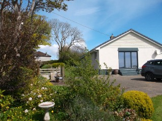
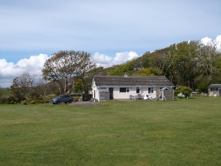
The application site is the residential curtilage of a detached dwelling located on Ballamenagh Road in Baldrine. 'Ashwood' is a bungalow that exhibits little in the way of architectural merit or interest, it is, nevertheless, well-proportioned and well-maintained. It sits within a very large plot, all of which is residential garden. The dwelling is isolated on the southern edge of this part of Baldrine, although a number of dwellings are located further north on Baldrine Park and with some further sporadic development to the west. When approaching the site from the north, the dwelling feels very much a part of the built environment to the north rather than a rural dwelling as might appear when looking at the site on a map.
The proposed application is a detailed planning application for the demolition of the existing dwelling and erection of 4No detached dwellings with garages and associated access road at Ashwood, Ballamenagh Road, Baldrine, Lonan, IM4 6AL
#### 2.00 Planning Drawings:
This proposed Planning Design Statement has been prepared as supporting evidence to the accompanying planning application and should be read in conjunction with the following Planning Drawings:
- • 21 1530/01 - 03: Plot 1 - 3 Details.
- • 21 1530/04 - 06: Plot 4 Details.
- • 21 1530/07: Existing Site Layout
- • 21 1530/08: Proposed Site Layout.
- • 21 1530/09: 1:500 Site Plan.
- • 21 1530/10: North-West Visibility Splay.
- • 21 1530/11: Access Road Details.
- • 21 1530/12: Location Plan.
#### 3.00 Planning History:
- • 02/00245/B: Extensions to existing dwelling. Approved 19/06/02.
- • 05/92370/A: Approval in principle for 3No detached dwellings. Refused at Appeal 17/10/06.
- • 08/01127/A: Approval in principle for a replacement dwelling. Approved 01/08/08.
- • 11/00933/B: Erection of a replacement dwelling. Approved 30/08/11.
- • 15/00668/B: Erection of a replacement dwelling. Approved 07/10/15.
#### 4.00 Land Zonage:
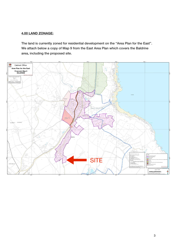
##### The land is currently zoned for residential development on the “Area Plan for the East”. We attach below a copy of Map 9 from the East Area Plan which covers the Baldrine area, including the proposed site.
Cabinet Office
Area Plan for the East
Proposals Map 9 BALDRINE
###### Signed map to accompany Order
|Made this 21st day of September 2020
Minister for Policy and Reform
Adopted by Order on 21st September 2020 Approved by Tynwald on 18th November 2020 Coming into Operation on 1st December 2020
|
|---|
GH013s
GM001g PS
GARFF (Lonan)
ABBREVIATIONS (All Proposals maps): AWPP - Animal Waste Processing Plant BP - Business Park Cem - Cemetery CF - Community Facility EfW - Energy from Waste facility GC - Golf Course H - Buildings/Land for Hospital Purposes HWTF - Hazardous Waste Treatment Facility Ind - Industry MU - Mixed use OS - Open Space definitions ( P=Park, PF=Playing Fields,
Legend
Local Authority boundaries Settlement Boundaries
| |
|---|
### Site
Raad ny Foillan Green Gaps Buildings or Land for Civic, Cultural or Other Use (see abbreviations) Industrial Mixed Use Open Space (which may be for particular purposes) Railway
| |
|---|
| |
|---|
| |
|---|
POS=Public Open Space, SP=Sports Pitch(es) ) PS - Primary School SS - Secondary School T - Telecommunications Site UCM - University College Isle of Man
| |
|---|
| |
|---|
ONCHAN
Predominantly Residential Strategic Reserve
Note: Buildings or Land for Civic, Cultural or Other Use may include cemeteries, faith, education, community health, other social infrastructure and sports centres.
|Map Ref: GDI/20/41/Map 9|
|---|
Scale 1:3,500
0 50 100 200 Meters
Map produced by the Department of Infrastructure Mapping Service. © Crown Copyright, Department of Infrastructure, Isle of Man. Reproduction of map in any form prohibited without prior permission from the publishers.
#### 5.00 Pre-Application Advice:
A meeting was held on Thursday 3rd June 2021 with a representative of the applicant and the Planning Officer, Mr Jason Singleton. The proposal to develop the site with 4No detached dwellings was discussed and some initial Sketch Floor Plans and Site Layout presented.
Mr Singleton confirmed that the site was zoned for housing and that there were no obvious policy restrictions on the land. In addition, the scale and mass appeared appropriate for the site.
Regarding local services Mr Singleton questioned the apparent lack of obvious sewer connection, and supported the Biodisc approach. Access was also discussed in some detail, with the point made that adequate consideration should be given to, and plans made, for adequate access for refuse vehicle.
#### 6.00 Site Context:
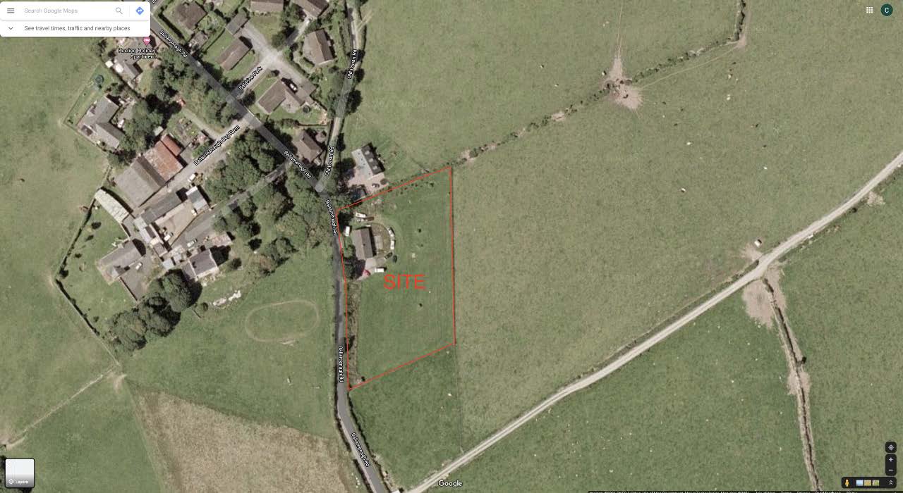
The site currently forms a very large garden to the existing bungalow known as “Ashwood”. The site has an approximate area of 5144 square metres, (1.27 acres), and has a gentle slope of 5m running down from the north boundary to the south boundary.
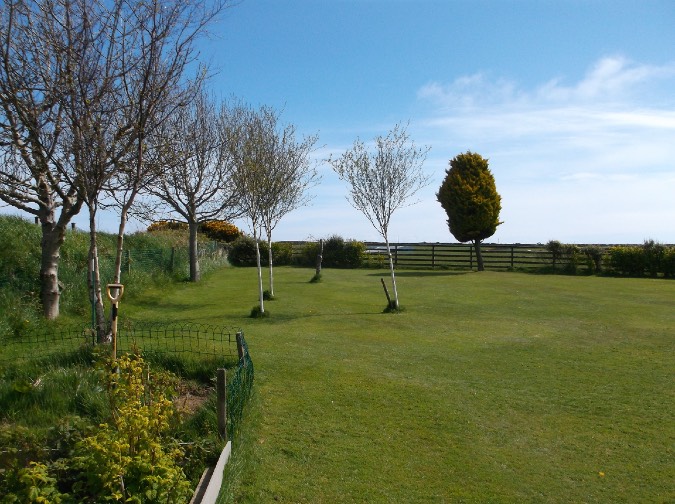
There is a timber post and rail fence to the east and south boundaries with a hedge planted on the site side of this timber fence.
The north boundary comprises of a sod hedge with some areas of small tree planting, which provide a natural boundary between Ashwood and the nearest neighbouring property known as Cubalibre Mooar.
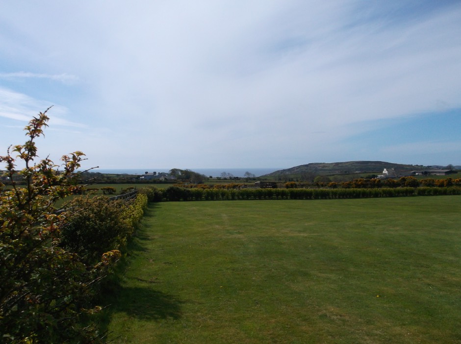
To the west boundary runs the main public highway known as Ballamenagh Road with a general sod hedge between the road and the proposed site. Again some small tree planting has been carried out along this west boundary within the confines of the proposed site. There are also two vehicular access points in this west boundary which provide access to Ashwood. One located in the north-west corner of the site and the other directly opposite Ashwood. Both are fitted with timber hinged gates.
The majority of the site is laid to lawn with a hardstanding/parking area located to the south of Ashwood and a patio area located to the east.
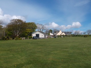
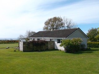
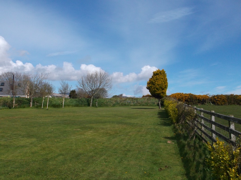
A series of site photographs are attached below and are taken stood within the confines of the proposed site and along the main public highway.
Stood looking east along the north boundary. The existing sod hedge and tree planting are to remain to provide a nature screen/ boundary between Plot 1 and the existing house known as “Cubalibre Mooar”.
Stood looking south along the east boundary. The existing timber fence and hedgerow to remain
Stood looking north along the east boundary. The existing timber fence and hedgerow to remain. Cubalibre Mooar is visible to the left of the photograph.
---
*Data sourced from the Isle of Man public planning register under the [Isle of Man Open Government Licence](https://www.gov.im/about-this-site/open-government-licence/).*
*Canonical page: https://planningportal.im/a/8111-lonan-ashwood-ballamenagh-road-dwelling/documents/940455*